Search Constraints
You searched for:
Classification Maps & Atlas (printed)
Remove constraint Classification: Maps & Atlas (printed)Search Results
1. [World map]

- Date:
- [1482]
- Physical Description:
- 1 map : woodcut ; image 41 x 57 cm
- Collection:
- Rare Books and Manuscripts

- Date:
- [1486]
- Physical Description:
- 1 map : woodcut ; 35 x 39 cm, on sheet 41 x 57 cm
- Collection:
- Rare Books and Manuscripts

- Date:
- [1486]
- Physical Description:
- 1 map : woodcut ; 35 x 36 cm, on sheet 41 x 54 cm
- Collection:
- Rare Books and Manuscripts

- Date:
- [1486]
- Physical Description:
- 1 map : woodcut ; 34 x 54 cm, on sheet 41 x 57 cm
- Collection:
- Rare Books and Manuscripts

- Date:
- [12 July 1493]
- Physical Description:
- 1 map ; 31 x 44 cm, on sheet 41 x 58 cm
- Collection:
- Rare Books and Manuscripts

- Date:
- 1903
- Physical Description:
- 2 maps on 24 sheets ; 127 x 230 cm., sheets 44 x 62 cm. or smaller and 122 x 227 cm., sheets 45 x 62 cm. or smaller, in portfolio 64 x 54 cm
- Collection:
- Rare Books and Manuscripts

- Date:
- anno Virginei partus 1508
- Physical Description:
- 1 atlas ([284] pages, [68] leaves of plates) : illustrations, 34 maps ; 43 cm (folio)
- Collection:
- Rare Books and Manuscripts

- Date:
- Anno Domini. M.D.XI. die. xx. mensis Martii. [March 22, 1511]
- Physical Description:
- 1 atlas ([62] leaves, [28] double leaves of plates) : ill., maps ; 43 cm (fol.)
- Collection:
- Rare Books and Manuscripts

- Date:
- Anno a Christi natiuitate MDXXV, tertio Kal[ends] Apriles [30 March 1525]
- Physical Description:
- 1 atlas (82 leaves, [96] pages, [98] leaves of plates) : illustrations, maps ; 41 cm (folio)
- Collection:
- Rare Books and Manuscripts

- Date:
- MDXLVI [1546]
- Physical Description:
- 1 map on 2 sheets ; 51.8 x 72.2 cm, on sheet 56.2 x 76.3 cm.
- Collection:
- Rare Books and Manuscripts

- Date:
- [1856]
- Physical Description:
- 1 map : col. ; 37.6 x 55.4 cm.
- Collection:
- Rare Books and Manuscripts

- Date:
- 1881-1882
- Physical Description:
- 1 portfolio (7 plates) : all ill. ; 53 x 295 cm, on 7 sheets 80 x 59 cm, in cover 79 x 58 cm.
- Collection:
- Rare Books and Manuscripts
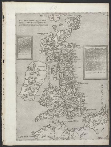
- Date:
- MDLVI [1556]
- Physical Description:
- 1 map ; 47.9 x 34.5 cm, on sheet 53.3 x 40.0 cm.
- Collection:
- Rare Books and Manuscripts

- Date:
- MDLVIII [1558]
- Physical Description:
- 1 map ; 38.2 x 52.3 cm, on sheet 42.8 x 55.6 cm.
- Collection:
- Rare Books and Manuscripts

- Date:
- MDLXII [1562]
- Physical Description:
- 1 atlas ([8], 112, 286, [66] pages, 64 double leaves of plates) : illustrations, maps ; 24 cm (4to)
- Collection:
- Rare Books and Manuscripts

- Date:
- anno MDLXII [1562]
- Physical Description:
- 1 map ; 47.0 x 34.2 cm, on sheet 53.2 x 40.0 cm.
- Collection:
- Rare Books and Manuscripts

- Date:
- XX Maij MDLXX [1570]
- Physical Description:
- 1 atlas ([284] pages) : maps ; 43 cm (folio)
- Collection:
- Rare Books and Manuscripts

- Date:
- [1574]
- Physical Description:
- 1 map ; 32 x 48 cm
- Collection:
- Rare Books and Manuscripts
- Credit Line:
- Yale Center for British Art, Gift of David Alan Richards, Yale BA 1967, JD 1972

- Date:
- MDLXXIIII [1574]
- Physical Description:
- 1 atlas ([396] pages) : 70 maps ; 46 cm (folio)
- Collection:
- Rare Books and Manuscripts

- Date:
- [1575]
- Physical Description:
- 1 map : engraving ; 38 x 42 cm
- Collection:
- Rare Books and Manuscripts

- Date:
- [1575]
- Physical Description:
- 1 map : hand col. engraving ; 33 x 44 cm, on sheet 41 x 52 cm.
- Collection:
- Rare Books and Manuscripts
- Credit Line:
- Yale Center for British Art, Gift of David Alan Richards, Yale BA 1967, JD 1972

- Date:
- MDLXXVIII [1578]
- Physical Description:
- 1 map : engraving ; 40.5 x 53.5 cm, on sheet, 41.5 x 54.5 cm
- Collection:
- Rare Books and Manuscripts

- Date:
- [1579]
- Physical Description:
- 1 atlas ([1] leaf, [71] leaves of plates) : 35 maps, port. ; 42 cm. (fol.)
- Collection:
- Rare Books and Manuscripts

- Date:
- Año MDLXXXVIII [1588]
- Physical Description:
- 1 atlas ([420] pages) : maps ; 46 cm (folio)
- Collection:
- Rare Books and Manuscripts

- Date:
- [1588?]
- Physical Description:
- 1 map ; 40.1 x 54.2 cm., on sheet 41.8 x 56.1cm.
- Collection:
- Rare Books and Manuscripts
![The famouse West Indian voyadge made by the Englishe fleete of 23 shippes and barkes [cartographic material] : wherin weare gotten the townes of St . Iago, Sto. Domingo, Cartagena and St. Augustines : the same beinge begon from Plimmouth in the moneth of September 1585 and ended at Portesmouth in Iulie 1586 : the whole course of the saide viadge beinge plainlie described by the pricked line / newlie come forth by Baptista B.](https://media.collections.yale.edu/thumbnail/ycba/b67e0d67-e748-494a-ba84-e1105f721bb5)
- Date:
- [1589?]
- Physical Description:
- [5] sheets : maps (engravings)
- Collection:
- Rare Books and Manuscripts

- Date:
- 1589
- Physical Description:
- 1 map : engraving ; 33 x 49 cm
- Collection:
- Rare Books and Manuscripts

- Date:
- [1589?]
- Physical Description:
- 1 map ; 40.5 x 52.5 cm., on sheet 41.8 x 55.6 cm.
- Collection:
- Rare Books and Manuscripts
![[Atlas of the counties of England and Wales].](https://media.collections.yale.edu/thumbnail/ycba/4ac23653-8668-40b0-b3f1-7228f7c1d7e3)
- Date:
- [1590?]
- Physical Description:
- 1 atlas ([74] leaves) : 34 maps (some folded) ; 44 cm
- Collection:
- Rare Books and Manuscripts

- Date:
- [ca. 1590]
- Physical Description:
- 1 map ; 42 cm in diameter, on sheet 42 x 55 cm
- Collection:
- Rare Books and Manuscripts

- Date:
- 1591
- Physical Description:
- 1 map : engraving ; 24 x 33 cm, on sheet 29 x 43 cm
- Collection:
- Rare Books and Manuscripts

- Date:
- MDXCI [1591]
- Physical Description:
- 1 atlas ([6], 36, [192] pages) : 47 maps ; 44 cm
- Collection:
- Rare Books and Manuscripts
- Date:
- anno 1595
- Physical Description:
- 1 atlas ([14], 32, [16] pages, [254] leaves) : illustrations, maps, portrait ; 43 cm (folio)
- Collection:
- Rare Books and Manuscripts
- Date:
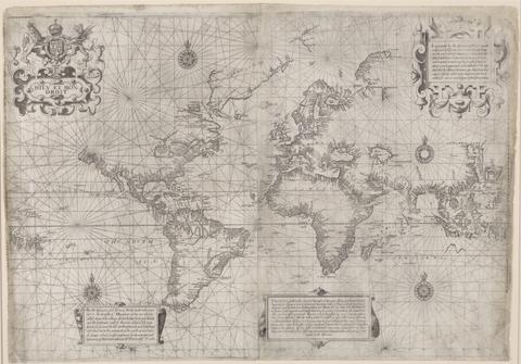
- [1599?]
- Physical Description:
- 1 map ; 43 x 62 cm
- Collection:
- Rare Books and Manuscripts

- Date:
- anno domini MDC [1600]
- Physical Description:
- 1 atlas : maps ; 30 cm (fol.)
- Collection:
- Rare Books and Manuscripts

- Date:
- anno MDC [1600]
- Physical Description:
- 1 atlas ([36] pages) : illustrations, maps ; 30 cm (fol.)
- Collection:
- Rare Books and Manuscripts

- Date:
- [1686?]
- Physical Description:
- 1 atlas ([60] leaves) : 30 hand-colored maps ; 54 cm
- Collection:
- Rare Books and Manuscripts

- Date:
- anno à partu Virgineo MDC [1600]
- Physical Description:
- 1 atlas ([84] pages) : illustrations, 20 maps ; 30 cm (fol.)
- Collection:
- Rare Books and Manuscripts

- Date:
- anno MDC [1600]
- Physical Description:
- 1 atlas ([52] pages) : maps ; 30 cm (fol.)
- Collection:
- Rare Books and Manuscripts
![Academiarum totius Europae seu orbis Christiani iuxta suas provincias nova tabula ad usum studiosorum emendate accomodate [cartographic material] / W. Kip sculp.](https://media.collections.yale.edu/thumbnail/ycba/73140180-2c50-4f87-81ba-d3ce924ad548)
- Date:
- An 1602
- Physical Description:
- 1 map ; 80 mm in diameter, on sheet 13 x 18 cm.
- Collection:
- Rare Books and Manuscripts

- Date:
- [ca. 1602]
- Physical Description:
- 1 map ; 80 mm in diameter, on sheet 13 x 18 cm.
- Collection:
- Rare Books and Manuscripts

- Date:
- [ca. 1602]
- Physical Description:
- 1 map ; 80 mm in diameter, on sheet 13 x 18 cm.
- Collection:
- Rare Books and Manuscripts

- Date:
- im Iahr MDCII [1602]
- Physical Description:
- 1 atlas ([120] pages) : illustrations, maps ; 28 cm (fol.)
- Collection:
- Rare Books and Manuscripts

- Date:
- [ca. 1602]
- Physical Description:
- 1 map ; 80 mm in diameter, on sheet 13 x 18 cm.
- Collection:
- Rare Books and Manuscripts

- Date:
- [Amsterdam?] :
- Physical Description:
- 1 atlas ([44] leaves of plates) ; 44 maps ; 13 x 18 cm.
- Collection:
- Rare Books and Manuscripts

- Date:
- [circa 1610?]
- Physical Description:
- 1 atlas ([110 ] leaves) : 55 maps ; 43 cm
- Collection:
- Rare Books and Manuscripts

- Date:
- 1606 [i.e. 1608?]
- Physical Description:
- 1 atlas ([510] pages) : 192 maps ; 42 cm (folio)
- Collection:
- Rare Books and Manuscripts

- Date:
- 1610
- Physical Description:
- 1 map : engraving ; 37 x 42 cm
- Collection:
- Rare Books and Manuscripts
- Credit Line:
- Yale Center for British Art, Gift of David Alan Richards, Yale BA 1967, JD 1972

- Date:
- 1610
- Physical Description:
- 1 map : engraving ; 37 x 50 cm
- Collection:
- Rare Books and Manuscripts
![The theatre of the empire of Great Britaine : presenting an exact geography of the kingdomes of England, Scotland, Ireland, and the iles adioyning : with the shires, hundreds, cities and shire-townes, within [the] kingdome of England / divided and described by Iohn Speed.](https://media.collections.yale.edu/thumbnail/ycba/05faa311-179e-44bd-a185-63bd2c871197)
- Date:
- [1612]
- Physical Description:
- [14], 146 [that is 280], [10] pages : illustrations (woodcuts), 67 maps (metal cuts) ; 46 cm (folio)
- Collection:
- Rare Books and Manuscripts

- Date:
- between 1613 and 1630]
- Physical Description:
- 1 map : hand col. ; 33.8 in diam.
- Collection:
- Rare Books and Manuscripts

- Date:
- anno cum privilegio 1616
- Physical Description:
- 1 atlas ([8], 94, [2], 99-126, [2], 131-132, [2], 137-146, [6] leaves) : maps ; 44 cm (folio)
- Collection:
- Rare Books and Manuscripts

- Date:
- 1966 [c1965]
- Physical Description:
- 6 pts. in 3 v. maps, plates. 45 cm.
- Collection:
- Reference Library

- Date:
- 1627
- Physical Description:
- [16], 146, [10] pages, [134] leaves of plates : maps ; 45 cm (folio)
- Collection:
- Rare Books and Manuscripts

- Date:
- 1627
- Physical Description:
- 1 atlas ([2], 44, 5-8 pages) : illustrations, 22 maps ; 43 cm
- Collection:
- Rare Books and Manuscripts

- Date:
- 1966
- Physical Description:
- xv, 44 (i.e. 86), 5-8 (i.e. 6), 43-56 p. illus., 29 fold. maps, port. 46 cm.
- Collection:
- Reference Library

- Date:
- anno 1632
- Physical Description:
- 1 atlas ([6], 749 [i.e. 743], [1] pages, [1] leaf of plates) : 179 maps ; 22 x 29 cm (4to)
- Collection:
- Rare Books and Manuscripts

- Date:
- 1635
- Physical Description:
- 1 atlas ([22], 401, [1], 409-599, 520-566, 649-930, [32] pages, 2 leaves of plates) : illustrations, maps (1 folded) ; 31 cm
- Collection:
- Rare Books and Manuscripts

- Date:
- 1633 [i.e. 1636]-1638
- Physical Description:
- 2 volumes (462 pages) : maps ; 47 cm
- Collection:
- Rare Books and Manuscripts

- Date:
- anno 1636[-1638]
- Physical Description:
- 2 volumes : illustrations, maps (some folded), portraits ; 49 cm (folio)
- Collection:
- Rare Books and Manuscripts

- Date:
- 1637
- Physical Description:
- 1 atlas ([22], 56, 55-56, [2], 401, [1], 409-599, 520-566, 649-930, [32] pages, 5 leaves of plates) : illustrations, maps ; 30 cm
- Collection:
- Rare Books and Manuscripts

- Date:
- [1638]
- Physical Description:
- 1 map : engraved ; 39 x 51 cm
- Collection:
- Rare Books and Manuscripts

- Date:
- 1638
- Physical Description:
- 3 volumes : illustrations, maps ; 51 cm
- Collection:
- Rare Books and Manuscripts
- Date:
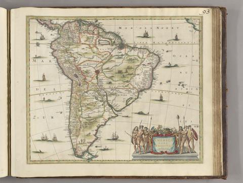
- [between 1641 and 1680]
- Physical Description:
- 1 map ; 45 x 52 cm
- Collection:
- Rare Books and Manuscripts
- Date:
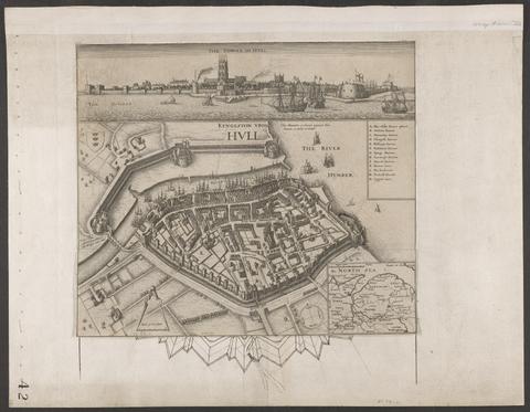
- circa 1642
- Physical Description:
- 1 view : illustrations ; 31 x 30 cm
- Collection:
- Rare Books and Manuscripts

- Date:
- [1645]
- Physical Description:
- 1 map ; 36 x 48 cm, on sheet 52 x 62 cm
- Collection:
- Rare Books and Manuscripts

- Date:
- [1645]
- Physical Description:
- 1 map : engraving ; 40 x 30 cm, on sheet 50 x 60 cm
- Collection:
- Rare Books and Manuscripts
- Date:
- [1970]
- Physical Description:
- 16 p., 230 plates : 2 col. illus., coats of arms, maps. ; 54 cm
- Collection:
- Reference Library

- Date:
- [not before 1645]
- Physical Description:
- 1 map ; 40.1 x 51 cm
- Collection:
- Rare Books and Manuscripts
- Credit Line:
- Yale Center for British Art, Gift of David Alan Richards, Yale BA 1967, JD 1972

- Date:
- 1646
- Physical Description:
- 1 atlas ([2], 44 [i.e. 88] pages) : illustrations, 22 maps ; 43 cm
- Collection:
- Rare Books and Manuscripts

- Date:
- [1646?]
- Physical Description:
- 1 atlas ([57] leaves) : 57 maps ; 44 x 56 cm
- Collection:
- Rare Books and Manuscripts

- Date:
- [not before 1647]
- Physical Description:
- 1 map ; 39.9 x 51 cm
- Collection:
- Rare Books and Manuscripts
- Credit Line:
- Yale Center for British Art, Gift of David Alan Richards, Yale BA 1967, JD 1972
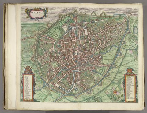
- Date:
- [1649]
- Physical Description:
- 1 atlas ([470] pages) : illustrations, maps, plans ; 54 cm
- Collection:
- Rare Books and Manuscripts

- Date:
- [1649]
- Physical Description:
- 1 atlas ([526] pages) : illustrations, maps, plans ; 53 cm
- Collection:
- Rare Books and Manuscripts

- Date:
- [1649]
- Physical Description:
- 1 atlas ([584] pages) : illustrations, maps, plans ; 54 cm
- Collection:
- Rare Books and Manuscripts

- Date:
- [1649]
- Physical Description:
- 1 atlas ([492] pages) : illustrations, maps, plans ; 53 cm
- Collection:
- Rare Books and Manuscripts
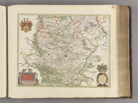
- Date:
- [1650?]
- Physical Description:
- 1 map; 40 x 51 cm
- Collection:
- Rare Books and Manuscripts

- Date:
- [1650]
- Physical Description:
- 1 atlas ([16], 5-8, 146 [i.e. 280], [10] pages) : illustrations, maps ; 45 cm (folio)
- Collection:
- Rare Books and Manuscripts

- Date:
- 1651 [1676 printing]
- Physical Description:
- 1 map : hand col. ; 2 hemipsheres each 25 cm. in diam., on sheet 45 x 57 cm.
- Collection:
- Rare Books and Manuscripts

- Date:
- 1652
- Physical Description:
- 1 map ; 29 x 43 cm, on sheet 45 x 55 cm
- Collection:
- Rare Books and Manuscripts

- Date:
- Año de MMCLIII [1653]
- Physical Description:
- 1 atlas (4 volumes) : maps ; 50 cm (folio)
- Collection:
- Rare Books and Manuscripts

- Date:
- MDCLVII [1657]
- Physical Description:
- 1 atlas (2 volumes) : illustrations, maps, plans, views ; 51 cm (folio)
- Collection:
- Rare Books and Manuscripts

- Date:
- [1657]
- Physical Description:
- 1 atlas (234 pages in various pagings, [3] leaves of plates) : illustrations, maps, plans ; 52 cm (folio)
- Collection:
- Rare Books and Manuscripts
84. Illustriorum regni Galliae civitatum tabulae, ut & Helvetiae confoederatae civitates celebriores.

- Date:
- [1657]
- Physical Description:
- 1 atlas (200 pages in various pagings, [1] leaf of plates) : illustrations, maps, plans ; 51 cm (folio)
- Collection:
- Rare Books and Manuscripts

- Date:
- MDCLVII [1657]
- Physical Description:
- 1 atlas (2 volumes) : illustrations, maps, plans, views ; 51 cm (folio)
- Collection:
- Rare Books and Manuscripts

- Date:
- [1657]
- Physical Description:
- 1 atlas (252 pages in various pagings, [3] leaves of plates (2 folded)) : illustrations, maps, plans ; 51 cm (folio)
- Collection:
- Rare Books and Manuscripts

- Date:
- [1657]
- Physical Description:
- 1 atlas (300 pages in various pagings, [6] leaves of plates) : illustrations, maps, plans ; 50 cm (folio)
- Collection:
- Rare Books and Manuscripts

- Date:
- [approximately 1660]
- Physical Description:
- 1 map : hand colored, vellum ; 77 x 96 cm
- Collection:
- Rare Books and Manuscripts

- Date:
- [ca. 1660?]
- Collection:
- Rare Books and Manuscripts

- Date:
- [ca. 1660]
- Physical Description:
- 1 map ; 36 x 48 cm
- Collection:
- Rare Books and Manuscripts

- Date:
- [1662?]
- Physical Description:
- 1 map ; 36 x 44 cm.
- Collection:
- Rare Books and Manuscripts
92. Atlas maior, sive, Cosmographia Blauiana : qua solum, salum, coelum, accuratissime describuntur.

- Date:
- MDCLXII [1662]
- Physical Description:
- 11 volumes : illustrations, maps ; 58 cm
- Collection:
- Rare Books and Manuscripts
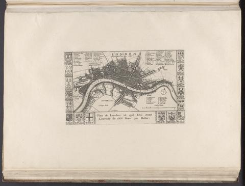
- Date:
- [1666?]
- Physical Description:
- 1 map ; 14 x 24 cm., on sheet 37 x 55 cm.
- Collection:
- Rare Books and Manuscripts

- Date:
- 1666
- Physical Description:
- 1 map ; 30 x 54 cm., on sheet 50 x 58 cm.
- Collection:
- Rare Books and Manuscripts

- Date:
- 1666
- Physical Description:
- 1 atlas ([20] pages, [82] leaves of plates (2 folded)) : 41 maps ; 59 cm (folio)
- Collection:
- Rare Books and Manuscripts
![[Chart of the Thames estuary with a view of the English fleet burning in the Medway] [cartographic material].](https://media.collections.yale.edu/thumbnail/ycba/02ae63ff-cd23-4365-8ae6-55a7533753c2)
- Date:
- 1667
- Physical Description:
- 1 map ; 34 x 45 cm, on sheet 45 x 49 cm
- Collection:
- Rare Books and Manuscripts

- Date:
- MDCLXVII [1667]
- Physical Description:
- 12 volumes : color illustrations, color maps ; 57 cm
- Collection:
- Rare Books and Manuscripts

- Date:
- [1671]-[1672]
- Physical Description:
- 1 atlas (2 volumes) : illustrations, maps, portraits ; 45 cm (folio)
- Collection:
- Rare Books and Manuscripts

- Date:
- [1673]
- Physical Description:
- 1 map ; 29.9 x 27 cm
- Collection:
- Rare Books and Manuscripts
- Credit Line:
- Yale Center for British Art, Gift of David Alan Richards, Yale BA 1967, JD 1972

- Date:
- MDCLXXV [1675]
- Physical Description:
- 1 atlas ([26], 200, [4] pages, [203] leaves of plates (some folded)) : illustrations, maps ; 43 cm (folio)
- Collection:
- Rare Books and Manuscripts