<< YCBA Home Yale Center for British Art Yale Center for British Art << YCBA Home

YCBA Collections Search

Search Constraints

You searched for:

Author ss Arrowsmith, Aaron, 1750-1823

Remove constraint Author ss: Arrowsmith, Aaron, 1750-1823

Period 19th century

Remove constraint Period: 19th century

Search Results

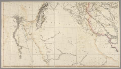
Arrowsmith, Aaron, 1750-1823. Outline of the countries between Delhi and Constantinople /
Arrowsmith, Aaron, 1750–1823
Outline of the countries between Delhi and Constantinople
1814 [i.e. 1821?]
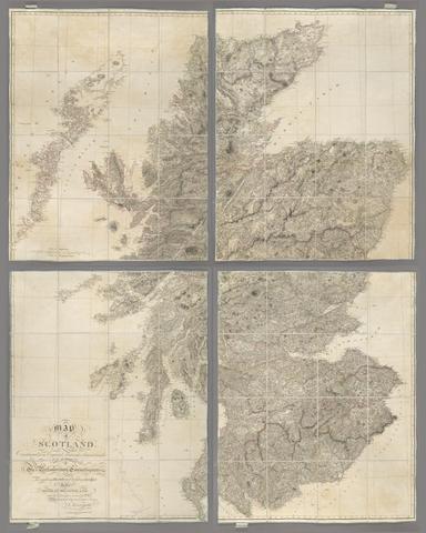
Arrowsmith, Aaron, 1750-1823, cartographer. Map of Scotland :
Arrowsmith, Aaron, 1750–1823
Map of Scotland
[1807.]
Arrowsmith, Aaron, 1750-1823. Map of Upper Egypt /
Arrowsmith, Aaron, 1750–1823
Map of Upper Egypt
1807
Arrowsmith, Aaron, 1750-1823. Ireland /
Arrowsmith, Aaron, 1750–1823
Ireland
1811
Arrowsmith, Aaron, 1750-1823. Map of the Alpine country, in the south of Europe /
Arrowsmith, Aaron, 1750–1823
Map of the Alpine country, in the south of Europe
June 11th 1804
Arrowsmith, Aaron, 1750-1823. Map of the Province of Malabar by A. Arrowsmith.
Arrowsmith, Aaron, 1750–1823
Map of the Province of Malabar by A. Arrowsmith
1809
Arrowsmith, Aaron, 1750-1823, cartographer. Chart of the West Indies and Spanish Dominions in North America /
Arrowsmith, Aaron, 1750–1823
Chart of the West Indies and Spanish Dominions in North America
[1810]
Arrowsmith, Aaron, 1750-1823. Map of lower Egypt /
Arrowsmith, Aaron, 1750–1823
Map of lower Egypt
1807
Arrowsmith, Aaron, 1750-1823. A map of the United States of North America :
Arrowsmith, Aaron, 1750–1823
A map of the United States of North America
Jany. 1st 1796
Arrowsmith, Aaron, 1750-1823. Map exhibiting the great post roads, physical and political divisions of Europe :
Arrowsmith, Aaron, 1750–1823
Map exhibiting the great post roads, physical and political divisions of Europe
2nd Jany. 1810
Arrowsmith, Aaron, 1750-1823. To Captain Carmichael Smyth of the Corps of Royal Engineers who obligingly furnished many of the materials this chart of the Cape of Good Hope is inscribed /
Arrowsmith, Aaron, 1750–1823
To Captain Carmichael Smyth of the Corps of Royal Engineers who obligingly furnished many of the materials this chart of the Cape of Good Hope is inscribed
1805
Arrowsmith, Aaron, 1750-1823. To Mark Wood Esq., M.P. colonel of the Army in India, late Chief Engineer and Surveyor General, Bengal, this map of India, compiled from various interesting and valuable materials, is inscribed in grateful testimony of his liberal communications /
Arrowsmith, Aaron, 1750–1823
To Mark Wood Esq., M.P. colonel of the Army in India, late Chief Engineer and Surveyor General, Bengal, this map of India, compiled from various interesting and valuable materials, is inscribed in grateful testimony of his liberal communications
1804
Arrowsmith, Aaron, 1750-1823, cartographer.  A new map of Mexico and adjacent provinces
Arrowsmith, Aaron, 1750–1823
A new map of Mexico and adjacent provinces
1810
Arrowsmith, Aaron, 1750-1823. Map of America /
Arrowsmith, Aaron, 1750–1823
Map of America
4th September 1804
Arrowsmith, Aaron, 1750-1823. Map of South Italy and adjacent coasts /
Arrowsmith, Aaron, 1750–1823
Map of South Italy and adjacent coasts
1807
Arrowsmith, Aaron, 1750-1823. Map of the island of Ceylon /
Arrowsmith, Aaron, 1750–1823
Map of the island of Ceylon
5, Janry. 1805
Arrowsmith, Aaron, 1750-1823. A map exhibiting all the new discoveries in the interior parts of North America :
Arrowsmith, Aaron, 1750–1823
A map exhibiting all the new discoveries in the interior parts of North America
[1811]
Arrowsmith, Aaron, 1750-1823. To His Royal Highness the Duke of Cambridge ... :
Arrowsmith, Aaron, 1750–1823
To His Royal Highness the Duke of Cambridge ...
1812
Arrowsmith, Aaron, 1750-1823. Hydrographical chart of the world :
Arrowsmith, Aaron, 1750–1823
Hydrographical chart of the world
1811 Sept. 10