Search Constraints
You searched for:
Period 18th century
Remove constraint Period: 18th centuryWork Type map
Remove constraint Work Type: mapSearch Results

1
- North America, and the West Indies
- [1764?]

2
- A plan of mathematical learning taught in the Royal Academy, Portsmouth
- approximately 1798-1799

3
- The route of the mail & post coaches, George Boulton & Co. proprietors
- [between 1796 and 1809]

4
- London and Westminster improved
- MDCCLXVU [1766]

5
- A map of London and the adjacent country 10 miles round
- 1748

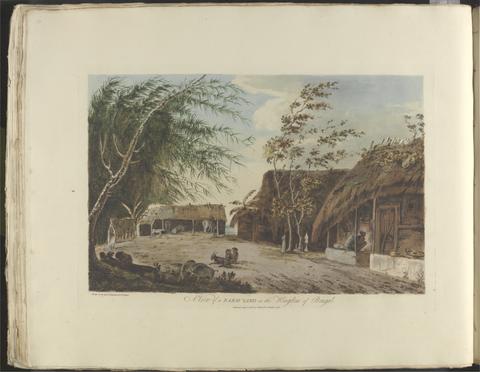
6
- London and Westminster in the reign of Queen Elizabeth anno dom. 1563
- October 30th, 1789

7
- A plan of Rome
- 1750

8
- The environs of London
- [1763]

9
- A survey and valuation of estates the property of Nicholas Smyth Esqr. and his Lady
- 1767

10
- A survey of the estate of John Plampin Esquire, taken in 1774,
- 1774

11
- A voyage to the South Sea, and round the world, perform'd in the years 1708, 1709, 1710, and 1711, by the ships Duke and Dutchess of Bristol
- MDCCXII [1712]

12
- Wallis's tour of Europe
- Nov. 24th, 1794

13
- To Martin Folkes, esq., president of the Royal Society
- 1749

14
- The county of Dorset
- June 1st, 1795

15
- Sir Joseph Banks's fishery book of the River Witham in Lincolnshire
- 1784-1800

16
- A survey of the estate of Richard Moore, Esq., Kentwell Hall, Suffolk
- 1777

17
- Survey and valuation of the several estates belonging to John Kinchant Esqr. and Emma his wife
- 1765

18
- Map of the southeastern part of North America
- 1721

19
- A map of Hindoostan or the Mogul Empire
- 1788
20
- Choix de vues de l'Inde
- [1788]

21
- The history of the British plantations in America
- MDCCXXXVIII [1738]
22
- America
- [after 1727]
23
- Travels through the interior parts of America
- MDCCLXXXIX [1789]
24
- Twenty-one plans, with explanations of different actions in the West Indies, during the late war
- MDCCLXXXIV [1784]
25
- Select views of the antiquities and harbours in the south of France
- 1794
26
- The Seraglio & gardens of the Grand Seignior = Serrail & jardins du Grand Seigneur
- 1752
27
- A survey of the city and suburbs of Dublin
- 1757
28
- The American atlas, or, A geographical description of the whole continent of America
- MDCCLXXVI [1776]
29
- A description of the Spanish islands and settlements on the coast of the West Indies
- 1762
30
- An exact survey of the cities of London and Westminster, the borough of Southwark, with the country near ten miles round
- [1747]
31
- The elements of navigation
- 1759
32
- A map of the county of Middlesex
- 1757
33
- Travels through the middle settlements in North America, in the years 1759 and 1760
- 1798
34
- A voyage to North-America: undertaken by command of the present King of France
- MDCCLXVI [1766]
35
- A plan of Paris and the adjacent country
- 1748
36
- The present state of the European settlements on the Missisippi
- MDCCLXX [1770]
37
- A description of the windward passage, and Gulf of Florida, with the course of the British trading-ships to, and from the island of Jamaica
38
- The county of Suffolk
- 1783
39
- The road from Cambridge to Coventry
- [1720]
40
- The London directory, or, A new and improved plan of London, Westminster & Southwark
- 1794
41
- Ichnographia urbis Londinii
- 1724
42
- A new map of Virginia, Mary-Land, and the improved parts of Pennsylvania & New Jersey
- 1719
43
- Voyage de La Pérouse autour du monde
- l'an VI de la République, 1798
44
- A general map of the middle British colonies in America
- 1771
45
- Magna Britannia, aut Anglia, Scotia et Hibernia, quarum prior divisa in septem Regna, sive Provincias, dictas Northumbriam, Merciam, Angliam Orient. Essexiam, Cantium, Sussexiam, Westsexiam, et Princi. Walliae. posterior in Septent. et Austr. Scotiam. postrema in quatuor Provincias Ultoniam, Lageniam, Momoniam, et Conagtiam
- [approximately 1705]
46
- England and Wales
- [circa 1768]
47
- The United States of North America, with the British territories and those of Spain, according to the treaty of 1784
- 1793
48
- The natural history of Cambridgeshire
- [1763]
49
- A new and compleat map of all America
- [1763]
50
- Journal dédié a Monsieur frere du roi
51
- Cambridgeshire
- 1747
52
- The history of the bucaniers of America
- 1704
53
- The road from London to Cambridge, Ely & Kings Lynn
- [1769]
54
- The history of the American Indians
- MDCCLXXV [1775]
55
- A general map of England & Wales, divided into its counties
- circa [1800?]
56
- A new pocket plan of the cities of London & Westminster
- [1790]
57
- A map of Pensilvania, New-Jersey, New-York, and the three Delaware counties
- 1749
58
- A voyage round the world
- MDCCLXXIX [1789]
59
- The American gazetteer
- 1762
60
- Travels through the United States of North America
- 1799
61
- A map of the British colonies in North America
- [1775?]
62
- The sea of Marmara or Propontis
- Jany. 11th, 1786
63
- A new map of the English empire in America
- 1719
64
- Cambridgeshire
- [1784]
65
- The roads from London to Norwich, Cambridge, Ely & Kings Lynn
- [1775?]
66
- A map of the British Empire in America
- [ca. 1737]
67
- James Bruce archive,
- ca. 1750-ca.1850
68
- A map of the British and French dominions in North America
- [that is, 1757]
69
- A plan of Paris &c.
- 1754,
70
- Map of England and Wales
- circa [1800?]
71
- A topographical map of the county of Norfolk
- 1797
72
- A voyage round the world
- 1789
73
- A new and accurate survey of the cities of London and Westminster, the borough of Southwark
- 1751
74
- A plan of the city of Dublin and the environs
- 1760]
75
- The history and antiquities of the county of Essex
- 1768
76
- An exact survey of the city and suburbs of Dublin
- 1756
77
- A map of the kingdom of Ireland
- [between 1762 and 1773]
78
- Recens edita totius Novi Belgii, in America Septentrionali siti
- [1730]
79
- To the nobility, gentry, clergy and others, this map of the county of Monmouth, is most humbly inscribed
- 1785
80
- Isole Britanniche
- [1706]
81
- The history of the origin, progress, and termination of the American war
- 1794
82
- A topographical map of Wiltshire
- [1773]
83
- The American traveller, or, Observations on the present state, culture and commerce of the British colonies in America, and the further improvements of which they are capable
- MDCCLXIX [1769]
84
- A new map containing the towns, gentlemens houses, villages, and other remarks round London
- [ca. 1700]
85
- A topographical map of Hartford-shire, from an actual survey
- [1782]
86
- Wiltshire, wth. Salisbury citty & Stone heng described ano. 1689
- [approximately 1715?]
87
- A plan of Paris &c.
- 1754
88
- Travels through the Maritime Alps, from Italy to Lyons, across the Col de Tende, by the way of Nice, Provence, Languedoc, &c.
- 1795
89
- A new and exact map of America laid down from the latest observations and discoveries
- [approximately 1740?]
90
- To the Right Honourable William Baron of Hedon, Viscount Pulteney of Wrington and Earl of Bath
- 1746
91
- Bowles's New pocket plan of the cities of London & Westminster
- [1790]
92
- Proposals
- 1745]
93
- A collection of voyages
- MDCCXXIX [1729]
94
- Manuscript copy of Richard Turner's A view of the earth : a short system of modern geography
- 1798
95
- Carte de France
- 1744-1760
96
- A plan for rebuilding the city of London, after the great fire in 1666
- [1749 October 3]
97
- A plan of London on the same scale as that of Paris
- 1754
98
- A survey of the city, harbour, bay and environs of Dublin
- 1757
99
- A map of the British Empire in America
- [ca. 1737]
100
- The County of Cambridge
- 1759