<< YCBA Home Yale Center for British Art Yale Center for British Art << YCBA Home

YCBA Collections Search

Search Constraints

You searched for:

Form genre ss Maps.

Remove constraint Form genre ss: Maps.

Search Results

Lowry, Howard Foster, 1901-1967, author. 'What was, and is, and will abide ...' :
Lowry, Howard Foster, 1901–1967
'What was, and is, and will abide ...'
1943
Great Britain. Ordnance Survey.  [Brecon] /
Great Britain. Ordnance Survey
[Brecon]
1st September 1832
Great Britain. Ordnance Survey. [Cambridge]
Great Britain. Ordnance Survey
[Cambridge]
1st June 1836
Bryan, Clare, 1966- [City].
Bryan, Clare, 1966–
[City]
2001
Great Britain. Ordnance Survey. [Colchester] /
Great Britain. Ordnance Survey
[Colchester]
1st Novr. 1838
Great Britain. Ordnance Survey.  [Downham] /
Great Britain. Ordnance Survey
[Downham]
1st March 1824
Great Britain. Ordnance Survey.  [Dunmow] /
Great Britain. Ordnance Survey
[Dunmow]
[not before 1862]
Great Britain. Ordnance Survey.  [Dunwich] /
Great Britain. Ordnance Survey
[Dunwich]
August 7th, 1837
Great Britain. Ordnance Survey.  [Eye] /
Great Britain. Ordnance Survey
[Eye]
August 7, 1837
Great Britain. Ordnance Survey.  [Norwich] /
Great Britain. Ordnance Survey
[Norwich]
January 1st 1838
Great Britain. Ordnance Survey. [Old series Ordnance Survey maps of England and Wales]
Great Britain. Ordnance Survey
[Old series Ordnance Survey maps of England and Wales]
[1839-1874?]
Great Britain. Ordnance Survey.  [Radnor] /
Great Britain. Ordnance Survey
[Radnor]
1st October 1833
Foster, Tony, 1946- artist.  [Sacred places portfolio book].
Foster, Tony, born 1946
[Sacred places portfolio book]
[2015]
Great Britain. Ordnance Survey.  [Swansea] /
Great Britain. Ordnance Survey
[Swansea]
[not before 1862]
Saxton, Christopher, 1542?- cartographer. [The travellers guide :
Saxton, Christopher, 1542?-
[The travellers guide
[1686?]
Lyon, G. F. (George Francis), 1795-1832, author, illustrator. A brief narrative of an unsuccessful attempt to reach Repulse Bay :
Lyon, G. F. (George Francis), 1795–1832
A brief narrative of an unsuccessful attempt to reach Repulse Bay
MDCCCXXV [1825]
Burney, James, 1750-1821, author. A chronological history of the discoveries in the South Sea or Pacific Ocean /
Burney, James, 1750–1821
A chronological history of the discoveries in the South Sea or Pacific Ocean
1803-1817
Dampier, William, 1652-1715, author. A collection of voyages :
Dampier, William, 1652–1715
A collection of voyages
MDCCXXIX [1729]
Badeslade, Thomas. A compleat sett of mapps of England and Wales in general, and of each county in particular :
Badeslade, Thomas
A compleat sett of mapps of England and Wales in general, and of each county in particular
1724
 A consequential coastline.
A consequential coastline
1996
Cowley, J. (John), author. A description of the windward passage, and Gulf of Florida, with the course of the British trading-ships to, and from the island of Jamaica :
Cowley, J. (John)
A description of the windward passage, and Gulf of Florida, with the course of the British trading-ships to, and from the island of Jamaica
Rocque, John, -1762, cartographer.  A general map of North America :
Rocque, John, -1762
A general map of North America
[1762?]
Evans, Lewis, 1700?-1756. A general map of the middle British colonies in America :
Evans, Lewis, 1700?-1756
A general map of the middle British colonies in America
1771
Greenough, George Bellas, 1778-1855, cartographer. A geological map of England & Wales /
Greenough, George Bellas, 1778–1855
A geological map of England & Wales
November 1st, 1819 [that is, 1820]
Greenough, George Bellas, 1778-1855, cartographer. A geological map of England & Wales /
Greenough, George Bellas, 1778–1855
A geological map of England & Wales
November 1st, 1819 [that is, 1820]
Glaser, Josef, author. A Guide to Schönbrunn.
Glaser, Josef
A Guide to Schönbrunn
[1958?]
Bryars, Tim, author. A history of the twentieth century in 100 maps /
Bryars, Tim
A history of the twentieth century in 100 maps
2014
Dallaway, James, 1763-1834, author. A history of the western division of the county of Sussex :
Dallaway, James, 1763–1834
A history of the western division of the county of Sussex
1815-1832
 A map of Cambridgeshire.
A map of Cambridgeshire
[1720?]
Smith, Elizabeth, approximately 1787- A map of England and Wales /
Smith, Elizabeth, approximately 1787–
A map of England and Wales
1797
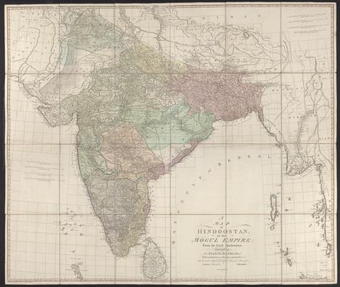
Rennell, James, 1742-1830. A map of Hindoostan or the Mogul Empire :
Rennell, James, 1742–1830
A map of Hindoostan or the Mogul Empire
1788
Speed, John, 1552?-1629. A map of New England and New York /
Speed, John, 1552?-1629
A map of New England and New York
[1676]
Evans, Lewis, 1700?-1756, cartographer. A map of Pensilvania, New-Jersey, New-York, and the three Delaware counties
Evans, Lewis, 1700?-1756
A map of Pensilvania, New-Jersey, New-York, and the three Delaware counties
1749
Carrington, F. A. (Frederick Augustus), 1801-1860. A map of Scotland :
Carrington, F. A. (Frederick Augustus), 1801–1860
A map of Scotland
1856
Mitchell, John, 1711-1768, cartographer. A map of the British and French dominions in North America :
Mitchell, John, 1711–1768
A map of the British and French dominions in North America
[that is, 1757]
Mitchell, John, 1711-1768, cartographer. A map of the British and French dominions in North America
Mitchell, John, 1711–1768
A map of the British and French dominions in North America
Febry 13th, 1755
Mitchell, John, 1711-1768, cartographer. A map of the British colonies in North America :
Mitchell, John, 1711–1768
A map of the British colonies in North America
[1775?]
Popple, Henry, -1743, cartographer. A map of the British Empire in America, with the French and Spanish settlements adjacent thereto /
Popple, Henry, -1743
A map of the British Empire in America, with the French and Spanish settlements adjacent thereto
[1739]
Rocque, John, -1762. A map of the county of Middlesex :
Rocque, John, -1762
A map of the county of Middlesex
1757
 A map of the Environs of Constantinople ... A. Arrowsmith 1801 and 1804.
A map of the Environs of Constantinople ... A. Arrowsmith 1801 and 1804
1804
Cassini, César-François, 1714-1784, cartographer. A map of the kingdom of France :
Cassini, César-François, 1714–1784
A map of the kingdom of France
Augt. 2nd. 1838
Rocque, John, -1762. A map of the kingdom of Ireland :
Rocque, John, -1762
A map of the kingdom of Ireland
[between 1762 and 1773]
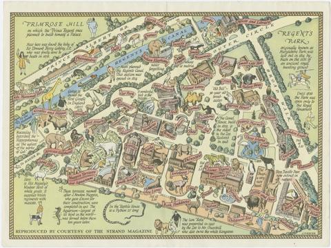
Zoological Society of London, creator. A map of the Zoological Society Gardens in Regents Park commonly called The Zoo :
Zoological Society of London
A map of the Zoological Society Gardens in Regents Park commonly called The Zoo
[approximately 1947]
 A mapp of the north part from the equinoctial, with the auncient seates of the families mentioned in Genesis :
A mapp of the north part from the equinoctial, with the auncient seates of the families mentioned in Genesis
[ca. 1590]
Speed, John, 1552?-1629. A new and accurat map of the world :
Speed, John, 1552?-1629
A new and accurat map of the world
1651 [1676 printing]
Bell, James, 1769-1833, author. A new and comprehensive gazetteer of England and Wales :
Bell, James, 1769–1833
A new and comprehensive gazetteer of England and Wales
MDCCCXXXIII-MDCCCXXXIV [1833-1834]
 A New Geographical Game exhibiting a complete Tour through Scotland and the Western Isles. Neele Sc.
A New Geographical Game exhibiting a complete Tour through Scotland and the Western Isles. Neele Sc
1792
Kitchin, Thomas, 1719-1784, cartographer. A new improved map of Oxfordshire :
Kitchin, Thomas, 1719–1784
A new improved map of Oxfordshire
[1750]
Cary, John, approximately 1754-1835, engraver, publisher. A new map of Cambridgeshire
Cary, John, approximately 1754–1835
A new map of Cambridgeshire
Apr. 28, 1811
Cary, John, approximately 1754-1835, engraver, publisher. A new map of Leicestershire
Cary, John, approximately 1754–1835
A new map of Leicestershire
Sepr. 28,1801
Stanford, Edward, 1827-1904, publisher. A new map of metropolitan railways, tramways & miscellaneous improvements :
Stanford, Edward, 1827–1904
A new map of metropolitan railways, tramways & miscellaneous improvements
January 1st, 1874
Arrowsmith, Aaron, 1750-1823, cartographer.  A new map of Mexico and adjacent provinces
Arrowsmith, Aaron, 1750–1823
A new map of Mexico and adjacent provinces
1810
 A new map of the county of Cornwall :
A new map of the county of Cornwall
January 6th 1804 [i.e. 1808]
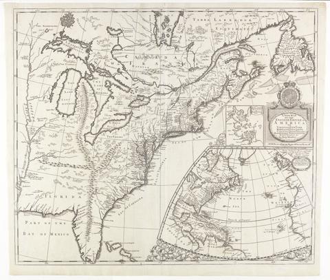
Morden, Robert, approximately 1650-1703, cartographer. A new map of the English empire in America :
Morden, Robert, approximately 1650–1703
A new map of the English empire in America
[ca. 1695]
Senex, John, -1740. A new map of the English empire in America
Senex, John, -1740
A new map of the English empire in America
1719
Senex, John, -1740. A new map of Virginia, Mary-Land, and the improved parts of Pennsylvania & New Jersey
Senex, John, -1740
A new map of Virginia, Mary-Land, and the improved parts of Pennsylvania & New Jersey
1719
Browne, Christopher, active 1684-1712. A new map of Virginia, Maryland, and the improved parts of Pennsylvania & New Jersey
Browne, Christopher, active 1684–1712
A new map of Virginia, Maryland, and the improved parts of Pennsylvania & New Jersey
[1685?]
Morden, Robert, approximately 1650-1703. A new mapp of England Scotland and Ireland
Morden, Robert, approximately 1650–1703
A new mapp of England Scotland and Ireland
[1678]
Gerning, J. I. (Johann Isaac), 1767-1837, author. A picturesque tour along the Rhine from Mentz to Cologne :
Gerning, J. I. (Johann Isaac), 1767–1837
A picturesque tour along the Rhine from Mentz to Cologne
MDCCCXX [1820]
Gwynn, John, 1713-1786, cartographer.  A plan for rebuilding the city of London, after the great fire in 1666 :
Gwynn, John, 1713–1786
A plan for rebuilding the city of London, after the great fire in 1666
[1749 October 3]
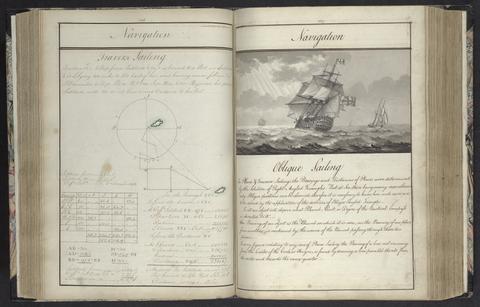
Rice, Edmund Nagle, -1801. A plan of mathematical learning taught in the Royal Academy, Portsmouth :
Rice, Edmund Nagle, -1801
A plan of mathematical learning taught in the Royal Academy, Portsmouth
approximately 1798-1799
 A practical guide during a journey from London to Paris :
A practical guide during a journey from London to Paris
1802
Pownall, Thomas, 1722-1805, author. A topographical description of such parts of North America as are contained in the (annexed) map of the middle British colonies & in North America. /
Pownall, Thomas, 1722–1805
A topographical description of such parts of North America as are contained in the (annexed) map of the middle British colonies & in North America.
MDCCLXXVI. [1776]
Dury, Andrew, cartographer.  A topographical map of Hartford-shire, from an actual survey :
Dury, Andrew
A topographical map of Hartford-shire, from an actual survey
[1782]
Faden, William, 1749-1836.  A topographical map of the county of Norfolk
Faden, William, 1749–1836
A topographical map of the county of Norfolk
1797
Andrews, John, 1736-1809, cartographer. A topographical map of Wiltshire :
Andrews, John, 1736–1809
A topographical map of Wiltshire
[1773]
Forbes, James, 1749-1819.  A voyage from England to Bombay with descriptions in Asia, Africa, and South America.
Forbes, James, 1749–1819
A voyage from England to Bombay with descriptions in Asia, Africa, and South America
Broughton, William Robert, 1762-1821, author. A voyage of discovery to the North Pacific Ocean :
Broughton, William Robert, 1762–1821
A voyage of discovery to the North Pacific Ocean
1804
Beresford, William, active 1788, author. A voyage round the world :
Beresford, William, active 1788
A voyage round the world
1789
Portlock, Nathaniel, 1748?-1817, author. A voyage round the world :
Portlock, Nathaniel, 1748?-1817
A voyage round the world
MDCCLXXIX [1789]
Ellis, Henry, 1721-1806, author. A voyage to Hudson's-Bay :
Ellis, Henry, 1721–1806
A voyage to Hudson's-Bay
MDCCXLVII [1748]
Charlevoix, Pierre-François-Xavier de, 1682-1761, author. A voyage to North-America: undertaken by command of the present King of France :
Charlevoix, Pierre-François-Xavier de, 1682–1761
A voyage to North-America: undertaken by command of the present King of France
MDCCLXVI [1766]
Cooke, Edward, Captain, author. A voyage to the South Sea, and round the world, perform'd in the years 1708, 1709, 1710, and 1711, by the ships Duke and Dutchess of Bristol :
Cooke, Edward, Captain
A voyage to the South Sea, and round the world, perform'd in the years 1708, 1709, 1710, and 1711, by the ships Duke and Dutchess of Bristol
MDCCXII [1712]
Le Charron, André-Louis-Lambert, Baron, 1759-1837. A word to the wise
Le Charron, André-Louis-Lambert, Baron, 1759–1837
A word to the wise
1796
James, Edwin, 1797-1861, compiler. Account of an expedition from Pittsburgh to the Rocky Mountains :
James, Edwin, 1797–1861
Account of an expedition from Pittsburgh to the Rocky Mountains
1822-1823
Smyth, W. H. (William Henry), 1788-1865, author. Addenda to the Aedes Hartwellianae /
Smyth, W. H. (William Henry), 1788–1865
Addenda to the Aedes Hartwellianae
MDCCCLXIV [1864]
Smyth, W. H. (William Henry), 1788-1865, author. Aedes Hartwellianae, or, Notices of the manor and mansion of Hartwell /
Smyth, W. H. (William Henry), 1788–1865
Aedes Hartwellianae, or, Notices of the manor and mansion of Hartwell
MDCCCLI [1851]
Ogilby, John, 1600-1676. Africa :
Ogilby, John, 1600–1676
Africa
MDC LXX [1670]
Valck, G. (Gerard), 1651-1726.  Africa
Valck, G. (Gerard), 1651–1726
Africa
[ca. 1686?]
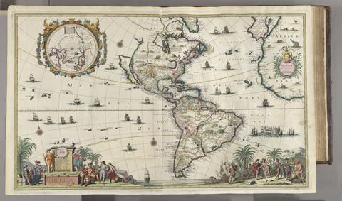
Ogilby, John, 1600-1676, author, publisher. America :
Ogilby, John, 1600–1676
America
MDCLXXI [1671]
Valck, G. (Gerard), 1651-1726.  America
Valck, G. (Gerard), 1651–1726
America
[ca. 1686]
Blaeu, Willem Janszoon, 1571-1638. America quarta pars orbis ...
Blaeu, Willem Janszoon, 1571–1638
America quarta pars orbis ..
[1686?]
Speed, John, 1552?-1629. America with those known parts in that unknowne worlde both people and manner of buildings /
Speed, John, 1552?-1629
America with those known parts in that unknowne worlde both people and manner of buildings
[1662?]
Mercator, Michael, d. 1600. America, siue, India Nova :
Mercator, Michael, d. 1600
America, siue, India Nova
between 1613 and 1630]
Overton, Henry, 1675 or 1676-1751. America.
Overton, Henry, 1675 or 1676–1751
America
[after 1727]
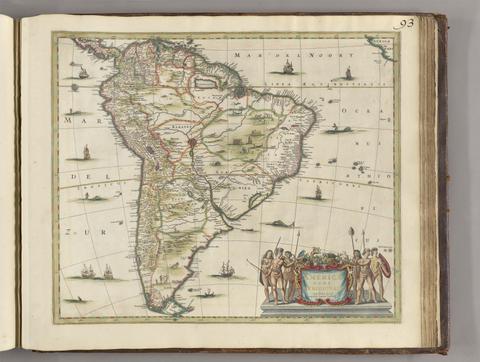
Jansson, Jan, 1588-1664, publisher. Americae pars meridionalis.
Jansson, Jan, 1588–1664
Americae pars meridionalis
[between 1641 and 1680]
Robson, Joseph, author. An account of six years residence in Hudson's-Bay from 1733 to 1736, and 1744 to 1747 /
Robson, Joseph
An account of six years residence in Hudson's-Bay from 1733 to 1736, and 1744 to 1747
MDCCLII [1752]
Leake, John, cartographer. An exact surveigh of the streets, lanes and churches comprehend[e]d within the ruins of the city of London :
Leake, John
An exact surveigh of the streets, lanes and churches comprehend[e]d within the ruins of the city of London
[1723]
Haliburton, Thomas Chandler, 1796-1865, author. An historical and statistical account of Nova-Scotia :
Haliburton, Thomas Chandler, 1796–1865
An historical and statistical account of Nova-Scotia
1829
Richardson, John, Sir, 1787-1865, author. Arctic searching expedition :
Richardson, John, Sir, 1787–1865
Arctic searching expedition
1851
Valck, G. (Gerard), 1651-1726. Asia.
Valck, G. (Gerard), 1651–1726
Asia
[ca. 1686?]
Russell, Georgia, 1974- Australia.
Russell, Georgia, 1974–
Australia
2003
 Bacon's county map and guide :
Bacon's county map and guide
[1902]
G.W. Bacon & Co.  Bacon's large print map of London and suburbs
G.W. Bacon & Co
Bacon's large print map of London and suburbs
[ca. 1910?]
G.W. Bacon & Co. Bacon's large print map of London and suburbs
G.W. Bacon & Co
Bacon's large print map of London and suburbs
[ca. 1910?]
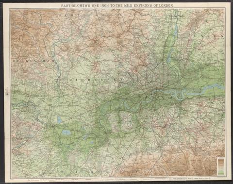
John Bartholomew and Son, cartographer. Bartholomew's one inch to the mile environs of London.
John Bartholomew and Son
Bartholomew's one inch to the mile environs of London
[not before 1921]
Adam and Charles Black (Firm) Black's plan of London /
Adam and Charles Black (Firm)
Black's plan of London
[1871?]
Blaeu, Willem Janszoon, 1571-1638. Blaeu's Atlas of England, Scotland, Wales and Ireland
Blaeu, Willem Janszoon, 1571–1638
Blaeu's Atlas of England, Scotland, Wales and Ireland
[1970]
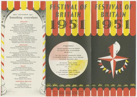
Festival of Britain (1951 : Great Britain) Britain at home to the world :
Festival of Britain (1951 : Great Britain)
Britain at home to the world
1951
Camden, William, 1551-1623. Britannia, or, A chorographical description of the flourishing kingdoms of England, Scotland, and Ireland, and the islands adjacent :
Camden, William, 1551–1623
Britannia, or, A chorographical description of the flourishing kingdoms of England, Scotland, and Ireland, and the islands adjacent
1806