Search Constraints
You searched for:
Genre cartographic material
Remove constraint Genre: cartographic materialSubject Terms ships
Remove constraint Subject Terms: shipsSearch Results
![Mrs. P. D. H. Page Map of Raleigh's Virginia: The East Coast of North America from Cape Lookout to Chesapeake Bay, after original by John White in the British Museum [Sir Walter Raleigh's Virginia, No. 111 A]](https://media.collections.yale.edu/thumbnail/ycba/aa273bf1-4d54-4726-99f1-aa8836010023)
1
- Map of Raleigh's Virginia: The East Coast of North America from Cape Lookout to Chesapeake Bay, after original by John White in the British Museum [Sir Walter Raleigh's Virginia, No. 111 A]
- undated
![Mrs. P. D. H. Page Map of North America from Florida to Chesapeake Bay, after the original by John White in the British Museum [Sir Walter Raleigh's Virginia, No. 110]](https://media.collections.yale.edu/thumbnail/ycba/f14d2599-644f-40b2-8aee-01feeb08ac1a)
2
- Map of North America from Florida to Chesapeake Bay, after the original by John White in the British Museum [Sir Walter Raleigh's Virginia, No. 110]
- undated
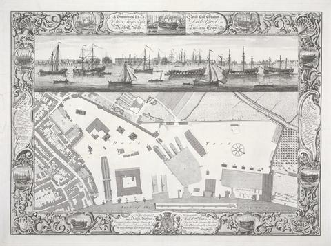
3
- Geometrical Plan of his Majesty's Dockyard, Deptford
- 1755
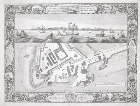
4
- Geometrical Plan of his Majesty's dockyard, at Sheerness
- 1755
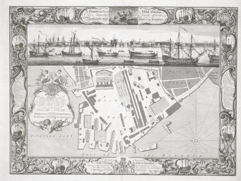
5
- Geometrical plan of his Majesty's Dockyard near Portsmouth
- 1754
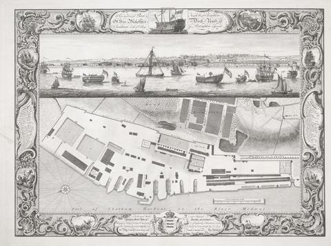
6
- Geometrical Plan of his Majesty's Dockyard, at Chatham
- 1755