<< YCBA Home Yale Center for British Art Yale Center for British Art << YCBA Home

YCBA Collections Search

Search Constraints

You searched for:

Language English

Remove constraint Language: English

Work Type map

Remove constraint Work Type: map

Search Results

 The first map of Australia
The first map of Australia
[1856]
Boazio, Baptista. S. Augustini pars est terrae Florida
Boazio, Baptista
S. Augustini pars est terrae Florida
[1588?]
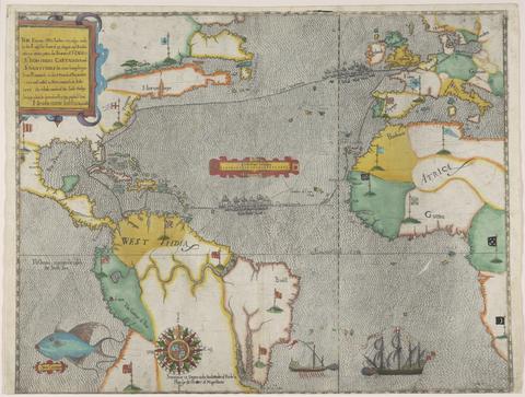
Boazio, Baptista. The famouse West Indian voyadge made by the Englishe fleete of 23 shippes and barkes
Boazio, Baptista
The famouse West Indian voyadge made by the Englishe fleete of 23 shippes and barkes
[1589?]
 A mapp of the north part from the equinoctial, with the auncient seates of the families mentioned in Genesis :
A mapp of the north part from the equinoctial, with the auncient seates of the families mentioned in Genesis
[ca. 1590]
Boazio, Baptista, cartographer. The true description or draffte of that famous Ile of Wighte :
Boazio, Baptista
The true description or draffte of that famous Ile of Wighte
1591
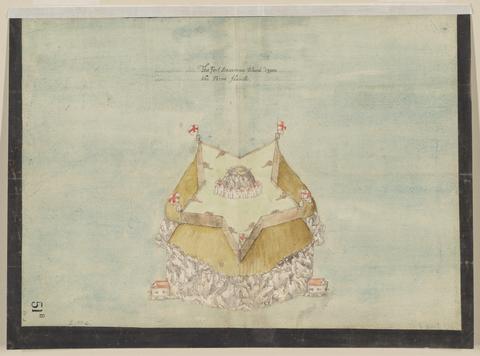
 The Fort Devereux placed uppon the Ferne Islande.
The Fort Devereux placed uppon the Ferne Islande
circa 1600
 Description of Jarsey.
Description of Jarsey
1600
 The Castell Perrott placed uppon the rocke cauled the stacke.
The Castell Perrott placed uppon the rocke cauled the stacke
circa 1600
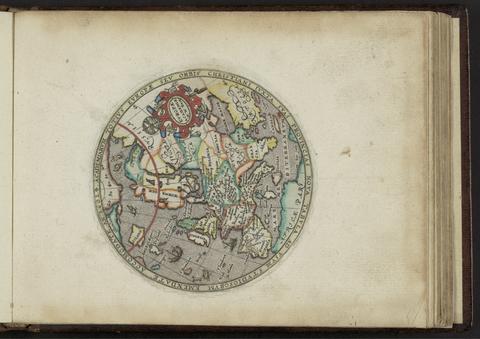
Kip, William, engraver. Academiarum totius Europae seu orbis Christiani iuxta suas provincias nova tabula ad usum studiosorum emendate accomodate
Kip, William
Academiarum totius Europae seu orbis Christiani iuxta suas provincias nova tabula ad usum studiosorum emendate accomodate
An 1602
Kip, William, engraver. Galliae descriptio
Kip, William
Galliae descriptio
[ca. 1602]
Kip, William, engraver. Angliae descpiptio [sic]
Kip, William
Angliae descpiptio [sic]
[ca. 1602]
Kip, William, engraver. Belgiae descriptio
Kip, William
Belgiae descriptio
[ca. 1602]
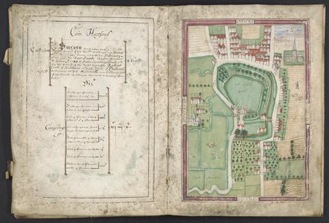
Basil, Simon, -1615, surveyor. Survey of Hertford Castle.
Basil, Simon, -1615
Survey of Hertford Castle
1608
Speed, John, 1552?-1629. Cambridgshire
Speed, John, 1552?-1629
Cambridgshire
1610
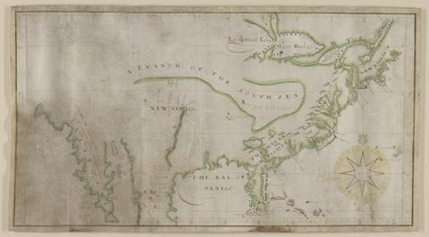
 Map of North America.
Map of North America
not before 1634
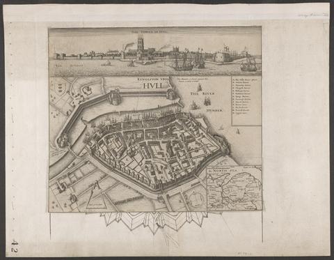
Hollar, Wenceslaus, 1607-1677. Kyngeston vpon Hvll.
Hollar, Wenceslaus, 1607–1677
Kyngeston vpon Hvll
circa 1642
Blaeu, Willem Janszoon, 1571-1638. Blaeu's Atlas of England, Scotland, Wales and Ireland
Blaeu, Willem Janszoon, 1571–1638
Blaeu's Atlas of England, Scotland, Wales and Ireland
[1970]
Speed, John, 1552?-1629. A new and accurat map of the world :
Speed, John, 1552?-1629
A new and accurat map of the world
1651 [1676 printing]
De Gomme, Bernard, 1620-1685.  Plans for fortification and harbor works at Dunkirk.
De Gomme, Bernard, 1620–1685
Plans for fortification and harbor works at Dunkirk
1661-1662?
Speed, John, 1552?-1629. America with those known parts in that unknowne worlde both people and manner of buildings /
Speed, John, 1552?-1629
America with those known parts in that unknowne worlde both people and manner of buildings
[1662?]
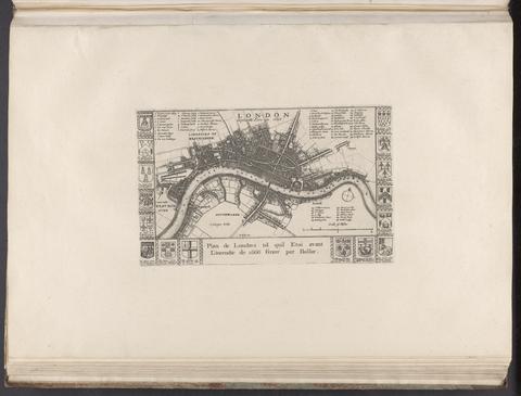
Hollar, Wenceslaus, 1607-1677. London before the fire in 1666 = Plan de Londres tel quil etoi avant l'incendie de 1666 /
Hollar, Wenceslaus, 1607–1677
London before the fire in 1666 = Plan de Londres tel quil etoi avant l'incendie de 1666
[1666?]
Ogilby, John, 1600-1676. Africa :
Ogilby, John, 1600–1676
Africa
MDC LXX [1670]
Ogilby, John, 1600-1676, author, publisher. America :
Ogilby, John, 1600–1676
America
MDCLXXI [1671]
Storff, Paul Auguste de. Plan of the fortification at Sandown, Isle of Wight.
Storff, Paul Auguste de
Plan of the fortification at Sandown, Isle of Wight
[1671?]
Storff, Paul Auguste de. Plan of Carisbrooke Castle, Isle of Wight.
Storff, Paul Auguste de
Plan of Carisbrooke Castle, Isle of Wight
[1671?]
Storff, Paul Auguste de. Plans of the fortifications at Newport and Cowes, Isle of Wight.
Storff, Paul Auguste de
Plans of the fortifications at Newport and Cowes, Isle of Wight
[1671?]
Storff, Paul Auguste de. Plan of fortification, possibly at Newtown, Isle of Wight.
Storff, Paul Auguste de
Plan of fortification, possibly at Newtown, Isle of Wight
December, 1671
Lederer, John, author. The discoveries of John Lederer :
Lederer, John
The discoveries of John Lederer
1672
Blome, Richard, 1635-1705, cartographer, publisher. A mapp of Cambridgshire
Blome, Richard, 1635–1705
A mapp of Cambridgshire
[1673]
Speed, John, 1552?-1629. A map of New England and New York /
Speed, John, 1552?-1629
A map of New England and New York
[1676]
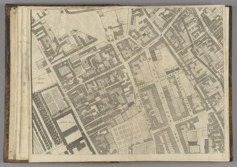
Ogilby, John, 1600-1676. A large and accurate map of the city of London :
Ogilby, John, 1600–1676
A large and accurate map of the city of London
1677]
Morden, Robert, approximately 1650-1703, cartographer. A new map of the English plantations in America
Morden, Robert, approximately 1650–1703
A new map of the English plantations in America
[ca. 1677]
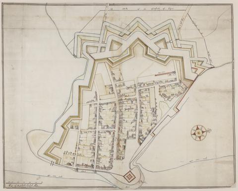
De Gomme, Bernard, 1620-1685, cartographer. The bounds of the fortificatie of Gosport.
De Gomme, Bernard, 1620–1685
The bounds of the fortificatie of Gosport
approximately 1678
Morden, Robert, approximately 1650-1703. A new mapp of England Scotland and Ireland
Morden, Robert, approximately 1650–1703
A new mapp of England Scotland and Ireland
[1678]
Phillips, Thomas, -1693.  Nautical chart of Grand Havre, Guernsey.
Phillips, Thomas, -1693
Nautical chart of Grand Havre, Guernsey
ca. 1680
Archer, James, approximately 1632-approximately 1680. Plan of the town of Hull and its immediate surroundings.
Archer, James, approximately 1632–approximately 1680
Plan of the town of Hull and its immediate surroundings
ca. 1680
Archer, James, approximately 1632-approximately 1680. Plan of Scarbrogh Castle & towne /
Archer, James, approximately 1632–approximately 1680
Plan of Scarbrogh Castle & towne
circa 1680
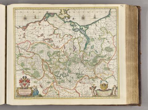
Gothus, Olaus Joannis, 1600-1644, cartographer. Marchionatus Brandenburgicus /
Gothus, Olaus Joannis, 1600–1644
Marchionatus Brandenburgicus
[ca. 1681]
Phillips, Thomas, -1693.  Nautical chart of the east coast of Guernsey.
Phillips, Thomas, -1693
Nautical chart of the east coast of Guernsey
ca. 1680
De Gomme, Bernard, 1620-1685.  Plan for the Citadel at Hull.
De Gomme, Bernard, 1620–1685
Plan for the Citadel at Hull
[1681?]
 Plans for the Citadel at Hull.
Plans for the Citadel at Hull
1681-1682
Beckman, Martin, -1702.  Plans for the fortifications at Hull.
Beckman, Martin, -1702
Plans for the fortifications at Hull
1681-1682
Morden, Robert, approximately 1650-1703. To Captain John Wood this map of the world drawn according to Mercators projection humbly dedicated by Robt. Morden & Willm. Berry.
Morden, Robert, approximately 1650–1703
To Captain John Wood this map of the world drawn according to Mercators projection humbly dedicated by Robt. Morden & Willm. Berry
[approximately 1682?]
 Plan of a fortification in Guernsey.
Plan of a fortification in Guernsey
July 20, 1682
Exquemelin, A. O. (Alexandre Olivier), author. Bucaniers of America, or, A true account of the most remarkable assaults committed of late years upon the coasts of the West-Indies, by the bucaniers of Jamaica and Tortuga, both English and French : wherein are contained more especially, the unparallel'd exploits of Sir Henry Morgan, our English Jamaican hero, who sack'd Puerto Velo, burnt Panama &c. /
Exquemelin, A. O. (Alexandre Olivier)
Bucaniers of America, or, A true account of the most remarkable assaults committed of late years upon the coasts of the West-Indies, by the bucaniers of Jamaica and Tortuga, both English and French : wherein are contained more especially, the unparallel'd exploits of Sir Henry Morgan, our English Jamaican hero, who sack'd Puerto Velo, burnt Panama &c.
1684-1685
Browne, Christopher, active 1684-1712. A new map of Virginia, Maryland, and the improved parts of Pennsylvania & New Jersey
Browne, Christopher, active 1684–1712
A new map of Virginia, Maryland, and the improved parts of Pennsylvania & New Jersey
[1685?]
Saxton, Christopher, 1542?- cartographer. [The travellers guide :
Saxton, Christopher, 1542?-
[The travellers guide
[1686?]
Beckman, Martin, -1702. The groundplott of Bouche de Vale on the N.W. side of Guarnsey /
Beckman, Martin, -1702
The groundplott of Bouche de Vale on the N.W. side of Guarnsey
1690
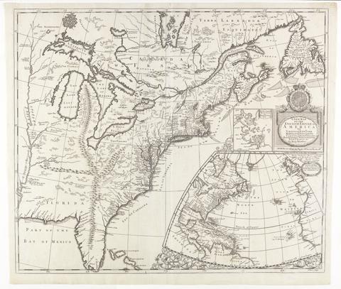
Morden, Robert, approximately 1650-1703, cartographer. A new map of the English empire in America :
Morden, Robert, approximately 1650–1703
A new map of the English empire in America
[ca. 1695]
 Cambridge Shire /
Cambridge Shire
[1695?]