Search Constraints
You searched for:
Subject Terms Great Britain -- Road maps.
Remove constraint Subject Terms: Great Britain -- Road maps.Search Results
- Date:
- 1679
- Physical Description:
- [13], 27 p., [1] folded leaf of plates : map ; 20 cm.
- Collection:
- Rare Books and Manuscripts
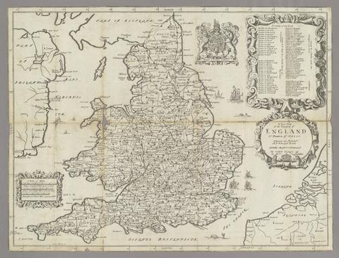
- Date:
- 1720
- Physical Description:
- [6], 273 p. : maps, coats of arms ; 20 cm.
- Collection:
- Rare Books and Manuscripts

- Date:
- 1752
- Physical Description:
- [40], 17-166 p., [1] folded leaf of plates : map ; 13 cm.
- Collection:
- Rare Books and Manuscripts
- Date:
- 1986
- Physical Description:
- 1 atlas (xl, 270 p., 120 p. of plates) : col. maps ; 30 cm
- Collection:
- Rare Books and Manuscripts
- Date:
- 1800
- Physical Description:
- 1 map : hand col., mounted on linen ; 75 x 61 cm.
- Collection:
- Rare Books and Manuscripts
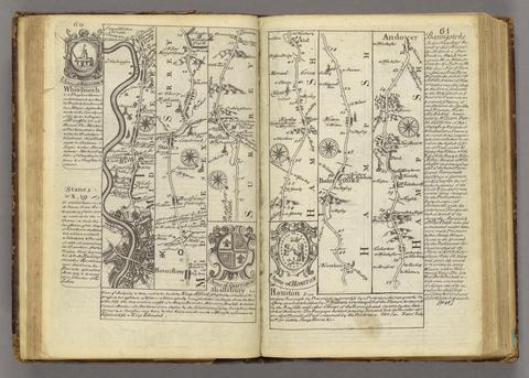
- Date:
- 1764
- Physical Description:
- 12, 273 p. : coats of arms, maps ; 21 cm.
- Collection:
- Rare Books and Manuscripts
- Date:
- 1802
- Physical Description:
- iv, 66, [36] p. : ill. maps ; 23 cm.
- Collection:
- Rare Books and Manuscripts
- Date:
- 1792
- Physical Description:
- 2 v. : ill., maps ; 24 cm.
- Collection:
- Rare Books and Manuscripts
- Date:
- 1786
- Physical Description:
- 1 atlas ([20] leaves) : 19 hand col. maps ; 34 cm.
- Collection:
- Rare Books and Manuscripts
- Date:
- 1979
- Physical Description:
- 273 p. : chiefly maps ; 23 cm
- Collection:
- Reference Library