Search Constraints
You searched for:
Period 17th century
Remove constraint Period: 17th centuryAssociated Places Ireland
Remove constraint Associated Places: IrelandSearch Results
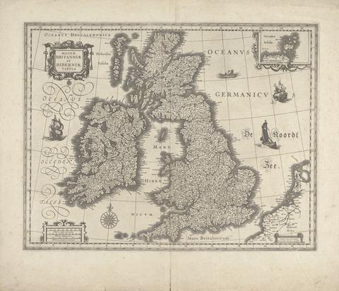
- Date:
- 1634
- Materials & Techniques:
- Line engraving; verso: Letterpress on medium, slightly textured, cream laid paper
- Dimensions:
- Sheet: 19 7/8 × 23 1/4 inches (50.5 × 59.1 cm)
- Collection:
- Prints and Drawings
- Credit Line:
- Yale Center for British Art, Gift of Helen Chillman
![The theatre of the empire of Great Britaine : presenting an exact geography of the kingdomes of England, Scotland, Ireland, and the iles adioyning : with the shires, hundreds, cities and shire-townes, within [the] kingdome of England / divided and described by Iohn Speed.](https://media.collections.yale.edu/thumbnail/ycba/05faa311-179e-44bd-a185-63bd2c871197)
- Date:
- [1612]
- Physical Description:
- [14], 146 [that is 280], [10] pages : illustrations (woodcuts), 67 maps (metal cuts) ; 46 cm (folio)
- Collection:
- Rare Books and Manuscripts

- Date:
- [1646?]
- Physical Description:
- 1 atlas ([57] leaves) : 57 maps ; 44 x 56 cm
- Collection:
- Rare Books and Manuscripts
- Date:
- 1627
- Physical Description:
- [16], 146, [10] pages, [134] leaves of plates : maps ; 45 cm (folio)
- Collection:
- Rare Books and Manuscripts
- Date:
- [1650]
- Physical Description:
- 1 atlas ([16], 5-8, 146 [i.e. 280], [10] pages) : illustrations, maps ; 45 cm (folio)
- Collection:
- Rare Books and Manuscripts
- Date:
- [Amsterdam?] :
- Physical Description:
- 1 atlas ([44] leaves of plates) ; 44 maps ; 13 x 18 cm.
- Collection:
- Rare Books and Manuscripts