Search Constraints
You searched for:
Image Available Available
Remove constraint Image Available: AvailableWork Type ink drawing
Remove constraint Work Type: ink drawingClassification Maps & Atlases (manuscript)
Remove constraint Classification: Maps & Atlases (manuscript)Search Results

1
- Map of North America
- not before 1634

2
- The bounds of the fortificatie of Gosport
- approximately 1678
3
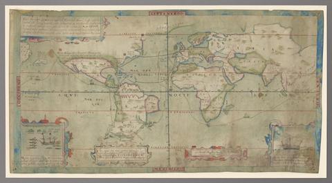
- Vera descriptio expeditionis nauticae Francisci Draci Angli, cognitis aurati
- circa 1587
4
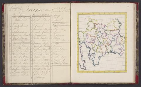
- A selection of maps
- 1818

5
- A survey of the estate of John Plampin Esquire, taken in 1774,
- 1774

6
- Map of the southeastern part of North America
- 1721

7
- The Fort Devereux placed uppon the Ferne Islande
- circa 1600

8
- A survey of the estate of Richard Moore, Esq., Kentwell Hall, Suffolk
- 1777