<< YCBA Home Yale Center for British Art Yale Center for British Art << YCBA Home

YCBA Collections Search

Search Constraints

You searched for:

Period 18th century

Remove constraint Period: 18th century

Associated Places Great Britain

Remove constraint Associated Places: Great Britain

Work Type map

Remove constraint Work Type: map

Search Results

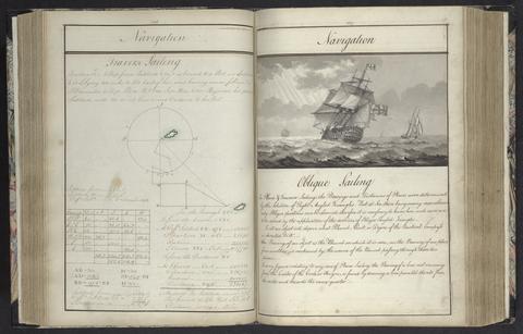
Rice, Edmund Nagle, -1801. A plan of mathematical learning taught in the Royal Academy, Portsmouth :
Rice, Edmund Nagle, -1801
A plan of mathematical learning taught in the Royal Academy, Portsmouth
approximately 1798-1799
Hipwell, John. The elements of navigation :
Hipwell, John
The elements of navigation
1759
Matthews, John, lieutenant in the Royal Navy, author, illustrator, publisher. Twenty-one plans, with explanations of different actions in the West Indies, during the late war /
Matthews, John, lieutenant in the Royal Navy
Twenty-one plans, with explanations of different actions in the West Indies, during the late war
MDCCLXXXIV [1784]
Valck, G. (Gerard), 1651-1726, cartographer. Magna Britannia, aut Anglia, Scotia et Hibernia, quarum prior divisa in septem Regna, sive Provincias, dictas Northumbriam, Merciam, Angliam Orient. Essexiam, Cantium, Sussexiam, Westsexiam, et Princi. Walliae. posterior in Septent. et Austr. Scotiam. postrema in quatuor Provincias Ultoniam, Lageniam, Momoniam, et Conagtiam /
Valck, G. (Gerard), 1651–1726
Magna Britannia, aut Anglia, Scotia et Hibernia, quarum prior divisa in septem Regna, sive Provincias, dictas Northumbriam, Merciam, Angliam Orient. Essexiam, Cantium, Sussexiam, Westsexiam, et Princi. Walliae. posterior in Septent. et Austr. Scotiam. postrema in quatuor Provincias Ultoniam, Lageniam, Momoniam, et Conagtiam
[approximately 1705]
Badeslade, Thomas. A compleat sett of mapps of England and Wales in general, and of each county in particular :
Badeslade, Thomas
A compleat sett of mapps of England and Wales in general, and of each county in particular
1724
Blaeu, Willem Janszoon, 1571-1638. Blaeu's Atlas of England, Scotland, Wales and Ireland
Blaeu, Willem Janszoon, 1571–1638
Blaeu's Atlas of England, Scotland, Wales and Ireland
[1970]