Search Constraints
You searched for:
Collection Rare Books and Manuscripts
Remove constraint Collection: Rare Books and ManuscriptsPeriod 18th century
Remove constraint Period: 18th centuryAssociated Places England
Remove constraint Associated Places: EnglandAssociated Places Wales
Remove constraint Associated Places: WalesSearch Results
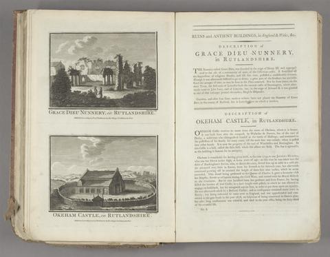
1
- Historical descriptions of new and elegant picturesque views of the antiquities of England and Wales
- [1786]

2
- A map of England and Wales
- 1797
3
- England and Wales
- [circa 1768]
4
- The large English atlas, or, A new set of maps of all the counties in England and Wales
- MDCCLXVII [1767]
5
- Chorographia Britanniae, or, A set of maps of all the counties in England and Wales
- 1742
6
- A set of fifty new and correct maps of England and Wales, &c.
- 1724
7
- Map of England and Wales
- circa [1800?]
8
- A new and accurate description of all the direct and principal cross roads in England and Wales ..
- 1789
9
- A general map of England & Wales, divided into its counties
- circa [1800?]
10
- A new and accurate description of all the direct and principal cross roads in England and Wales ..
- 1784
11
- Index villaris, or, An exact register, alphabetically digested, of all the cities, market-towns, parishes, villages, ... the bishopricks, deanries [sic], churches, chapels, hospitals
- 1700
12
- The English gentleman's guide, or, A new and compleat book of maps of all England and Wales
- [1717?]
13
- A compleat sett of mapps of England and Wales in general, and of each county in particular
- 1724