Search Constraints
You searched for:
Period 18th century
Remove constraint Period: 18th centuryExhibition History Wilde Americk - Discovery and Exploration of the New World, 1500-1850 (Yale Center for British Art, 2001-09-27 - 2001-09-27)
Remove constraint Exhibition History: Wilde Americk - Discovery and Exploration of the New World, 1500-1850 (Yale Center for British Art, 2001-09-27 - 2001-09-27)Search Results
1
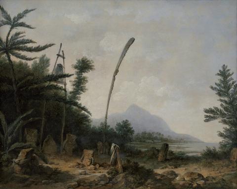
- Burial Ground in the South Seas
- ca. 1777
- Not on view
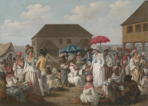
2
- Linen Market, Dominica
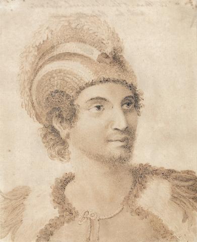
- ca. 1780
- Not on view
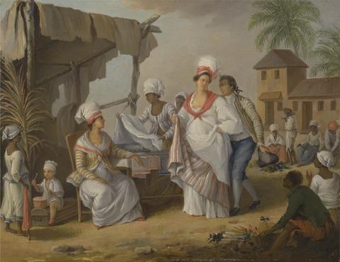
3
- Market Day, Roseau, Dominica
- ca. 1780
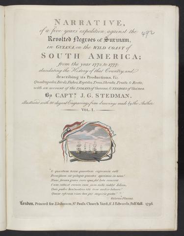
- Not on view
![John Faber the Younger Tomo Chachi Mico, or King of Yamacraw, and Tooanahowi [sic], His Nephew](https://media.collections.yale.edu/thumbnail/ycba/d2350461-bf7f-4c88-8c51-84d76ade2c40)
4
- Tomo Chachi Mico, or King of Yamacraw, and Tooanahowi [sic], His Nephew
- ca. 1734
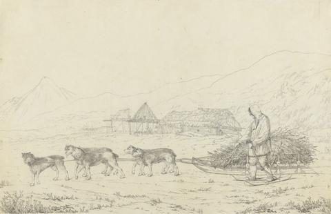
5
- The Narta or Sledge for Burdens in Kamtschatka
- 1789
6
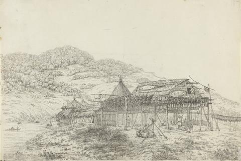
- The Balagans or Summer Habitations, with the Method of Drying Fish, at St. Peter and Paul, Kamtschatka
- 1792
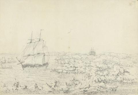
7
- The Resolution Beating through the Ice, with the Discovery in the most eminent Danger in the Distance
- 1792

8
- Spilsbury's Views of Jamaica: A Prospect of Rio Bona Harbour in the Parish of St. Ann's, and the Tavern, Wharf, and Stores, in the Parish of St. James's, the North Side Jamaica
- 1769
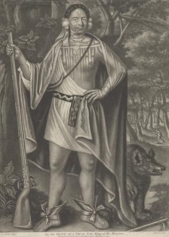
9
- Portraits of Four Indian Kings of Canada: Sa Ga Yeath Pieth Tow, King of the Maquas
- ca. 1755
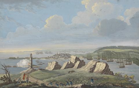
10
- Views of Montreal and Louisburg: A View of Louisburg in North America taken near the Light House when that city was beseiged in 1758
- 1762
11
- A Man of the Sandwich Islands
- ca. 1784
12
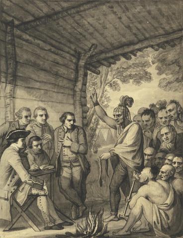
- The Indians Giving a Talk to Colonel Bouquet in a conference at a Council Fire Near his Camp on the Banks of Muskingum in America, in October 1764, 1765
- between 1765 and 1766
13
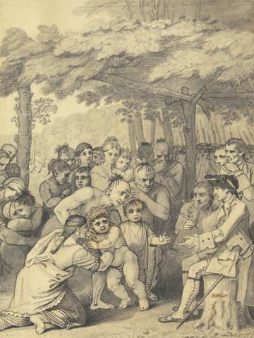
- The Indians Delivering up the English Captives to Colonel Bouquet near his camp at the folks of Muskingum in North America in November 1764, 1765
- between 1765 and 1766
14
- A voyage to the islands Madera, Barbados, Nieves, S. Christophers and Jamaica
- 1707-1725

15
- Map of the southeastern part of North America
- 1721
16
- Narrative, of a five years' expedition, against the revolted Negroes of Surinam, in Guiana, on the wild coast of South America, from the year 1772, to 1777
- 1796

17
- Atlas minor, sive, Geographia compendiosa, qua orbis terrarum, per paucas attamen novissimas tabulas ostenditur
- [approximately 1716?]
18
- La galerie agreable du monde
- [1729?]
19
- A new and compleat map of all America
- [1763]
20
- America
- [after 1727]
21
- A map of Pensilvania, New-Jersey, New-York, and the three Delaware counties
- 1749
22
- Le nouveau & grand illuminant flambeau de la mer, de tout le monde
- 1736
23
- An historical account of the expedition against the Ohio Indians, in the year MDCCLXIV, under the command of Henry Bouquet, Esq., colonel of foot, and now brigadier general in America
- MDCCLXVI [1766]
24
- Recens edita totius Novi Belgii, in America Septentrionali siti
- [1730]
25
- A voyage to the Pacific ocean
- 1784
26
- The natural and civil history of the French dominions in North and South America
- MDCCLX [1760]
27
- A map of the British and French dominions in North America
- Febry 13th, 1755
28
- A compleat sett of mapps of England and Wales in general, and of each county in particular
- 1724
29
- A chart of North and South America
- 1753