Search Constraints
You searched for:
On-site Access Accessible by appointment in the Study Room
Remove constraint On-site Access: Accessible by appointment in the Study RoomAssociated Places England
Remove constraint Associated Places: EnglandAssociated Places Great Britain
Remove constraint Associated Places: Great BritainSearch Results
1
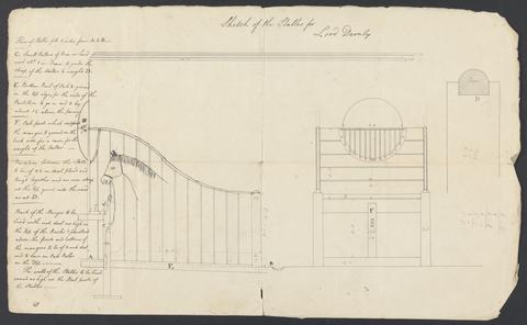
- Cobham Hall, Kent: Sketch of Stables
- ca. 1790
2
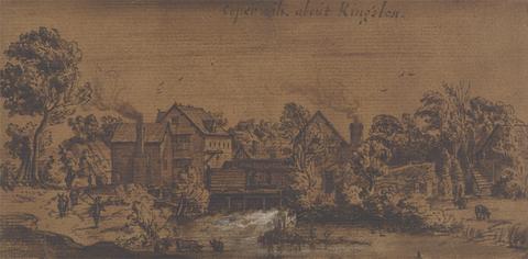
- Water-mill, Kingston, Surrey
- undated
3
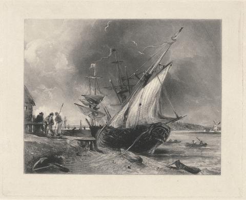
- View on the Orwell
- 1830
4
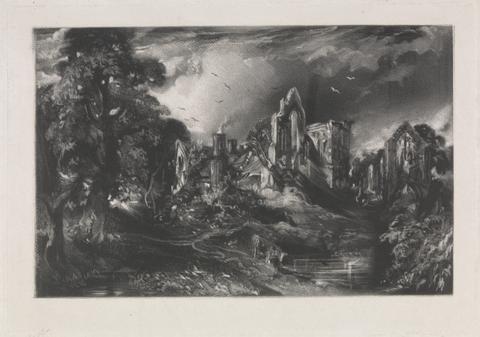
- Castle Acre Priory
- 1830 to 1831
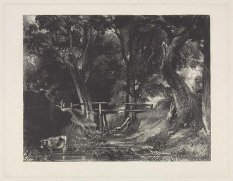
5
- A Dell, Helmingham Park, Suffolk
- 1830
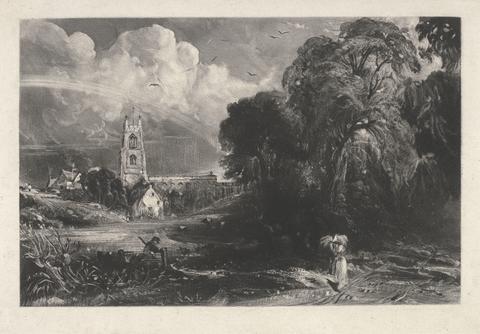
6
- Stoke by Neyland, Suffolk
- 1829
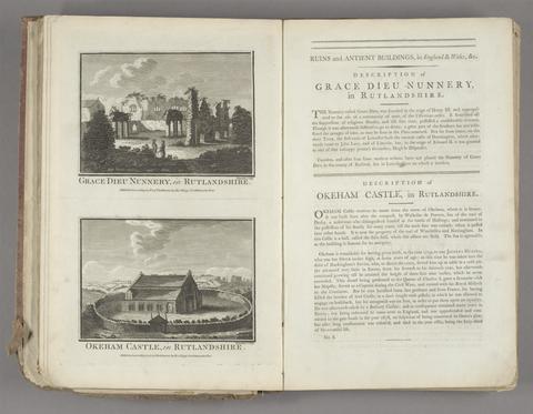
7
- Historical descriptions of new and elegant picturesque views of the antiquities of England and Wales
- [1786]
![Great Britain. Ordnance Survey, cartographer, publisher. [Old series Ordnance Survey maps of England and Wales]](https://media.collections.yale.edu/thumbnail/ycba/00e4c053-1da0-4b6a-9606-069ea90649fa)
8
- [Old series Ordnance Survey maps of England and Wales]
- 1805-1834 [i.e. 1834-1835?]

9
- Hobson's fox-hunting atlas
- [1848]
10
- Horda angel-cynnan, or, A compleat view of the manners, customs, arms, habits, &c. of the inhabitants of England
- MDCCLXXV-MDCCLXXVI [1775-1776]
11
- Britannia, volume the first, or, An illustration of the kingdom of England and dominion of Wales
- MDCLXXV [1675]
12
- George Selwyn and his contemporaries
- 1843-1844
13
- Peacock's Superior dissected maps
- [between 1875 and 1909]
14
- New and Improved map of England and Wales, including the principal part of Scotland
- 16th. April 1823
15
- A compleat sett of mapps of England and Wales in general, and of each county in particular
- 1724
16
- Index villaris, or, An exact register, alphabetically digested, of all the cities, market-towns, parishes, villages, ... the bishopricks, deanries [sic], churches, chapels, hospitals
- 1700
17
- Mogg's New map of England and Wales, with part of Scotland
- [183-?]
18
- Baronagium genealogicum;
- [1764-84]
19
- An account of Roman antiquities discovered at Woodchester in the county of Gloucester
- 1797
20
- Plans of the cities and boroughs of England and Wales
- 1832
21
- The book of English trades, and library of the useful arts
- 1824
22
- The Durobrivae of Antoninus
- 1828
23
- Chorographia Britanniae, or, A set of maps of all the counties in England and Wales
- 1742
24
- Lives of topographers and antiquaries who have written concerning the antiquities of England,
- 1815
25
- Hobson's fox-hunting atlas
- [1850?]
26
- [Old series Ordnance Survey maps of England and Wales]
- [1839-1874?]
27
- [Old series Ordnance Survey maps of England and Wales]
- Novr. 9th, 1843 [i.e. ca. 1853-1874?]
28
- Bridging the gap
- [2001]
29
- Britannia, volume the first, or, An illustration of the kingdom of England and dominion of Wales
- MDCLXXV [1675]
30
- [Plans of borough towns included in List no. VIII on Parliamentary representation, 1832]
- [1832]