Search Constraints
You searched for:
Associated Places England
Remove constraint Associated Places: EnglandAssociated Places Great Britain
Remove constraint Associated Places: Great BritainLanguage English
Remove constraint Language: EnglishSearch Results
![Great Britain. Ordnance Survey, cartographer, publisher. [Old series Ordnance Survey maps of England and Wales]](https://media.collections.yale.edu/thumbnail/ycba/00e4c053-1da0-4b6a-9606-069ea90649fa)
1
- [Old series Ordnance Survey maps of England and Wales]
- 1805-1834 [i.e. 1834-1835?]
2
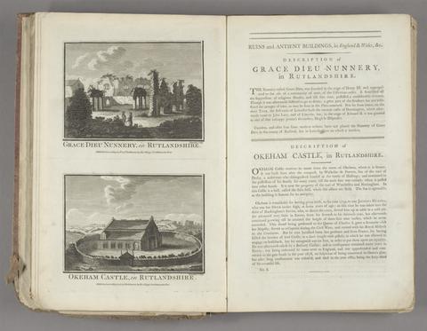
- Historical descriptions of new and elegant picturesque views of the antiquities of England and Wales
- [1786]

3
- George Selwyn and his contemporaries
- 1843-1844
4
- The Durobrivae of Antoninus
- 1828
5
- Peacock's Superior dissected maps
- [between 1875 and 1909]
6
- Britannia, volume the first, or, An illustration of the kingdom of England and dominion of Wales
- MDCLXXV [1675]
7
- An account of Roman antiquities discovered at Woodchester in the county of Gloucester
- 1797
8
- New and Improved map of England and Wales, including the principal part of Scotland
- 16th. April 1823
9
- [Old series Ordnance Survey maps of England and Wales]
- [1839-1874?]
10
- Britannia, volume the first, or, An illustration of the kingdom of England and dominion of Wales
- MDCLXXV [1675]
11
- Bridging the gap
- [2001]
12
- [Old series Ordnance Survey maps of England and Wales]
- Novr. 9th, 1843 [i.e. ca. 1853-1874?]
13
- Lives of topographers and antiquaries who have written concerning the antiquities of England,
- 1815
14
- Hobson's fox-hunting atlas
- [1850?]
15
- Index villaris, or, An exact register, alphabetically digested, of all the cities, market-towns, parishes, villages, ... the bishopricks, deanries [sic], churches, chapels, hospitals
- 1700
16
- Horda angel-cynnan, or, A compleat view of the manners, customs, arms, habits, &c. of the inhabitants of England
- MDCCLXXV-MDCCLXXVI [1775-1776]
17
- Mogg's New map of England and Wales, with part of Scotland
- [183-?]
18
- Baronagium genealogicum;
- [1764-84]
19
- Hobson's fox-hunting atlas
- [1848]
20
- Chorographia Britanniae, or, A set of maps of all the counties in England and Wales
- 1742
21
- A compleat sett of mapps of England and Wales in general, and of each county in particular
- 1724
22
- The book of English trades, and library of the useful arts
- 1824
23
- Julie Cope's grand tour
- [2017]
24
- Victorian rural England;
- [1966]
25
- Duel
- [1996]
26
- Sociability and power in late-Stuart England
- 2007, c1999
27
- The remarkable Lushington family
- [2020]
28
- Behind closed doors
- 2009
29
- British studies monitor
30
- High Victorian design
- 1983
31
- Classical culture and the idea of Rome in eighteenth-century England
- 1997
32
- Crown pictorial
- 1990
33
- A mad, bad, and dangerous people?
- c2006
34
- The Connoisseur new guide to antique English pottery, porcelain and glass
- [1961]
35
- Tudorism
- 2011
36
- The note-book and account book of Nicholas Stone
- 1919
37
- The Tudors
- 2022
38
- The sketchbook of 1792-1799
- 2017
39
- A painter of dreams and other biographical studies,
- 1916
40
- A bibliographical account of the principal works relating to English topography
- 1978
41
- The county maps of old England
- 1990
42
- Fire from heaven
- 1992
43
- Consuming splendor
- 2005
44
- A mad, bad, and dangerous people?
- 2006
45
- Shakespeare's England;
- 1917
46
- An illustrated history of England
- c1963
47
- The Stuart image
- 2023
48
- Charles II
- 2017
49
- Gerald Laing, 1936-2011
- [2016]
50
- The English print trade in the reign of Edward VI, 1547-1553
- [2023]
51
- The end of an English royal marriage
- 1997
52
- Bartholomew's revised half-inch map
- 1964-1968
53
- Court patronage and corruption in early Stuart England
- 1993
54
- The trophies of time
- 1995
55
- The making of England, 55 B.C. to 1399
- [1983]
56
- The queen's servants
- 2016
57
- Elizabethan households
- 1995
58
- Crown pictorial
- 1990
59
- Domesday
- [1988], c1986
60
- The face of England;
- [1959]
61
- The genealogical magazine
- 1898-1904
62
- The country house
- 2016
63
- This realm of England, 1399 to 1688
- ©1983
64
- Church monuments
- ©1985-
65
- Who's who in Shakespeare's England
- 1981
66
- Sociability and power in late-Stuart England
- 1999
67
- A polite and commercial people
- 1989
68
- Anecdotes of painting in England
- 1969
69
- The Age of William III & Mary II
- c1989
70
- Capability Brown
- 2013
71
- Life in Georgian Britain
- c2000
72
- The age of patronage
- 1972
73
- The evolution of the grand tour
- c1998
74
- Bejewelled
- [2017]
75
- Photographing in old England
- 1910
76
- England in 1819
- 1998
77
- Among the bohemians
- [2003.]
78
- Art of power : masterpieces from the Bute Collection at Mount Stuart
- 2017
79
- Damozels & deities
- [2017]
80
- The Shell book of English villages
- 1980
81
- C.F.A. Voysey
- 2016
82
- The royal palaces of Tudor England
- 1993
83
- Lost mansions
- 2015
84
- Tudor and Jacobean tournaments
- 1987
85
- The age of aristocracy, 1688 to 1830
- ©1983
86
- Georgian England
- 1931
87
- Pre-Raphaelite papers
- [1984]