<< YCBA Home Yale Center for British Art Yale Center for British Art << YCBA Home

YCBA Collections Search

Search Constraints

You searched for:

On-site Access Accessible by appointment in the Study Room

Remove constraint On-site Access: Accessible by appointment in the Study Room

Period 18th century

Remove constraint Period: 18th century

Work Type engraving

Remove constraint Work Type: engraving

Classification Maps & Atlas (printed)

Remove constraint Classification: Maps & Atlas (printed)

Search Results

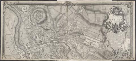
Rocque, John, -1762. A plan of the city of Bristol /
Rocque, John, -1762
A plan of the city of Bristol
1743
Rocque, John, -1762. Plan du chateau, jardin et parc de Wilton :
Rocque, John, -1762
Plan du chateau, jardin et parc de Wilton
1754
 To Martin Folkes, esq., president of the Royal Society :
To Martin Folkes, esq., president of the Royal Society
1749
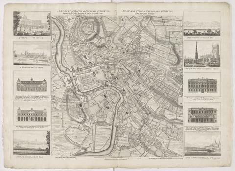
Rocque, John, -1762. A survey of the city and suburbs of Bristol /
Rocque, John, -1762
A survey of the city and suburbs of Bristol
1750
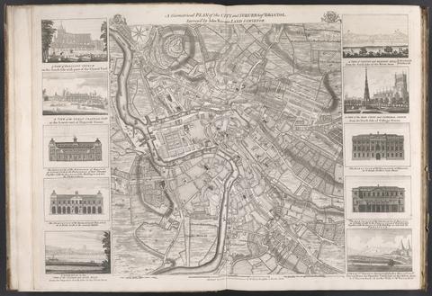
Rocque, John, -1762. A geometrical plan of the city and suburbs of Bristol /
Rocque, John, -1762
A geometrical plan of the city and suburbs of Bristol
[175-?]
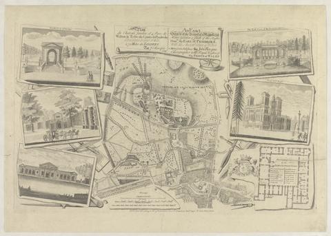
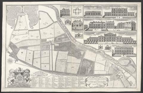
Rocque, John, -1762. Plan of the house, gardens, park & hermitage of Their Majesties at Richmond :
Rocque, John, -1762
Plan of the house, gardens, park & hermitage of Their Majesties at Richmond
1734
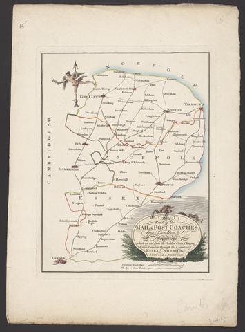
Boulton, George. The route of the mail & post coaches, George Boulton & Co. proprietors :
Boulton, George
The route of the mail & post coaches, George Boulton & Co. proprietors
[between 1796 and 1809]
Popple, Henry, -1743, cartographer. A map of the British Empire in America, with the French and Spanish settlements adjacent thereto /
Popple, Henry, -1743
A map of the British Empire in America, with the French and Spanish settlements adjacent thereto
[1739]
 The American military pocket atlas :
The American military pocket atlas
[1776]
Des Barres, Joseph F. W. (Joseph Frederick Wallet), 1729-1824.  The Atlantic Neptune
Des Barres, Joseph F. W. (Joseph Frederick Wallet), 1729–1824
The Atlantic Neptune
[1774-1800?]
Ogilby, John, 1600-1676. The road from Cambridge to Coventry
Ogilby, John, 1600–1676
The road from Cambridge to Coventry
[1720]
Kitchin, Thomas, 1719-1784, cartographer. Cambridgeshire
Kitchin, Thomas, 1719–1784
Cambridgeshire
1747
Gibson, J. (John), active 1750-1792, engraver. The road from London to Cambridge, Ely & Kings Lynn :
Gibson, J. (John), active 1750–1792
The road from London to Cambridge, Ely & Kings Lynn
[1769]
Bowen, Thomas, -1790, engraver. The roads from London to Norwich, Cambridge, Ely & Kings Lynn
Bowen, Thomas, -1790
The roads from London to Norwich, Cambridge, Ely & Kings Lynn
[1775?]
 Cambridgeshire.
Cambridgeshire
[1784]
Bowen, Emanuel, -1767. The County of Cambridge
Bowen, Emanuel, -1767
The County of Cambridge
1759
Seutter, Matthaeus, 1678-1756, engraver, publisher. Atlas geographicus, oder, Accurate Vorstellung der ganzen Welt in den nothwendigsten und von dem hochberühmten hamburgischen Rectore :
Seutter, Matthaeus, 1678–1756
Atlas geographicus, oder, Accurate Vorstellung der ganzen Welt in den nothwendigsten und von dem hochberühmten hamburgischen Rectore
MDCCXX [1720]
Popple, Henry, -1743, cartographer. A map of the British Empire in America :
Popple, Henry, -1743
A map of the British Empire in America
[ca. 1737]
 A map of Cambridgeshire.
A map of Cambridgeshire
[1720?]
Rocque, John, -1762. A new and accurate survey of the cities of London and Westminster, the borough of Southwark :
Rocque, John, -1762
A new and accurate survey of the cities of London and Westminster, the borough of Southwark
1751
Wren, Christopher, Sir, 1632-1723. Ichnographia urbis Londinii :
Wren, Christopher, Sir, 1632–1723
Ichnographia urbis Londinii
1724
Rocque, John, -1762. A survey of the city and suburbs of Dublin :
Rocque, John, -1762
A survey of the city and suburbs of Dublin
1757
Rocque, John, -1762. A map of the kingdom of Ireland :
Rocque, John, -1762
A map of the kingdom of Ireland
[between 1762 and 1773]
Moll, Herman, -1732. A new map containing the towns, gentlemens houses, villages, and other remarks round London :
Moll, Herman, -1732
A new map containing the towns, gentlemens houses, villages, and other remarks round London
[ca. 1700]
Rocque, John, -1762. A survey of the city, harbour, bay and environs of Dublin :
Rocque, John, -1762
A survey of the city, harbour, bay and environs of Dublin
1757
Rocque, John, -1762. A plan of the cities of London and Westminster, and borough of Southwark, with the contiguous buildings /
Rocque, John, -1762
A plan of the cities of London and Westminster, and borough of Southwark, with the contiguous buildings
1746
Downing, Alexander. A new and accurate plan of the ancient borough of Bury Saint Edmunds :
Downing, Alexander
A new and accurate plan of the ancient borough of Bury Saint Edmunds
1741
Rocque, John, -1762, cartographer.  A general map of North America :
Rocque, John, -1762
A general map of North America
[1762?]
Green, John, -1757. A chart of North and South America :
Green, John, -1757
A chart of North and South America
1753
Leake, John, cartographer. An exact surveigh of the streets, lanes and churches comprehend[e]d within the ruins of the city of London :
Leake, John
An exact surveigh of the streets, lanes and churches comprehend[e]d within the ruins of the city of London
[1723]
Rocque, John, -1762. A new plan of Richmond Garden :
Rocque, John, -1762
A new plan of Richmond Garden
1748
Bowles, John, 1701-1779. A new and exact map of America laid down from the latest observations and discoveries.
Bowles, John, 1701–1779
A new and exact map of America laid down from the latest observations and discoveries
[approximately 1740?]
Evans, Lewis, 1700?-1756. A general map of the middle British colonies in America :
Evans, Lewis, 1700?-1756
A general map of the middle British colonies in America
1771
Mitchell, John, 1711-1768, cartographer. A map of the British and French dominions in North America
Mitchell, John, 1711–1768
A map of the British and French dominions in North America
Febry 13th, 1755
Collins, Greenvile, active 1669-1698, cartographer. Great Britain's coasting-pilot :
Collins, Greenvile, active 1669–1698
Great Britain's coasting-pilot
MDCCLXXVI [1776]
Evans, Lewis, 1700?-1756, cartographer. A map of Pensilvania, New-Jersey, New-York, and the three Delaware counties
Evans, Lewis, 1700?-1756
A map of Pensilvania, New-Jersey, New-York, and the three Delaware counties
1749
Dury, Andrew, cartographer.  A topographical map of Hartford-shire, from an actual survey :
Dury, Andrew
A topographical map of Hartford-shire, from an actual survey
[1782]
Valck, G. (Gerard), 1651-1726, cartographer. Magna Britannia, aut Anglia, Scotia et Hibernia, quarum prior divisa in septem Regna, sive Provincias, dictas Northumbriam, Merciam, Angliam Orient. Essexiam, Cantium, Sussexiam, Westsexiam, et Princi. Walliae. posterior in Septent. et Austr. Scotiam. postrema in quatuor Provincias Ultoniam, Lageniam, Momoniam, et Conagtiam /
Valck, G. (Gerard), 1651–1726
Magna Britannia, aut Anglia, Scotia et Hibernia, quarum prior divisa in septem Regna, sive Provincias, dictas Northumbriam, Merciam, Angliam Orient. Essexiam, Cantium, Sussexiam, Westsexiam, et Princi. Walliae. posterior in Septent. et Austr. Scotiam. postrema in quatuor Provincias Ultoniam, Lageniam, Momoniam, et Conagtiam
[approximately 1705]
Ogilby, John, 1600-1676, cartographer. Britannia depicta, or, Ogilby improv'd :
Ogilby, John, 1600–1676
Britannia depicta, or, Ogilby improv'd
1749
Andrews, John, 1736-1809, cartographer. A topographical map of Wiltshire :
Andrews, John, 1736–1809
A topographical map of Wiltshire
[1773]
Gibson, J. (John), active 1750-1792, cartographer. Atlas minimus, or A new set of pocket maps of the several empires, kingdoms and states of the known world :
Gibson, J. (John), active 1750–1792
Atlas minimus, or A new set of pocket maps of the several empires, kingdoms and states of the known world
[1758]
Senex, John, -1740. A new map of the English empire in America
Senex, John, -1740
A new map of the English empire in America
1719
Popple, Henry, -1743. A map of the British Empire in America :
Popple, Henry, -1743
A map of the British Empire in America
[ca. 1737]
Kitchin, Thomas, 1719-1784, cartographer. A new improved map of Oxfordshire :
Kitchin, Thomas, 1719–1784
A new improved map of Oxfordshire
[1750]
Lobeck, Tobias, engraver, artist, publisher. Atlas geographicus portatilis, XXIX mappis orbis habitabilis regna exhibens /
Lobeck, Tobias
Atlas geographicus portatilis, XXIX mappis orbis habitabilis regna exhibens
[1762?]
 [Composite atlas of Caribbean charts].
[Composite atlas of Caribbean charts]
1763-1808