Search Constraints
You searched for:
On-site Access Accessible by appointment in the Study Room
Remove constraint On-site Access: Accessible by appointment in the Study RoomWork Type map
Remove constraint Work Type: mapSearch Results

1
- Cambridgeshire
- [1808]

2
- Marchionatus Brandenburgicus
- [ca. 1681]

3
- The paths of life
- [circa 1840]

4
- Americae pars meridionalis
- [between 1641 and 1680]

5
- Wallis's tour of Europe
- Nov. 24th, 1794

6
- Bugle Hotel, Newport, Isle of Wight
- [late 19th century]

7
- Britain at home to the world
- 1951

8
- Academiarum totius Europae seu orbis Christiani iuxta suas provincias nova tabula ad usum studiosorum emendate accomodate
- An 1602

9
- Outline of the countries between Delhi and Constantinople
- 1814 [i.e. 1821?]

10
- Britannia insula quae duo regna continet Angliam et Scotiam cum Hibernia adiacente
- MDLVI [1556]

11
- Summer of smiles
- 2011

12
- The environs of London
- [1763]

13
- Novi Belgii Novaeque, Angliae nec non partis Virginiae tabula
- [ca. 1684]

14
- Scotiae Regni Antiqvissimi Accvrata Descriptio
- MDLXXVIII [1578]

15
- Queen Hotel
- [188-?]

16
- The antiquities of Magna Graecia
- MDCCCVII [1807]

17
- A plan of Rome
- 1750

18
- America
- MDCLXXI [1671]

19
- Africa
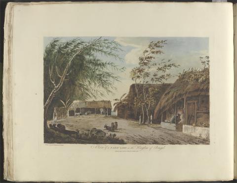
- [ca. 1686?]

20
- Crowned heads, or, Contemporary sovereigns
- [ca. 1845?]

21
- America
- [ca. 1686]

22
- London and Westminster in the reign of Queen Elizabeth anno dom. 1563
- October 30th, 1789

23
- North America, and the West Indies
- [1764?]

24
- London and Westminster improved
- MDCCLXVU [1766]

25
- L'orient, or, The Indian travellers : a geographical and historical game
- [1846]

26
- London before the fire in 1666 = Plan de Londres tel quil etoi avant l'incendie de 1666
- [1666?]

27
- The route of the mail & post coaches, George Boulton & Co. proprietors
- [between 1796 and 1809]

28
- A plan of mathematical learning taught in the Royal Academy, Portsmouth
- approximately 1798-1799

29
- Map of North America
- not before 1634

30
- Bartholomew's one inch to the mile environs of London
- [not before 1921]

31
- A map of London and the adjacent country 10 miles round
- 1748

32
- This newly constructed and extended map of India
- 1841

33
- The famouse West Indian voyadge made by the Englishe fleete of 23 shippes and barkes
- [1589?]

34
- [The travellers guide
- [1686?]

35
- The map of England and Wales with part of Scotland, France and Ireland, worked by Maria Harvey in the ninth year of age
- 1806

36
- A voyage to the South Sea, and round the world, perform'd in the years 1708, 1709, 1710, and 1711, by the ships Duke and Dutchess of Bristol
- MDCCXII [1712]

37
- The county of Dorset
- June 1st, 1795

38
- Thuringia landgraviatus
- [1650?]

39
- Festival pleasure gardens
- 1951

40
- Insulae Americanae in Oceano Septentrionali ac regiones adiacentes
- ca. 1682]

41
- A survey and valuation of estates the property of Nicholas Smyth Esqr. and his Lady
- 1767

42
- Africa
- MDC LXX [1670]

43
- Survey and valuation of the several estates belonging to John Kinchant Esqr. and Emma his wife
- 1765

44
- Map of the southeastern part of North America
- 1721

45
- A large and accurate map of the city of London
- 1677]

46
- A survey of the estate of John Plampin Esquire, taken in 1774,
- 1774

47
- Survey of Hertford Castle
- 1608

48
- Sir Joseph Banks's fishery book of the River Witham in Lincolnshire
- 1784-1800

49
- To Martin Folkes, esq., president of the Royal Society
- 1749

50
- A new map of the English empire in America
- [ca. 1695]

51
- A survey of the estate of Richard Moore, Esq., Kentwell Hall, Suffolk
- 1777

52
- The bounds of the fortificatie of Gosport
- approximately 1678

53
- The Fort Devereux placed uppon the Ferne Islande
- circa 1600

54
- Kyngeston vpon Hvll
- circa 1642

55
- A map of Hindoostan or the Mogul Empire
- 1788

56
- A map of the Zoological Society Gardens in Regents Park commonly called The Zoo
- [approximately 1947]

57
- Wallis's new dissected map of America : engraved from the latest authorities, for the use of young students in geography
- [between 1812 and 1818]

58
- Panorama of the Rhine and the adjacent country from Cologne to Mayence
- [between 1834 and 1839]

59
- The Crystal Palace game
- [1854?]
![Allard, Hugo, approximately 1628-1691, cartographer. [Chart of the Thames estuary with a view of the English fleet burning in the Medway]](https://media.collections.yale.edu/thumbnail/ycba/02ae63ff-cd23-4365-8ae6-55a7533753c2)
60
- [Chart of the Thames estuary with a view of the English fleet burning in the Medway]
- 1667
61
- Choix de vues de l'Inde
- [1788]

62
- Illustrated excursions in Italy
- MDCCCXLVI [1846]
63
- Children's map of London
- [approximately 1939]
64
- Australia
- 2003
65
- [Sacred places portfolio book]
- [2015]
66
- The elements of navigation
- 1759
67
- [Dunmow]
- [not before 1862]
68
- [Cambridge]
- 1st June 1836
69
- Peacock's Superior dissected maps
- [between 1875 and 1909]
70
- Walker's tour through England and Wales
- January 2nd 1809
71
- Centre section of the 9 sheet master plan of London
- [1995]
72
- Fragments
- 2018
73
- Large map circle
- 2004
74
- The island
- 2017
75
- The city of London, in the time of the Saxons (about the year 1000)
- April 25th, 1817
76
- [Downham]
- 1st March 1824
77
- James Bruce archive,
- ca. 1750-ca.1850
78
- A panoramic view of London / drawn & engraved by J.H. Banks ..
- [1845]
79
- Scotland
- [between 1901 and 1909?]
80
- [Norwich]
- January 1st 1838
81
- [Colchester]
- 1st Novr. 1838
82
- Walks in Rome
- 1878
83
- A geological map of England & Wales
- November 1st, 1819 [that is, 1820]
84
- The groundplott of Bouche de Vale on the N.W. side of Guarnsey
- 1690
85
- The Coronation of Their Majesties King George VI & Queen Elizabeth
- [1937]
86
- Trolleybus & tram map
- 1939
87
- Reading the landscape
- [2019]
88
- Kort liden Udtog over Soldatens Forhold og Fremgang efter sin Indtrædelse i Soldaterstanden
- 1851-1852
89
- [Dunwich]
- August 7th, 1837
90
- Voyages from Montreal, on the river St. Laurence, through the continent of North America, to the frozen and Pacific oceans ; in the years 1789 and 1793
- MDCCCI [1801]
91
- S. Augustini pars est terrae Florida
- [1588?]
92
- London Design Festival
- 2012
93
- Part the first of the general survey of England and Wales containing the whole of Essex
- 1805]
94
- Tercia Europe tabula
- [1486]
95
- Map of lower Egypt
- 1807
96
- The road from London to Cambridge, Ely & Kings Lynn
- [1769]
97
- The history of the American Indians
- MDCCLXXV [1775]
98
- A consequential coastline
- 1996
99
- Nautical chart of the east coast of Guernsey
- ca. 1680
100
- Travels through the United States of North America
- 1799