<< YCBA Home Yale Center for British Art Yale Center for British Art << YCBA Home

YCBA Collections Search

Search Constraints

Search Results

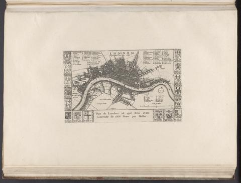
Hollar, Wenceslaus, 1607-1677. London before the fire in 1666 = Plan de Londres tel quil etoi avant l'incendie de 1666 /
Hollar, Wenceslaus, 1607–1677
London before the fire in 1666 = Plan de Londres tel quil etoi avant l'incendie de 1666
[1666?]
Ogilby, John, 1600-1676, author, publisher. America :
Ogilby, John, 1600–1676
America
MDCLXXI [1671]
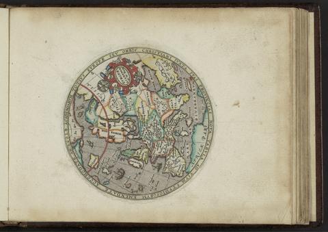
Kip, William, engraver. Academiarum totius Europae seu orbis Christiani iuxta suas provincias nova tabula ad usum studiosorum emendate accomodate
Kip, William
Academiarum totius Europae seu orbis Christiani iuxta suas provincias nova tabula ad usum studiosorum emendate accomodate
An 1602
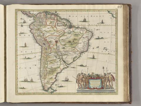
Jansson, Jan, 1588-1664, publisher. Americae pars meridionalis.
Jansson, Jan, 1588–1664
Americae pars meridionalis
[between 1641 and 1680]
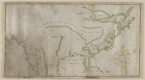
 Map of North America.
Map of North America
not before 1634
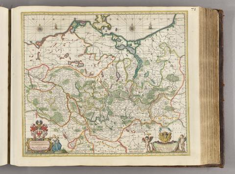
Gothus, Olaus Joannis, 1600-1644, cartographer. Marchionatus Brandenburgicus /
Gothus, Olaus Joannis, 1600–1644
Marchionatus Brandenburgicus
[ca. 1681]
Saxton, Christopher, 1542?- cartographer. [The travellers guide :
Saxton, Christopher, 1542?-
[The travellers guide
[1686?]
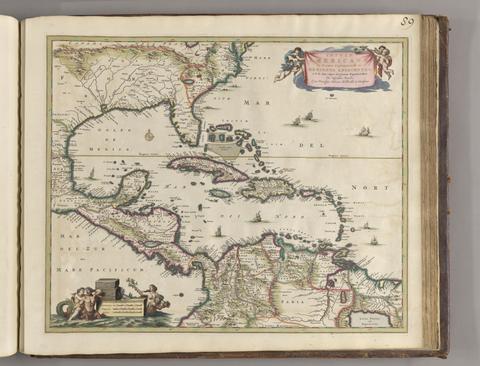
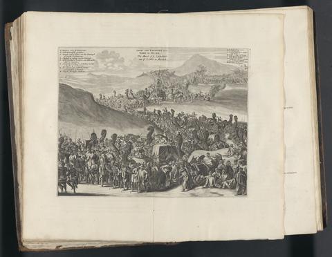
Ogilby, John, 1600-1676. Africa :
Ogilby, John, 1600–1676
Africa
MDC LXX [1670]
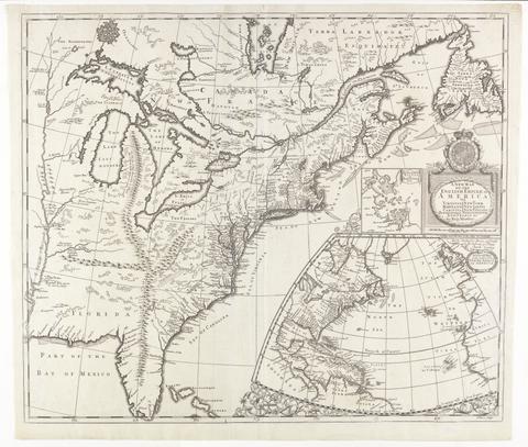
Morden, Robert, approximately 1650-1703, cartographer. A new map of the English empire in America :
Morden, Robert, approximately 1650–1703
A new map of the English empire in America
[ca. 1695]
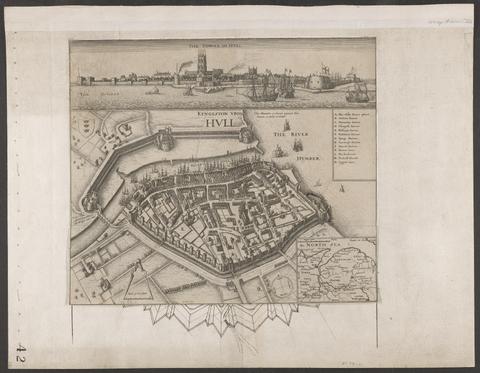
Hollar, Wenceslaus, 1607-1677. Kyngeston vpon Hvll.
Hollar, Wenceslaus, 1607–1677
Kyngeston vpon Hvll
circa 1642
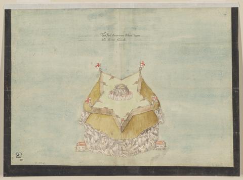
 The Fort Devereux placed uppon the Ferne Islande.
The Fort Devereux placed uppon the Ferne Islande
circa 1600
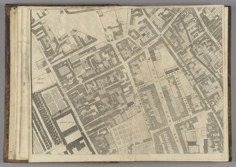
Ogilby, John, 1600-1676. A large and accurate map of the city of London :
Ogilby, John, 1600–1676
A large and accurate map of the city of London
1677]
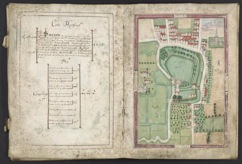
Basil, Simon, -1615, surveyor. Survey of Hertford Castle.
Basil, Simon, -1615
Survey of Hertford Castle
1608
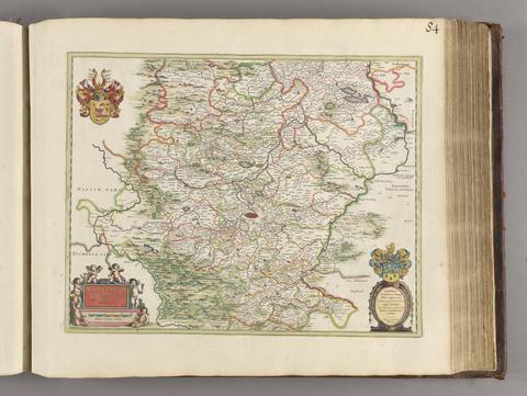
Erich, Adolar, 1559-1634, cartographer. Thuringia landgraviatus /
Erich, Adolar, 1559–1634
Thuringia landgraviatus
[1650?]
Visscher, Nicolaes, 1649-1702. Insulae Americanae in Oceano Septentrionali ac regiones adiacentes :
Visscher, Nicolaes, 1649–1702
Insulae Americanae in Oceano Septentrionali ac regiones adiacentes
ca. 1682]
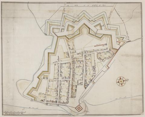
De Gomme, Bernard, 1620-1685, cartographer. The bounds of the fortificatie of Gosport.
De Gomme, Bernard, 1620–1685
The bounds of the fortificatie of Gosport
approximately 1678
Valck, G. (Gerard), 1651-1726.  Africa
Valck, G. (Gerard), 1651–1726
Africa
[ca. 1686?]
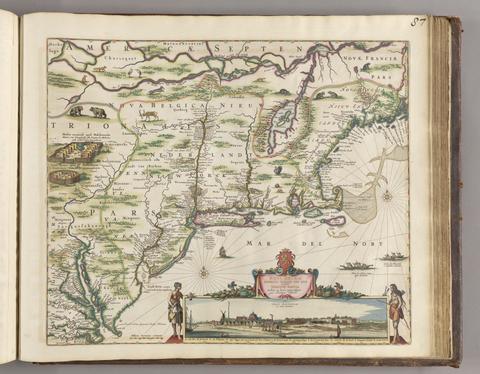
Visscher, Nicolaes, 1618-1679, cartographer. Novi Belgii Novaeque, Angliae nec non partis Virginiae tabula :
Visscher, Nicolaes, 1618–1679
Novi Belgii Novaeque, Angliae nec non partis Virginiae tabula
[ca. 1684]
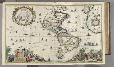
Valck, G. (Gerard), 1651-1726.  America
Valck, G. (Gerard), 1651–1726
America
[ca. 1686]
Allard, Hugo, approximately 1628-1691, cartographer. [Chart of the Thames estuary with a view of the English fleet burning in the Medway]
Allard, Hugo, approximately 1628–1691
[Chart of the Thames estuary with a view of the English fleet burning in the Medway]
1667
Zeiller, Martin, 1589-1661. Topographia Archiepiscopatuvm Moguntinensis, Trevirensis, et Coloniensis :
Zeiller, Martin, 1589–1661
Topographia Archiepiscopatuvm Moguntinensis, Trevirensis, et Coloniensis
1646
Blaeu, Joan, 1596-1673, author, publisher. Theatrum civitatum et admirandorum Italiae :
Blaeu, Joan, 1596–1673
Theatrum civitatum et admirandorum Italiae
MDCLXIII [1663]
Valck, G. (Gerard), 1651-1726, cartographer. Les isles Britanniques, qui contiennent les Royaumes d'Angleterre, Escosse, et Irlande :
Valck, G. (Gerard), 1651–1726
Les isles Britanniques, qui contiennent les Royaumes d'Angleterre, Escosse, et Irlande
[approximately 1695]
Zeiller, Martin, 1589-1661. M.Z. Topographia Bohemiæ, Moraviæ et Silesiæ :
Zeiller, Martin, 1589–1661
M.Z. Topographia Bohemiæ, Moraviæ et Silesiæ
1650
Beckman, Martin, -1702. The groundplott of Bouche de Vale on the N.W. side of Guarnsey /
Beckman, Martin, -1702
The groundplott of Bouche de Vale on the N.W. side of Guarnsey
1690
Zeiller, Martin, 1589-1661, author. Topographia Hassiae, et regionum vicinarum :
Zeiller, Martin, 1589–1661
Topographia Hassiae, et regionum vicinarum
Im Jahr MDCLV [1655]
Doornick, Marcus Williamsz. Platte grondt der Vebrande Stadt London /
Doornick, Marcus Williamsz
Platte grondt der Vebrande Stadt London
1666
Jansson, Jan, 1588-1664. Comitatis Cantabrigiensis :
Jansson, Jan, 1588–1664
Comitatis Cantabrigiensis
[not before 1647]
Zeiller, Martin, 1589-1661. Topographia Alsatiæ &c. completa :
Zeiller, Martin, 1589–1661
Topographia Alsatiæ &c. completa
im Jahr MDCLXIII [1663]
De Gomme, Bernard, 1620-1685.  Plans for fortification and harbor works at Dunkirk.
De Gomme, Bernard, 1620–1685
Plans for fortification and harbor works at Dunkirk
1661-1662?
Storff, Paul Auguste de. Plan of the fortification at Sandown, Isle of Wight.
Storff, Paul Auguste de
Plan of the fortification at Sandown, Isle of Wight
[1671?]
Zeiller, Martin, 1589-1661. Topographia Helvetiæ, Rhætiæ et Valesiæ :
Zeiller, Martin, 1589–1661
Topographia Helvetiæ, Rhætiæ et Valesiæ
Im Jahr MDCLIV [1654]
 Cambridge Shire /
Cambridge Shire
[1695?]
Morden, Robert, approximately 1650-1703. A new mapp of England Scotland and Ireland
Morden, Robert, approximately 1650–1703
A new mapp of England Scotland and Ireland
[1678]
Goos, Pieter, approximately 1616-1675. West-Indische paskaert :
Goos, Pieter, approximately 1616–1675
West-Indische paskaert
[approximately 1660]
Kip, William, engraver. Galliae descriptio
Kip, William
Galliae descriptio
[ca. 1602]
Blaeu, Joan, 1596-1673. Theatrum civitatum nec non admirandorum Neapolis et Siciliae regnorum.
Blaeu, Joan, 1596–1673
Theatrum civitatum nec non admirandorum Neapolis et Siciliae regnorum
[1663]
Speed, John, 1552?-1629. America with those known parts in that unknowne worlde both people and manner of buildings /
Speed, John, 1552?-1629
America with those known parts in that unknowne worlde both people and manner of buildings
[1662?]
Phillips, Thomas, -1693.  Nautical chart of the east coast of Guernsey.
Phillips, Thomas, -1693
Nautical chart of the east coast of Guernsey
ca. 1680
Storff, Paul Auguste de. Plans of the fortifications at Newport and Cowes, Isle of Wight.
Storff, Paul Auguste de
Plans of the fortifications at Newport and Cowes, Isle of Wight
[1671?]
Morden, Robert, approximately 1650-1703, cartographer. A new map of the English plantations in America
Morden, Robert, approximately 1650–1703
A new map of the English plantations in America
[ca. 1677]
Carolus Flandro, Joris, 1601-1625. Tabula Islandiae
Carolus Flandro, Joris, 1601–1625
Tabula Islandiae
[ca. 1660]
Mercator, Michael, d. 1600. America, siue, India Nova :
Mercator, Michael, d. 1600
America, siue, India Nova
between 1613 and 1630]
Zeiller, Martin, 1589-1661, author. Topographia Bavariæ, das ist, Beschreib. vnd aigentliche Abbildung der vornembsten Stätt vnd Orth in Ober vnd Nieder Beÿern, der obern Pfaltz, vnd andern, zum hochlöblichen Baÿrischen Craisse gehörigen Landschaften.
Zeiller, Martin, 1589–1661
Topographia Bavariæ, das ist, Beschreib. vnd aigentliche Abbildung der vornembsten Stätt vnd Orth in Ober vnd Nieder Beÿern, der obern Pfaltz, vnd andern, zum hochlöblichen Baÿrischen Craisse gehörigen Landschaften
MDCXLIV [1644]
Storff, Paul Auguste de. Plan of Carisbrooke Castle, Isle of Wight.
Storff, Paul Auguste de
Plan of Carisbrooke Castle, Isle of Wight
[1671?]
Zeiller, Martin, 1589-1661. Topographia Italiæ :
Zeiller, Martin, 1589–1661
Topographia Italiæ
MDCLXXXIIX [1688]
Morden, Robert, approximately 1650-1703, cartographer. England
Morden, Robert, approximately 1650–1703
England
[1695?]
Jansson, Jan, 1588-1664, cartographer. Cantabrigiensis comitatus :
Jansson, Jan, 1588–1664
Cantabrigiensis comitatus
[not before 1645]
Zeiller, Martin, 1589-1661. Topographia Palatinatus Rheni et vicinarum regionum :
Zeiller, Martin, 1589–1661
Topographia Palatinatus Rheni et vicinarum regionum
1645
Storff, Paul Auguste de. Plan of fortification, possibly at Newtown, Isle of Wight.
Storff, Paul Auguste de
Plan of fortification, possibly at Newtown, Isle of Wight
December, 1671
Zeiller, Martin, 1589-1661, author. Topographia Galliae, sive, Descriptio et delineatio famosissimorum locorum in potentissimo regno Galliae :
Zeiller, Martin, 1589–1661
Topographia Galliae, sive, Descriptio et delineatio famosissimorum locorum in potentissimo regno Galliae
1655-1661
 Description of Jarsey.
Description of Jarsey
1600
Blome, Richard, 1635-1705, cartographer, publisher. A mapp of Cambridgshire
Blome, Richard, 1635–1705
A mapp of Cambridgshire
[1673]
Boissard, Jean Jacques, 1528-1602. Topographia urbis Romæ, das ist eigentliche, Beschreibung der Stadt Rom :
Boissard, Jean Jacques, 1528–1602
Topographia urbis Romæ, das ist eigentliche, Beschreibung der Stadt Rom
Im Jahr M. DC. LXXXI [1681]
Zeiller, Martin, 1589-1661. Topographia Germaniae-Inferioris :
Zeiller, Martin, 1589–1661
Topographia Germaniae-Inferioris
[1659]
Zeiller, Martin, 1589-1661, author. M. Z. Topographia Electorat Brandenburgici et Ducatus Pomeraniae, das ist, Beschreibung der vornembsten und bekantisten Stätte und Plätz in dem hochlöblichsten Churfürstenthum und March Brandenburg, und dem Hertzogtum Pommeren :
Zeiller, Martin, 1589–1661
M. Z. Topographia Electorat Brandenburgici et Ducatus Pomeraniae, das ist, Beschreibung der vornembsten und bekantisten Stätte und Plätz in dem hochlöblichsten Churfürstenthum und March Brandenburg, und dem Hertzogtum Pommeren
[1652]
Exquemelin, A. O. (Alexandre Olivier), author. Bucaniers of America, or, A true account of the most remarkable assaults committed of late years upon the coasts of the West-Indies, by the bucaniers of Jamaica and Tortuga, both English and French : wherein are contained more especially, the unparallel'd exploits of Sir Henry Morgan, our English Jamaican hero, who sack'd Puerto Velo, burnt Panama &c. /
Exquemelin, A. O. (Alexandre Olivier)
Bucaniers of America, or, A true account of the most remarkable assaults committed of late years upon the coasts of the West-Indies, by the bucaniers of Jamaica and Tortuga, both English and French : wherein are contained more especially, the unparallel'd exploits of Sir Henry Morgan, our English Jamaican hero, who sack'd Puerto Velo, burnt Panama &c.
1684-1685
Zeiller, Martin, 1589-1661. Topographia Franconiæ :
Zeiller, Martin, 1589–1661
Topographia Franconiæ
[1648?]
Sanderus, Antoine, 1586-1664, author. Flandria illustrata, sive, Descriptio comitatus istius per totum terraru[m] orbem celeberrimi, III tomis absoluta /
Sanderus, Antoine, 1586–1664
Flandria illustrata, sive, Descriptio comitatus istius per totum terraru[m] orbem celeberrimi, III tomis absoluta
MDCXXXXI-MDCXXXXIIII [1641]-[1644]
Archer, James, approximately 1632-approximately 1680. Plan of the town of Hull and its immediate surroundings.
Archer, James, approximately 1632–approximately 1680
Plan of the town of Hull and its immediate surroundings
ca. 1680
Zeiller, Martin, 1589-1661. Topographia provinciarum Austriacaru[m], Austriæ, Stÿriæ, Carinthiæ, Carniolæ, Tyrolis, etc :
Zeiller, Martin, 1589–1661
Topographia provinciarum Austriacaru[m], Austriæ, Stÿriæ, Carinthiæ, Carniolæ, Tyrolis, etc
[1677]
 Britannia prout divisa fuit temporibus Anglo-Saxonum praesertim durante illorum heptarchia
Britannia prout divisa fuit temporibus Anglo-Saxonum praesertim durante illorum heptarchia
[1645]
Phillips, Thomas, -1693.  Nautical chart of Grand Havre, Guernsey.
Phillips, Thomas, -1693
Nautical chart of Grand Havre, Guernsey
ca. 1680
Speed, John, 1552?-1629. Cambridgshire
Speed, John, 1552?-1629
Cambridgshire
1610
Hennepin, Louis, active 17th century, author. A new discovery of a vast country in America :
Hennepin, Louis, active 17th century
A new discovery of a vast country in America
1698
Zeiller, Martin, 1589-1661. Topographia Sueviae, das ist, Beschreib. vnd aigentliche Abcontrafeitung der fürnembste[n] Stätt vnd Plätz in Ober vnd Nider Schwaben, Herzogthum Würtenberg, Marggraffschafft Baden vnd andern zu dem hochlöbl. schwabischen Craisse gehörigen Landtschafften vnd Orten.
Zeiller, Martin, 1589–1661
Topographia Sueviae, das ist, Beschreib. vnd aigentliche Abcontrafeitung der fürnembste[n] Stätt vnd Plätz in Ober vnd Nider Schwaben, Herzogthum Würtenberg, Marggraffschafft Baden vnd andern zu dem hochlöbl. schwabischen Craisse gehörigen Landtschafften vnd Orten
MDCXLIII [1643] [i.e. ca. 1655]
Kip, William, engraver. Angliae descpiptio [sic]
Kip, William
Angliae descpiptio [sic]
[ca. 1602]
Speed, John, 1552?-1629. A new and accurat map of the world :
Speed, John, 1552?-1629
A new and accurat map of the world
1651 [1676 printing]
Morden, Robert, approximately 1650-1703. Westmorland
Morden, Robert, approximately 1650–1703
Westmorland
[1695]
Blaeu, Willem Janszoon, 1571-1638. America quarta pars orbis ...
Blaeu, Willem Janszoon, 1571–1638
America quarta pars orbis ..
[1686?]
Lederer, John, author. The discoveries of John Lederer :
Lederer, John
The discoveries of John Lederer
1672
Kip, William, engraver. Belgiae descriptio
Kip, William
Belgiae descriptio
[ca. 1602]
Browne, Christopher, active 1684-1712. A new map of Virginia, Maryland, and the improved parts of Pennsylvania & New Jersey
Browne, Christopher, active 1684–1712
A new map of Virginia, Maryland, and the improved parts of Pennsylvania & New Jersey
[1685?]
 The first map of Australia
The first map of Australia
[1856]
De Gomme, Bernard, 1620-1685.  Plan for the Citadel at Hull.
De Gomme, Bernard, 1620–1685
Plan for the Citadel at Hull
[1681?]
Morden, Robert, approximately 1650-1703. To Captain John Wood this map of the world drawn according to Mercators projection humbly dedicated by Robt. Morden & Willm. Berry.
Morden, Robert, approximately 1650–1703
To Captain John Wood this map of the world drawn according to Mercators projection humbly dedicated by Robt. Morden & Willm. Berry
[approximately 1682?]
Zeiller, Martin, 1589-1661. Topographia vnd eigentliche Beschreibung der vornembsten Stätte, Schlösser auch anderer Plätze vnd Örter in denen Hertzogthumer̃ Braunschweig vnd Lüneburg :
Zeiller, Martin, 1589–1661
Topographia vnd eigentliche Beschreibung der vornembsten Stätte, Schlösser auch anderer Plätze vnd Örter in denen Hertzogthumer̃ Braunschweig vnd Lüneburg
MDCLIIII [1654]
Archer, James, approximately 1632-approximately 1680. Plan of Scarbrogh Castle & towne /
Archer, James, approximately 1632–approximately 1680
Plan of Scarbrogh Castle & towne
circa 1680
Zeiller, Martin, 1589-1661. Topographia Superioris Saxoniæ, Thüringiæ, Misniæ, Lusatiæ, etc :
Zeiller, Martin, 1589–1661
Topographia Superioris Saxoniæ, Thüringiæ, Misniæ, Lusatiæ, etc
MDCL [1650]
 The Castell Perrott placed uppon the rocke cauled the stacke.
The Castell Perrott placed uppon the rocke cauled the stacke
circa 1600
Zeiller, Martin, 1589-1661, author. Topographia Westphaliae :
Zeiller, Martin, 1589–1661
Topographia Westphaliae
[1647]
 Plans for the Citadel at Hull.
Plans for the Citadel at Hull
1681-1682
Valck, G. (Gerard), 1651-1726. Europa.
Valck, G. (Gerard), 1651–1726
Europa
[ca. 1686?]
Speed, John, 1552?-1629. A map of New England and New York /
Speed, John, 1552?-1629
A map of New England and New York
[1676]
Beckman, Martin, -1702.  Plans for the fortifications at Hull.
Beckman, Martin, -1702
Plans for the fortifications at Hull
1681-1682
Valck, G. (Gerard), 1651-1726. Asia.
Valck, G. (Gerard), 1651–1726
Asia
[ca. 1686?]
Zeiller, Martin, 1589-1661. Topographia Saxoniae Inferioris :
Zeiller, Martin, 1589–1661
Topographia Saxoniae Inferioris
MDCLIII [1653]
 Plan of a fortification in Guernsey.
Plan of a fortification in Guernsey
July 20, 1682
Blaeu, Willem Janszoon, 1571-1638. Blaeu's Atlas of England, Scotland, Wales and Ireland
Blaeu, Willem Janszoon, 1571–1638
Blaeu's Atlas of England, Scotland, Wales and Ireland
[1970]