Search Constraints
You searched for:
Collection Rare Books and Manuscripts
Remove constraint Collection: Rare Books and ManuscriptsWork Type map
Remove constraint Work Type: mapSearch Results

1
- London before the fire in 1666 = Plan de Londres tel quil etoi avant l'incendie de 1666
- [1666?]

2
- Cambridgeshire
- [1808]

3
- The route of the mail & post coaches, George Boulton & Co. proprietors
- [between 1796 and 1809]

4
- A map of London and the adjacent country 10 miles round
- 1748

5
- London and Westminster improved
- MDCCLXVU [1766]

6
- L'orient, or, The Indian travellers : a geographical and historical game
- [1846]

7
- A plan of mathematical learning taught in the Royal Academy, Portsmouth
- approximately 1798-1799

8
- Map of North America
- not before 1634

9
- Bartholomew's one inch to the mile environs of London
- [not before 1921]

10
- This newly constructed and extended map of India
- 1841

11
- London and Westminster in the reign of Queen Elizabeth anno dom. 1563
- October 30th, 1789

12
- Marchionatus Brandenburgicus
- [ca. 1681]

13
- Summer of smiles
- 2011

14
- A plan of Rome
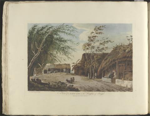
- 1750

15
- The environs of London
- [1763]

16
- Africa
- MDC LXX [1670]

17
- Queen Hotel
- [188-?]

18
- Scotiae Regni Antiqvissimi Accvrata Descriptio
- MDLXXVIII [1578]

19
- Americae pars meridionalis
- [between 1641 and 1680]

20
- North America, and the West Indies
- [1764?]

21
- Britain at home to the world
- 1951

22
- America
- MDCLXXI [1671]

23
- The antiquities of Magna Graecia
- MDCCCVII [1807]

24
- Britannia insula quae duo regna continet Angliam et Scotiam cum Hibernia adiacente
- MDLVI [1556]

25
- Outline of the countries between Delhi and Constantinople
- 1814 [i.e. 1821?]

26
- Wallis's tour of Europe
- Nov. 24th, 1794

27
- The map of England and Wales with part of Scotland, France and Ireland, worked by Maria Harvey in the ninth year of age
- 1806

28
- The paths of life
- [circa 1840]

29
- The famouse West Indian voyadge made by the Englishe fleete of 23 shippes and barkes
- [1589?]

30
- [The travellers guide
- [1686?]

31
- To Martin Folkes, esq., president of the Royal Society
- 1749

32
- The bounds of the fortificatie of Gosport
- approximately 1678

33
- The Fort Devereux placed uppon the Ferne Islande
- circa 1600

34
- Bugle Hotel, Newport, Isle of Wight
- [late 19th century]

35
- Academiarum totius Europae seu orbis Christiani iuxta suas provincias nova tabula ad usum studiosorum emendate accomodate
- An 1602

36
- A survey and valuation of estates the property of Nicholas Smyth Esqr. and his Lady
- 1767

37
- A new map of the English empire in America
- [ca. 1695]

38
- Thuringia landgraviatus
- [1650?]

39
- Insulae Americanae in Oceano Septentrionali ac regiones adiacentes
- ca. 1682]

40
- Kyngeston vpon Hvll
- circa 1642

41
- A survey of the estate of John Plampin Esquire, taken in 1774,
- 1774

42
- A survey of the estate of Richard Moore, Esq., Kentwell Hall, Suffolk
- 1777

43
- Sir Joseph Banks's fishery book of the River Witham in Lincolnshire
- 1784-1800

44
- Festival pleasure gardens
- 1951

45
- A voyage to the South Sea, and round the world, perform'd in the years 1708, 1709, 1710, and 1711, by the ships Duke and Dutchess of Bristol
- MDCCXII [1712]
46
- Choix de vues de l'Inde
- [1788]

47
- Africa
- [ca. 1686?]

48
- Novi Belgii Novaeque, Angliae nec non partis Virginiae tabula
- [ca. 1684]

49
- The county of Dorset
- June 1st, 1795

50
- Survey of Hertford Castle
- 1608

51
- Panorama of the Rhine and the adjacent country from Cologne to Mayence
- [between 1834 and 1839]

52
- Crowned heads, or, Contemporary sovereigns
- [ca. 1845?]

53
- A large and accurate map of the city of London
- 1677]

54
- Survey and valuation of the several estates belonging to John Kinchant Esqr. and Emma his wife
- 1765

55
- Map of the southeastern part of North America
- 1721

56
- A map of Hindoostan or the Mogul Empire
- 1788

57
- America
- [ca. 1686]
![Allard, Hugo, approximately 1628-1691, cartographer. [Chart of the Thames estuary with a view of the English fleet burning in the Medway]](https://media.collections.yale.edu/thumbnail/ycba/02ae63ff-cd23-4365-8ae6-55a7533753c2)
58
- [Chart of the Thames estuary with a view of the English fleet burning in the Medway]
- 1667

59
- Wallis's new dissected map of America : engraved from the latest authorities, for the use of young students in geography
- [between 1812 and 1818]

60
- A map of the Zoological Society Gardens in Regents Park commonly called The Zoo
- [approximately 1947]

61
- The Crystal Palace game
- [1854?]

62
- Illustrated excursions in Italy
- MDCCCXLVI [1846]
63
- Topographia Helvetiæ, Rhætiæ et Valesiæ
- Im Jahr MDCLIV [1654]
64
- Thoreau's country
- [1998?]
65
- Southamtoniae comitatus (preter insulas Vectis, Jersey et Garnsey quae sunt partes eius dem comitatus) cum suis undiq[ue] confinibus, oppidis, pagis, villis, et fluminibus vera descriptio
- [1575]
66
- Map of the county of Monmouth
- 1831
67
- Scotland
- [approximately 1870?]
68
- Survey of the country around London
- 1852
69
- Fragments
- 2018
70
- A new map of the English plantations in America
- [ca. 1677]
71
- Official handbook of the Air Union, 1927
- 1927
72
- The present state of the European settlements on the Missisippi
- MDCCLXX [1770]
73
- Children's map of London
- [approximately 1939]
74
- Ichnographia urbis Londinii
- 1724
75
- Topographia Alsatiæ &c. completa
- im Jahr MDCLXIII [1663]
76
- Maris Pacifici (quod vulg ̣Mar del Zur)
- 1589
77
- A new map of Virginia, Mary-Land, and the improved parts of Pennsylvania & New Jersey
- 1719
78
- Paddington Cemetery, Willesden Lane, Kilburn
- [approximately 1890]
79
- Black's travelling map of Ireland
- [184-?]
80
- Londinum feracissimi Angliae Regni metropolis
- [1574]
81
- Voyage de la corvette l'Astrolabe
- 1830-1834
82
- Voyage autour du monde sur la frégate la Vénus, pendant les années 1836-1839
- 1840-1864
83
- Magna Britannia, aut Anglia, Scotia et Hibernia, quarum prior divisa in septem Regna, sive Provincias, dictas Northumbriam, Merciam, Angliam Orient. Essexiam, Cantium, Sussexiam, Westsexiam, et Princi. Walliae. posterior in Septent. et Austr. Scotiam. postrema in quatuor Provincias Ultoniam, Lageniam, Momoniam, et Conagtiam
- [approximately 1705]
84
- Australia
- 2003
85
- Walker's tour through England and Wales
- January 2nd 1809
86
- A brief narrative of an unsuccessful attempt to reach Repulse Bay
- MDCCCXXV [1825]
87
- Travels through the middle settlements in North America, in the years 1759 and 1760
- 1798
88
- A voyage to North-America: undertaken by command of the present King of France
- MDCCLXVI [1766]
89
- Narrative of a voyage to the Pacific and Beering's strait
- MDCCCXXXI [1831]
90
- Facsimile of the Illustrated Arctic News
- 15th March, 1852
91
- Cambridge Shire
- [1695?]
92
- New and Improved map of England and Wales, including the principal part of Scotland
- 16th. April 1823
93
- [Old series Ordnance Survey maps of England and Wales]
- [1839-1874?]
94
- Plans for fortification and harbor works at Dunkirk
- 1661-1662?
95
- Plan of the fortification at Sandown, Isle of Wight
- [1671?]
96
- America with those known parts in that unknowne worlde both people and manner of buildings
- [1662?]
97
- The Barra Isles
- 2016
98
- The Seraglio & gardens of the Grand Seignior = Serrail & jardins du Grand Seigneur
- 1752
99
- Topographia Archiepiscopatuvm Moguntinensis, Trevirensis, et Coloniensis
- 1646
100
- Platte grondt der Vebrande Stadt London
- 1666