Search Constraints
You searched for:
Classification Maps & Atlas (printed)
Remove constraint Classification: Maps & Atlas (printed)Search Results

- Date:
- [Amsterdam?] :
- Physical Description:
- 1 atlas ([44] leaves of plates) ; 44 maps ; 13 x 18 cm.
- Collection:
- Rare Books and Manuscripts
![[Atlas of the counties of England and Wales].](https://media.collections.yale.edu/thumbnail/ycba/4ac23653-8668-40b0-b3f1-7228f7c1d7e3)
- Date:
- [1590?]
- Physical Description:
- 1 atlas ([74] leaves) : 34 maps (some folded) ; 44 cm
- Collection:
- Rare Books and Manuscripts

- Date:
- [1579]
- Physical Description:
- 1 atlas ([1] leaf, [71] leaves of plates) : 35 maps, port. ; 42 cm. (fol.)
- Collection:
- Rare Books and Manuscripts

- Date:
- 1st September 1832
- Physical Description:
- 1 map ; 59 x 90 cm, on sheet 67 x 98 cm, folded to 17 x 12 cm
- Collection:
- Rare Books and Manuscripts
5. [Cambridge]

- Date:
- 1st June 1836
- Physical Description:
- 1 map ; 59 x 91 cm, on sheet 67 x 98 cm, folded to 17 x 12 cm
- Collection:
- Rare Books and Manuscripts
![[Chart of the Thames estuary with a view of the English fleet burning in the Medway] [cartographic material].](https://media.collections.yale.edu/thumbnail/ycba/02ae63ff-cd23-4365-8ae6-55a7533753c2)
- Date:
- 1667
- Physical Description:
- 1 map ; 34 x 45 cm, on sheet 45 x 49 cm
- Collection:
- Rare Books and Manuscripts

- Date:
- 1st Novr. 1838
- Physical Description:
- 1 map ; 59 x 91 cm, on sheet 67 x 98 cm, folded to 17 x 12 cm
- Collection:
- Rare Books and Manuscripts

- Date:
- [1799?]
- Physical Description:
- 1 atlas ([142] leaves, some folded) : 74 hand-colored maps ; 55 cm
- Collection:
- Rare Books and Manuscripts

- Date:
- [1686?]
- Physical Description:
- 1 atlas ([60] leaves) : 30 hand-colored maps ; 54 cm
- Collection:
- Rare Books and Manuscripts
10. [Downham] / engraved at the Ordnance Map Office in the Tower under the direction of Major Colby ...

- Date:
- 1st March 1824
- Physical Description:
- 1 map ; 59 x 91 cm, on sheet 67 x 98 cm, folded to 17 x 12 cm
- Collection:
- Rare Books and Manuscripts

- Date:
- [not before 1862]
- Physical Description:
- 1 map ; 59 x 90 cm, on sheet 67 x 98 cm, folded to 17 x 12 cm
- Collection:
- Rare Books and Manuscripts

- Date:
- August 7th, 1837
- Physical Description:
- 1 map ; 59 x 45 cm, on sheet 67 x 55 cm, folded to 17 x 12 cm
- Collection:
- Rare Books and Manuscripts

- Date:
- August 7, 1837
- Physical Description:
- 1 map ; 59 x 90 cm, on sheet 67 x 98 cm, folded to 17 x 12 cm
- Collection:
- Rare Books and Manuscripts

- Date:
- [ca. 1930?]
- Physical Description:
- 4 maps
- Collection:
- Rare Books and Manuscripts

- Date:
- January 1st 1838
- Physical Description:
- 1 map ; 59 x 91 cm, on sheet 67 x 98 cm, folded to 17 x 12 cm
- Collection:
- Rare Books and Manuscripts
![[Old series Ordnance Survey maps of England and Wales]](https://media.collections.yale.edu/thumbnail/ycba/00e4c053-1da0-4b6a-9606-069ea90649fa)
- Date:
- 1805-1834 [i.e. 1834-1835?]
- Physical Description:
- 65 maps on 66 sheets : mounted on linen ; sheets 69 x 98 cm, or smaller + index.
- Collection:
- Rare Books and Manuscripts

- Date:
- [1839-1874?]
- Physical Description:
- 110 sheets : mounted on linen ; sheets 69 x 98 cm, or smaller + index.
- Collection:
- Rare Books and Manuscripts

- Date:
- Novr. 9th, 1843 [i.e. ca. 1853-1874?]
- Physical Description:
- 110 sheets : mounted on linen ; sheets 69 x 98 cm, or smaller + index.
- Collection:
- Rare Books and Manuscripts

- Date:
- [circa 1610?]
- Physical Description:
- 1 atlas ([110 ] leaves) : 55 maps ; 43 cm
- Collection:
- Rare Books and Manuscripts

- Date:
- 1st October 1833
- Physical Description:
- 1 map ; 59 x 91 cm, on sheet 67 x 98 cm, folded to 17 x 12 cm
- Collection:
- Rare Books and Manuscripts

- Date:
- [not before 1862]
- Physical Description:
- 1 map ; 59 x 90 cm, on sheet 67 x 98 cm, folded to 17 x 12 cm
- Collection:
- Rare Books and Manuscripts

- Physical Description:
- 52 maps : ill. ; on playing cards 9.5 x 5.5 cm.
- Collection:
- Rare Books and Manuscripts

- Date:
- [1646?]
- Physical Description:
- 1 atlas ([57] leaves) : 57 maps ; 44 x 56 cm
- Collection:
- Rare Books and Manuscripts
![[The travellers guide : being the best mapp of the kingdom of England and principalaty [sic] of Wales. Wherein are delineated 3000 towns and villages more than in any mapp yet extent besides ye notations of bridges & rivers &c. To which is added ye direct and cross roads according to Mr. Ogilby's late survey. / Described by C: Saxton and now carefully corrected with new additions by Phillip Lea].](https://media.collections.yale.edu/thumbnail/ycba/906da49f-9f3d-41c8-9cb7-2f67ee863785)
- Date:
- [1686?]
- Physical Description:
- 1 atlas ([10] sheets) : hand colored maps ; sheets 28 x 69 cm, and smaller
- Collection:
- Rare Books and Manuscripts
25. [World map]

- Date:
- [1482]
- Physical Description:
- 1 map : woodcut ; image 41 x 57 cm
- Collection:
- Rare Books and Manuscripts

- Date:
- [1851]
- Physical Description:
- 1 map : hand-colored ; 62.0 x 105.9 cm, on sheet 69.8 x 109.5 cm.
- Collection:
- Rare Books and Manuscripts

- Date:
- 1753
- Physical Description:
- 1 map : hand col., mounted on linen ; 1753.
- Collection:
- Rare Books and Manuscripts

- Date:
- [1762?]
- Physical Description:
- 1 map on 4 sheets : hand colored ; 87 x 89 cm
- Collection:
- Rare Books and Manuscripts

- Date:
- 1771
- Physical Description:
- 1 map : engraving, hand colored ; 48 x 63 cm, on sheet 53 x 71 cm
- Collection:
- Rare Books and Manuscripts

- Date:
- November 1st, 1819 [that is, 1820]
- Physical Description:
- 1 map on 6 sheets : hand-colored ; 185 x 162 cm, sheets 65 x 79 cm
- Collection:
- Rare Books and Manuscripts

- Date:
- November 1st, 1819 [that is, 1820]
- Physical Description:
- 1 map on 4 sheets : hand-colored, mounted on linen ; 192 x 162 cm, sheets 96 x 81 cm, folded to 32 x 27 cm, in portfolio 36 x 28 cm + 1 book ([2], 17, [1] pages ; 33 cm)
- Collection:
- Rare Books and Manuscripts
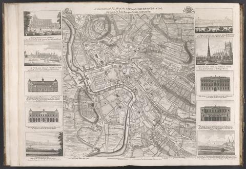
- Date:
- [175-?]
- Physical Description:
- 1 map : ill. ; 48 x 45 cm., on sheet 55 x 75 cm.
- Collection:
- Rare Books and Manuscripts
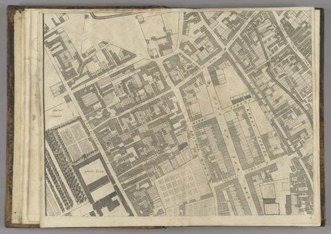
- Date:
- 1677]
- Physical Description:
- 1 map : 160 x 255 cm. on 20 sheets 40 x 51 cm.
- Collection:
- Rare Books and Manuscripts

- Date:
- [1811]
- Physical Description:
- 1 map on 4 sheets : hand col., dissected and mounted on linen ; 126 x 147 cm., sheets 64 x 75 cm.
- Collection:
- Rare Books and Manuscripts

- Date:
- 1966
- Physical Description:
- map 63 x 48 cm.
- Collection:
- Reference Library

- Date:
- [1720?]
- Physical Description:
- 1 map ; 11 x 11 cm, on sheet 19 x 15 cm
- Collection:
- Rare Books and Manuscripts
- Credit Line:
- Yale Center for British Art, Gift of David Alan Richards, Yale BA 1967, JD 1972

- Date:
- 1839
- Physical Description:
- 1 map on 4 sheets : hand col., mounted on linen ; 202 x 168 cm., sheets 106 x 90 cm., folded to 22 x 13 cm., in covers 23 x 14 cm.
- Collection:
- Rare Books and Manuscripts
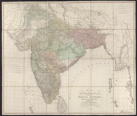
- Date:
- 1788
- Physical Description:
- 1 map : hand col., mounted on linen ; 105 x 124 cm., folded to 27 x 21 cm., in case 27 x 23 cm.
- Collection:
- Rare Books and Manuscripts
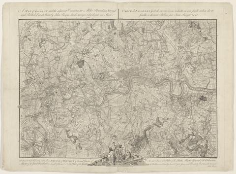
- Date:
- 1748
- Physical Description:
- 1 map ; 44 x 63 cm., on sheet 52 x 66 cm.
- Collection:
- Rare Books and Manuscripts

- Date:
- [1676]
- Physical Description:
- 1 map ; 38 x 50 cm., on sheet 44 x 56 cm.
- Collection:
- Rare Books and Manuscripts

- Date:
- 1749
- Physical Description:
- 1 map ; 63 x 47 cm, on sheet 66 x 50 cm
- Collection:
- Rare Books and Manuscripts

- Date:
- 1856
- Physical Description:
- 1 map on 2 sheets : hand col., mounted on linen ; map 183 x 126 cm., sheets 106 x 135 cm. and 85 x 135 cm., folded to 22 x 15 cm.
- Collection:
- Rare Books and Manuscripts

- Date:
- [that is, 1757]
- Physical Description:
- 1 map in 4 sheets : hand colored ; 136 x 192 cm, sheets 71 x 99 cm and 71 x 100 cm
- Collection:
- Rare Books and Manuscripts

- Date:
- Febry 13th, 1755
- Physical Description:
- 1 map : engraving ; 136 x 195 cm, on sheets 77 x 57 cm
- Collection:
- Rare Books and Manuscripts

- Date:
- [1775?]
- Physical Description:
- 1 map on 8 sheets : hand col., mounted on linen ; 135 x 192 cm., sheets 70 x 51 or smaller.
- Collection:
- Rare Books and Manuscripts

- Date:
- [ca. 1737]
- Physical Description:
- 1 map ; 48 x 47 cm, on sheet 54 x 64 cm
- Collection:
- Rare Books and Manuscripts

- Date:
- [ca. 1737]
- Physical Description:
- 1 map on 6 sheets : outline col. ; each ca. 58 x 53 cm
- Collection:
- Rare Books and Manuscripts

- Date:
- [1739]
- Physical Description:
- 1 map on 20 sheets ; sheets 53 x 72 cm or smaller, bound 53 x 41 cm. + 1 key map (48 x 47 cm.)
- Collection:
- Rare Books and Manuscripts

- Date:
- 1785
- Physical Description:
- 25 sheets + index map.
- Collection:
- Rare Books and Manuscripts

- Date:
- 1757
- Physical Description:
- 1 map ; 50 x 68 cm., on sheet 55 x 72 cm.
- Collection:
- Rare Books and Manuscripts
- Date:
- 1999
- Physical Description:
- 1 map : col. ; 62 x 96 cm., folded to 20 x 15 cm.
- Collection:
- Reference Library

- Date:
- 1804
- Physical Description:
- 1 map on 4 sheets ; sheets 63 x 80 cm.
- Collection:
- Rare Books and Manuscripts

- Date:
- Augt. 2nd. 1838
- Physical Description:
- 1 map : 121 x 121 cm on sheet 126 x 126 cm
- Collection:
- Rare Books and Manuscripts

- Date:
- [between 1762 and 1773]
- Physical Description:
- 1 map on 2 sheets ; 120 x 188 cm., sheets 67 x 108 cm.
- Collection:
- Rare Books and Manuscripts

- Date:
- 1809
- Physical Description:
- 1 map on 10 sheets : mounted on linen ; 102 x 224 cm, sheets 51 x 48 cm.
- Collection:
- Rare Books and Manuscripts

- Date:
- [18--?]
- Physical Description:
- 1 map : on linen ; 57 x 62 cm., on sheet 66 x 74 cm.
- Collection:
- Rare Books and Manuscripts

- Date:
- 1863,
- Physical Description:
- 1 map : hand col., mounted on linen ; 62 x 69 cm., folded to 17 x 11 cm., in case 18 x 12 cm.
- Collection:
- Rare Books and Manuscripts

- Date:
- Jany. 1st 1796
- Physical Description:
- 1 map : hand col., mounted on linen ; 123 x 141 cm.
- Collection:
- Rare Books and Manuscripts

- Date:
- [19--?]
- Physical Description:
- 1 map ; 48 x 59 cm., on sheet 64 x 78 cm.
- Collection:
- Rare Books and Manuscripts

- Date:
- [1673]
- Physical Description:
- 1 map ; 29.9 x 27 cm
- Collection:
- Rare Books and Manuscripts
- Credit Line:
- Yale Center for British Art, Gift of David Alan Richards, Yale BA 1967, JD 1972

- Date:
- 1740]
- Physical Description:
- 1 map on 4 sheets ; 240 x 186 cm., on sheets 66 x 55 cm.
- Collection:
- Rare Books and Manuscripts

- Date:
- [ca. 1590]
- Physical Description:
- 1 map ; 42 cm in diameter, on sheet 42 x 55 cm
- Collection:
- Rare Books and Manuscripts

- Date:
- 1651 [1676 printing]
- Physical Description:
- 1 map : hand col. ; 2 hemipsheres each 25 cm. in diam., on sheet 45 x 57 cm.
- Collection:
- Rare Books and Manuscripts

- Date:
- 1741
- Physical Description:
- 1 map ; 53 x 69 cm., on sheet 55 x 75 cm.
- Collection:
- Rare Books and Manuscripts

- Date:
- 1751
- Physical Description:
- 1 atlas ([2], [32] leaves) : maps ; 55 cm.
- Collection:
- Rare Books and Manuscripts

- Date:
- 1753
- Physical Description:
- 1 map : ill. ; 27 x 55 cm., on sheet 55 x 75 cm.
- Collection:
- Rare Books and Manuscripts

- Date:
- [1763]
- Physical Description:
- 1 map : hand col., mounted on linen ; 104 x 121 cm., folded to 26 x 15 cm., in case 27 x 16 cm.
- Collection:
- Rare Books and Manuscripts

- Date:
- [approximately 1740?]
- Physical Description:
- 1 map : engraving ; 56 x 70 cm, on sheet 62 x 104 cm
- Collection:
- Rare Books and Manuscripts

- Date:
- [17--]
- Physical Description:
- 1 map ; 30 x 49 cm., on sheet 40 x 55 cm.
- Collection:
- Rare Books and Manuscripts

- Date:
- MDCC XXI [1721]
- Physical Description:
- [8], 272, 141-261, [11] pages, [75] leaves of plates : 34 maps, coats of arms ; 56 cm
- Collection:
- Rare Books and Manuscripts

- Date:
- [1750]
- Physical Description:
- 1 map : engraving ; 69 x 51 cm, on sheet 73 x 56 cm
- Collection:
- Rare Books and Manuscripts

- Date:
- [ca. 1700]
- Physical Description:
- 1 map ; 26 x 28 cm., on sheet 30 x 32 cm.
- Collection:
- Rare Books and Manuscripts

- Date:
- Apr. 28, 1811
- Physical Description:
- 1 map ; 52 x 46 cm
- Collection:
- Rare Books and Manuscripts
- Credit Line:
- Yale Center for British Art, Gift of David Alan Richards, Yale BA 1967, JD 1972

- Date:
- Sepr. 28,1801
- Physical Description:
- 1 map : engraving ; 51 x 46 cm, on sheet 65 x 55 cm
- Collection:
- Rare Books and Manuscripts

- Date:
- January 1st, 1874
- Physical Description:
- 1 map : color ; 66 x 84 cm, on sheet 73 x 87 cm, folded in cover 19 x 13 cm
- Collection:
- Rare Books and Manuscripts

- Date:
- 1810
- Physical Description:
- 1 map on 4 sheets : hand col. ; 129 x 158 cm on sheets 65 x 80 cm
- Collection:
- Rare Books and Manuscripts

- Date:
- January 6th 1804 [i.e. 1808]
- Physical Description:
- 1 map ; 44 x 50 cm
- Collection:
- Rare Books and Manuscripts
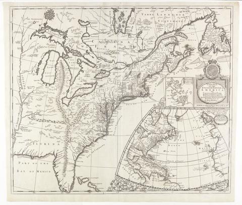
- Date:
- [ca. 1695]
- Physical Description:
- 1 map : engraving ; 51 x 60 cm
- Collection:
- Rare Books and Manuscripts

- Date:
- 1719
- Physical Description:
- 1 map : engraving, hand colored ; 49 x 58 cm, on sheet 55 x 63 cm
- Collection:
- Rare Books and Manuscripts

- Date:
- [ca. 1677]
- Physical Description:
- 1 map : engraving ; 42 x 52 cm
- Collection:
- Rare Books and Manuscripts

- Date:
- 1719
- Physical Description:
- 1 map ; 48 x 54 cm, on sheet 53 x 59 cm
- Collection:
- Rare Books and Manuscripts

- Date:
- [1685?]
- Physical Description:
- 1 map : engraving, hand-colored ; 48 x 55 cm, on sheet 53 x 65 cm
- Collection:
- Rare Books and Manuscripts

- Date:
- [1678]
- Physical Description:
- 1 map : engraving ; 50 x 57 cm, on sheet 54 x 63 cm
- Collection:
- Rare Books and Manuscripts
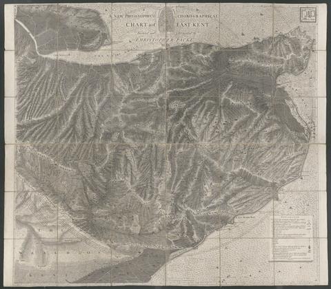
- Date:
- 1743
- Physical Description:
- 1 map : mounted on linen ; 122 x 140 cm., folded to 21 x 24 cm.
- Collection:
- Rare Books and Manuscripts

- Date:
- 1748
- Physical Description:
- 1 map : ill. ; 57 x 90 cm., on sheet 62 x 93 cm.
- Collection:
- Rare Books and Manuscripts

- Date:
- 1801
- Physical Description:
- 1 map : col. ; 17 x 32 cm. folded to 17 x 11 cm.
- Collection:
- Rare Books and Manuscripts

- Date:
- [1790]
- Physical Description:
- 1 map : hand col., mounted on linen ; 47 x 91 cm., folded to 18 x 12 cm., in case 19 x 13 cm.
- Collection:
- Rare Books and Manuscripts

- Date:
- 1812
- Physical Description:
- 1 map : hand col., mounted on linen ; 46 x 92 cm., folded to 16 x 12 cm., in case 16 x 12 cm.
- Collection:
- Rare Books and Manuscripts

- Date:
- 1804]
- Physical Description:
- 1 map : col. ; 62 x 132 cm. folded to 27 x 20 cm.
- Collection:
- Rare Books and Manuscripts

- Date:
- [1845]
- Physical Description:
- 1 map ; image 39 x 101 cm, on sheet 45 x 105 cm
- Collection:
- Rare Books and Manuscripts

- Date:
- [1749 October 3]
- Physical Description:
- 1 map ; 16 x 4 cm, on sheet 30 x 42 cm
- Collection:
- Rare Books and Manuscripts
92. A plan of Geneva, with the adjacent parts = Plan de Geneve, avec ses environs / P. Martel, delin.

- Date:
- 1743
- Physical Description:
- 1 map ; 48 x 64 cm., on sheet 55 x 75 cm.
- Collection:
- Rare Books and Manuscripts

- Date:
- 1754
- Physical Description:
- 1 map ; 43 x 62 cm., on sheet 55 x 74 cm.
- Collection:
- Rare Books and Manuscripts

- Date:
- 1751
- Physical Description:
- 1 map ; 32 x 46 cm., on sheet 40 x 55 cm.
- Collection:
- Rare Books and Manuscripts

- Date:
- 1754
- Physical Description:
- 1 map ; 46 x 69 cm., on sheet 55 x 75 cm.
- Collection:
- Rare Books and Manuscripts

- Date:
- 1754,
- Physical Description:
- 1 map ; 41 x 65 cm., on sheet 55 x 75 cm.
- Collection:
- Rare Books and Manuscripts

- Date:
- 1748
- Physical Description:
- 1 map on 6 sheets ; 222 x 262 cm., sheets 55 x 75 cm.
- Collection:
- Rare Books and Manuscripts
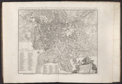
- Date:
- 1750
- Physical Description:
- 1 map ; 43 x 53 cm., on sheet 55 x 74 cm.
- Collection:
- Rare Books and Manuscripts

- Date:
- 1756
- Physical Description:
- 1 map ; 66 x 45 cm., on sheet 75 x 55 cm.
- Collection:
- Rare Books and Manuscripts

- Date:
- 1746
- Physical Description:
- 1 map on 24 sheets ; 203 x 385 cm., sheets 77 x 57 cm.
- Collection:
- Rare Books and Manuscripts