Search Constraints
You searched for:
Collection Rare Books and Manuscripts
Remove constraint Collection: Rare Books and ManuscriptsWork Type map
Remove constraint Work Type: mapSearch Results

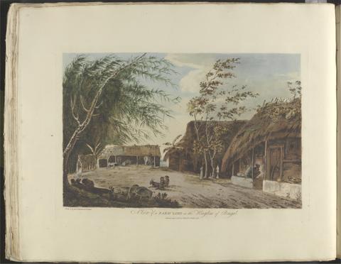
- Date:
- [between 1796 and 1809]
- Physical Description:
- 1 map : engraving ; 26 x 20 cm, on sheet 38 x 28 cm
- Collection:
- Rare Books and Manuscripts
![A plan of mathematical learning taught in the Royal Academy, Portsmouth : performed by a student there 177[blank].](https://media.collections.yale.edu/thumbnail/ycba/c0aa2982-81d7-4478-bddd-d57c5423beee)
- Date:
- approximately 1798-1799
- Physical Description:
- 518 pages : illustrations, diagrams, maps ; 37 cm
- Collection:
- Rare Books and Manuscripts

- Date:
- 1748
- Physical Description:
- 1 map ; 44 x 63 cm., on sheet 52 x 66 cm.
- Collection:
- Rare Books and Manuscripts

- Date:
- 1841
- Physical Description:
- 1 map : hand col., mounted on linen ; 158 x 151 cm., folded to 26 x 17 cm., in case 27 x 18 cm.
- Collection:
- Rare Books and Manuscripts

- Date:
- MDCCLXVU [1766]
- Physical Description:
- xv, [1], 132 pages, IIII folded leaves of plates : plans ; 27 cm
- Collection:
- Rare Books and Manuscripts

- Date:
- [1846]
- Physical Description:
- 1 sheet : hand-colored lithograph ; 56 x 75 cm
- Collection:
- Rare Books and Manuscripts
- Credit Line:
- Yale Center for British Art, Gift of Ellen and Arthur Liman, Yale JD 1957

- Date:
- not before 1634
- Physical Description:
- 1 map : pen and ink and watercolor, on parchment ; 21.9 x 42.8 cm, on sheet 23.5 x 45.8 cm
- Collection:
- Rare Books and Manuscripts

- Date:
- [not before 1921]
- Physical Description:
- 1 map : color, mounted on linen ; 70 x 91 cm, folded to 19 x 10 cm
- Collection:
- Rare Books and Manuscripts

- Date:
- [1808]
- Physical Description:
- 1 map ; 18 x 11 cm, on sheet 21 x 13 cm
- Collection:
- Rare Books and Manuscripts
- Credit Line:
- Yale Center for British Art, Gift of David Alan Richards, Yale BA 1967, JD 1972
![London and Westminster in the reign of Queen Elizabeth anno dom. 1563 [cartographic material] / Radulphus Aggus.](https://media.collections.yale.edu/thumbnail/ycba/693f90a8-80a4-4756-8dfb-b6fc214d8949)
- Date:
- October 30th, 1789
- Physical Description:
- 1 map ; 38 x 104 cm
- Collection:
- Rare Books and Manuscripts
- Credit Line:
- Yale Center for British Art, Paul Mellon Collection

- Date:
- [1666?]
- Physical Description:
- 1 map ; 14 x 24 cm., on sheet 37 x 55 cm.
- Collection:
- Rare Books and Manuscripts

- Date:
- [188-?]
- Physical Description:
- 4 pages : illustrations ; 120 x 80 mm
- Collection:
- Rare Books and Manuscripts

- Date:
- [between 1641 and 1680]
- Physical Description:
- 1 map ; 45 x 52 cm
- Collection:
- Rare Books and Manuscripts

- Date:
- [circa 1840]
- Physical Description:
- 1 game : hand-colored lithograph ; 55 x 64 cm, folded to 16 x 11 cm
- Collection:
- Rare Books and Manuscripts
- Credit Line:
- Yale Center for British Art, Gift of Ellen and Arthur Liman, Yale JD 1957

- Date:
- [ca. 1681]
- Physical Description:
- 1 map ; 46 x 52 cm
- Collection:
- Rare Books and Manuscripts

- Date:
- MDLVI [1556]
- Physical Description:
- 1 map ; 47.9 x 34.5 cm, on sheet 53.3 x 40.0 cm.
- Collection:
- Rare Books and Manuscripts
![Academiarum totius Europae seu orbis Christiani iuxta suas provincias nova tabula ad usum studiosorum emendate accomodate [cartographic material] / W. Kip sculp.](https://media.collections.yale.edu/thumbnail/ycba/73140180-2c50-4f87-81ba-d3ce924ad548)
- Date:
- An 1602
- Physical Description:
- 1 map ; 80 mm in diameter, on sheet 13 x 18 cm.
- Collection:
- Rare Books and Manuscripts

- Date:
- [late 19th century]
- Physical Description:
- 1 tariff card : map ; 76 x 114 mm
- Collection:
- Rare Books and Manuscripts

- Date:
- 1951
- Physical Description:
- 1 folded sheet ([12] pages) : illustrations, maps ; 43 x 31 cm folded to 11 x 31 cm
- Collection:
- Rare Books and Manuscripts

- Date:
- MDC LXX [1670]
- Physical Description:
- [18], 38, [2], 39-146, [2], 147-281, [3], 283-304, [2], 305-314, [2], 315-488, [2], 489-632, [2], 633-658, [2], 659-767, [1] pages, [98] leaves of plates : illustrations, maps, plans ; 41 cm (folio)
- Collection:
- Rare Books and Manuscripts
![The famouse West Indian voyadge made by the Englishe fleete of 23 shippes and barkes [cartographic material] : wherin weare gotten the townes of St . Iago, Sto. Domingo, Cartagena and St. Augustines : the same beinge begon from Plimmouth in the moneth of September 1585 and ended at Portesmouth in Iulie 1586 : the whole course of the saide viadge beinge plainlie described by the pricked line / newlie come forth by Baptista B.](https://media.collections.yale.edu/thumbnail/ycba/b67e0d67-e748-494a-ba84-e1105f721bb5)
- Date:
- [1589?]
- Physical Description:
- [5] sheets : maps (engravings)
- Collection:
- Rare Books and Manuscripts

- Date:
- 1814 [i.e. 1821?]
- Physical Description:
- 1 map on 4 sheets : hand col., mounted on linen ; 162 x 283 cm., on sheets 79 x 153 cm. and 79 x 138 cm., folded to 26 x 16 cm., in case 27 x 18 cm.
- Collection:
- Rare Books and Manuscripts

- Date:
- MDCCCVII [1807]
- Physical Description:
- [6], xxii, 74, [2] pages, [73] leaves of plates (1 folded) : illustrations, maps, plans ; 57 cm
- Collection:
- Rare Books and Manuscripts

- Date:
- [1763]
- Physical Description:
- 1 map on 4 sheets ; 86 x 125 cm., sheets 58 x 79 cm.
- Collection:
- Rare Books and Manuscripts

- Date:
- 1750
- Physical Description:
- 1 map ; 43 x 53 cm., on sheet 55 x 74 cm.
- Collection:
- Rare Books and Manuscripts

- Date:
- MDCLXXI [1671]
- Physical Description:
- [8], 674, [2] pages, [107] leaves of plates (some folded) : ill., ports., maps ; 43 cm (folio)
- Collection:
- Rare Books and Manuscripts
27. Summer of smiles : London Guitar Festival : E4 Udderbelly : Ray Davies' Meltdown : Light Fantastic.

- Date:
- 2011
- Physical Description:
- 25 pages : color illustrations ; 30 cm
- Collection:
- Rare Books and Manuscripts

- Date:
- [1764?]
- Physical Description:
- 1 map : hand col., mounted on linen ; 103 x 116., folded to 20 x 14 cm., in case 20 x 14 cm.
- Collection:
- Rare Books and Manuscripts

- Date:
- MDLXXVIII [1578]
- Physical Description:
- 1 map : engraving ; 40.5 x 53.5 cm, on sheet, 41.5 x 54.5 cm
- Collection:
- Rare Books and Manuscripts

- Date:
- approximately 1678
- Physical Description:
- 1 map : pen-and-ink and watercolor ; 74 x 93 cm
- Collection:
- Rare Books and Manuscripts

- Date:
- circa 1600
- Physical Description:
- 1 map : pen and ink and watercolor ; sheet 31 x 41 cm
- Collection:
- Rare Books and Manuscripts

- Date:
- 1767
- Physical Description:
- 1 volume (122 leaves) : illustrations, maps ; 36 cm
- Collection:
- Rare Books and Manuscripts

- Date:
- 1806
- Physical Description:
- 1 map : embroidery ; image 49.5 x 60 cm
- Collection:
- Rare Books and Manuscripts
- Credit Line:
- Yale Center for British Art, Gift of Mr. and Mrs. Kent Lydecker in honor of Helen B. Lydecker and Sandra Priest Rose.
![[The travellers guide : being the best mapp of the kingdom of England and principalaty [sic] of Wales. Wherein are delineated 3000 towns and villages more than in any mapp yet extent besides ye notations of bridges & rivers &c. To which is added ye direct and cross roads according to Mr. Ogilby's late survey. / Described by C: Saxton and now carefully corrected with new additions by Phillip Lea].](https://media.collections.yale.edu/thumbnail/ycba/906da49f-9f3d-41c8-9cb7-2f67ee863785)
- Date:
- [1686?]
- Physical Description:
- 1 atlas ([10] sheets) : hand colored maps ; sheets 28 x 69 cm, and smaller
- Collection:
- Rare Books and Manuscripts

- Date:
- Nov. 24th, 1794
- Physical Description:
- 1 game : hand-colored engraving ; 46 x 50 cm, on sheet 49 x 70 cm, folded to 17 x 13 cm
- Collection:
- Rare Books and Manuscripts
- Credit Line:
- Yale Center for British Art, Gift of Ellen and Arthur Liman, Yale JD 1957

- Date:
- 1749
- Physical Description:
- 1 map ; 46 x 91 cm., on sheet 55 x 96 cm.
- Collection:
- Rare Books and Manuscripts

- Date:
- [ca. 1695]
- Physical Description:
- 1 map : engraving ; 51 x 60 cm
- Collection:
- Rare Books and Manuscripts

- Date:
- 1777
- Physical Description:
- 1 volume : illustrations, maps ; 16 x 17 cm
- Collection:
- Rare Books and Manuscripts

- Date:
- circa 1642
- Physical Description:
- 1 view : illustrations ; 31 x 30 cm
- Collection:
- Rare Books and Manuscripts

- Date:
- 1677]
- Physical Description:
- 1 map : 160 x 255 cm. on 20 sheets 40 x 51 cm.
- Collection:
- Rare Books and Manuscripts

- Date:
- 1765
- Physical Description:
- 1 volume ([44] p.) : maps ; 26 cm.
- Collection:
- Rare Books and Manuscripts

- Date:
- 1721
- Physical Description:
- 1 map : pen and black and brown ink, with red, yellow, and blue-gray wash ; 78 x 132 cm.
- Collection:
- Rare Books and Manuscripts
- Credit Line:
- Yale Center for British Art, Gift of the Acorn Foundation, Inc., Alexander O. Vietor, Yale BA 1936, President, in honor of Paul Mellon

- Date:
- 1951
- Physical Description:
- 1 sheet : illustrations ; 44 x 21 cm, folded to 22 x 11 cm
- Collection:
- Rare Books and Manuscripts

- Date:
- MDCCXII [1712]
- Physical Description:
- 2 volumes : illustrations, maps ; 20 cm
- Collection:
- Rare Books and Manuscripts

- Date:
- 1784-1800
- Physical Description:
- 2 v. ; ill. ; 22 cm.
- Collection:
- Rare Books and Manuscripts

- Date:
- [ca. 1684]
- Physical Description:
- 1 map ; 46.1 x 55.9 cm, on sheet 52.4 x 62.9 cm
- Collection:
- Rare Books and Manuscripts

- Date:
- [approximately 1947]
- Physical Description:
- 1 folded sheet : color maps ; 42 x 28 cm, folded to 21 x 14 cm
- Collection:
- Rare Books and Manuscripts

- Date:
- June 1st, 1795
- Physical Description:
- 1 map on 6 sheets : hand colored ; sheets 53 x 44 cm
- Collection:
- Rare Books and Manuscripts

- Date:
- 1608
- Physical Description:
- 1 volume (3 leaves) : on parchment ; 38 x 28 cm
- Collection:
- Rare Books and Manuscripts

- Date:
- ca. 1682]
- Physical Description:
- 1 map : hand col. ; 44.8 x 55.1 cm.
- Collection:
- Rare Books and Manuscripts

- Date:
- [between 1834 and 1839]
- Physical Description:
- 3 prints on 6 sheets : engraving ; sheets end-to-end 284 x 28 cm, accordion folded to 19 x 23 cm, in covers 21 x 25 cm
- Collection:
- Rare Books and Manuscripts

- Date:
- [ca. 1845?]
- Physical Description:
- 1 game : hand-colored lithograph ; 56 x 76 cm
- Collection:
- Rare Books and Manuscripts
- Credit Line:
- Yale Center for British Art, Gift of Ellen and Arthur Liman, Yale JD 1957
![America [cartographic material].](https://media.collections.yale.edu/thumbnail/ycba/6f6a5b25-3bf2-4151-a3f1-3e9133dae84b)
- Date:
- [ca. 1686]
- Physical Description:
- 1 map : hand colored ; 56.5 x 95 cm, on sheet 63.5 x 102 cm
- Collection:
- Rare Books and Manuscripts
![[Chart of the Thames estuary with a view of the English fleet burning in the Medway] [cartographic material].](https://media.collections.yale.edu/thumbnail/ycba/02ae63ff-cd23-4365-8ae6-55a7533753c2)
- Date:
- 1667
- Physical Description:
- 1 map ; 34 x 45 cm, on sheet 45 x 49 cm
- Collection:
- Rare Books and Manuscripts

- Date:
- [1650?]
- Physical Description:
- 1 map; 40 x 51 cm
- Collection:
- Rare Books and Manuscripts

- Date:
- 1788
- Physical Description:
- 1 map : hand col., mounted on linen ; 105 x 124 cm., folded to 27 x 21 cm., in case 27 x 23 cm.
- Collection:
- Rare Books and Manuscripts
![Africa [cartographic material].](https://media.collections.yale.edu/thumbnail/ycba/f326eddf-1bc5-4bb4-83a0-d7ac0f9b6f40)
- Date:
- [ca. 1686?]
- Physical Description:
- 1 map : hand colored ; 57 x 94 cm, on sheet 62 x 102 cm
- Collection:
- Rare Books and Manuscripts

- Date:
- 1774
- Physical Description:
- 1 v. (45, [3] p., with blanks) : ill., maps ; 24 cm.
- Collection:
- Rare Books and Manuscripts
![Wallis's new dissected map of America : engraved from the latest authorities, for the use of young students in geography [cartographic material].](https://media.collections.yale.edu/thumbnail/ycba/97fc221b-81f2-421b-a9c7-67d384896a11)
- Date:
- [between 1812 and 1818]
- Physical Description:
- 1 jigsaw puzzle (39 pieces) : paper on wood, hand colored ; 26 x 21 cm, on sheet 28 x 23 cm, in wooden box 16 x 13 x 4 cm
- Collection:
- Rare Books and Manuscripts

- Date:
- [1854?]
- Physical Description:
- 1 game : color, mounted on linen ; 45.5 x 65 cm, folded to 20.3 x 18 cm
- Collection:
- Rare Books and Manuscripts
- Credit Line:
- Yale Center for British Art, Gift of Ellen and Arthur Liman, Yale JD 1957
- Date:
- [1788]
- Physical Description:
- [44] leaves, [49] leaves of plates : illustrations, map ; 60 cm
- Collection:
- Rare Books and Manuscripts

- Date:
- MDCCCXLVI [1846]
- Physical Description:
- xii, 144 pages, [1], 30 leaves of plates : illustrations, map ; 39 cm
- Collection:
- Rare Books and Manuscripts
- Credit Line:
- Yale Center for British Art, Gift of Michael D. Coe, Yale MAH 1968
- Date:
- [1662?]
- Physical Description:
- 1 map ; 36 x 44 cm.
- Collection:
- Rare Books and Manuscripts
- Date:
- [1851]
- Physical Description:
- 2 maps on 1 sheet : color ; maps 14.8 x 21.6 and 13.6 x 22 cm, on sheet 37 x 26 cm
- Collection:
- Rare Books and Manuscripts
- Credit Line:
- Yale Center for British Art, Gift of David Alan Richards, Yale BA 1967, JD 1972
- Date:
- 2016
- Physical Description:
- 10 prints : aquatints ; sheets 23 x 37 cm, in box 26 x 40 cm
- Collection:
- Rare Books and Manuscripts
- Credit Line:
- Yale Center for British Art, Gift of Jason Bacon, Yale BA 1956.
- Date:
- January 2nd 1809
- Physical Description:
- 1 game (1 board) : paper mounted on linen, color ; 53 x 65 cm, folded to 18 x 12 cm
- Collection:
- Rare Books and Manuscripts
- Date:
- [1575]
- Physical Description:
- 1 map : engraving ; 38 x 42 cm
- Collection:
- Rare Books and Manuscripts
- Date:
- 1831
- Physical Description:
- 1 map : hand col. ; 55 x 67 cm.
- Collection:
- Rare Books and Manuscripts
- Date:
- [approximately 1870?]
- Physical Description:
- 2 volumes : illustrations, maps ; 29 cm
- Collection:
- Rare Books and Manuscripts
- Date:
- [between 1888 and 1898]
- Physical Description:
- 1 map : color ; 23 x 17 cm, on sheet 33 x 24 cm, folded in cover to 9 x 6 cm
- Collection:
- Rare Books and Manuscripts
- Credit Line:
- Yale Center for British Art, Gift of Michael Morris
- Date:
- 16th. April 1823
- Physical Description:
- 1 map : color ; 74 x 61 cm
- Collection:
- Rare Books and Manuscripts
- Date:
- [1839-1874?]
- Physical Description:
- 110 sheets : mounted on linen ; sheets 69 x 98 cm, or smaller + index.
- Collection:
- Rare Books and Manuscripts
- Date:
- 1646
- Physical Description:
- 54, [6] p., 43, [34] leaves of plates (some folded) : ill. (engravings), maps, plans ; fol.
- Collection:
- Rare Books and Manuscripts
- Date:
- 1666
- Physical Description:
- 1 map ; 30 x 54 cm., on sheet 50 x 58 cm.
- Collection:
- Rare Books and Manuscripts
- Date:
- 1752
- Physical Description:
- 1 map ; 31 x 26 cm., on sheet 36 x 55 cm.
- Collection:
- Rare Books and Manuscripts
- Date:
- [1836]
- Physical Description:
- 1 map on 4 sheets : hand col., mounted on linen ; 113 x 137 cm, sheets 56 x 68 cm
- Collection:
- Rare Books and Manuscripts
- Date:
- 1757
- Physical Description:
- 1 map ; 50 x 68 cm., on sheet 55 x 72 cm.
- Collection:
- Rare Books and Manuscripts
- Date:
- 1748
- Physical Description:
- 1 map on 6 sheets ; 222 x 262 cm., sheets 55 x 75 cm.
- Collection:
- Rare Books and Manuscripts
- Date:
- MDCCXXXVIII [1738]
- Physical Description:
- [8], 187, [1] pages, ([2] folded leaves of plates) : maps ; 25 cm
- Collection:
- Rare Books and Manuscripts
- Date:
- l'an VI de la République, 1798
- Physical Description:
- 4 volumes : illustrations ; 21 cm
- Collection:
- Rare Books and Manuscripts
- Date:
- 2018
- Physical Description:
- 12 prints : aquatints ; plate marks 14 x 22 cm, on sheets 23 x 28 cm, in box 26 x 31 cm
- Collection:
- Rare Books and Manuscripts
- Credit Line:
- Yale Center for British Art, Gift of the artist in memory of Jason Bacon, Yale BA 1956
- Date:
- [ca. 1677]
- Physical Description:
- 1 map : engraving ; 42 x 52 cm
- Collection:
- Rare Books and Manuscripts
- Date:
- 1852
- Physical Description:
- 1 map : hand col., mounted on linen ; 61 x 80 cm., folded to 22 x 13 cm., in case 23 x 14 cm.
- Collection:
- Rare Books and Manuscripts
- Date:
- MDCCCXXV [1825]
- Physical Description:
- xvi, 198, [2] pages, [7] leaves of plates : illustrations, maps ; 21 cm
- Collection:
- Rare Books and Manuscripts
- Date:
- 1854
- Physical Description:
- [2], iii, [2], 6-414 pages, 16, [1] leaves of plates (1 folded) : illustrations, color map ; 23 cm
- Collection:
- Rare Books and Manuscripts
- Date:
- [between 1875 and 1909]
- Physical Description:
- 1 jigsaw puzzle (85 pieces) : paper on wood, hand colored ; puzzle 36 x 48 cm, in box 5 x 20 x 23 cm
- Collection:
- Rare Books and Manuscripts
- Credit Line:
- Yale Center for British Art, Gift of Ellen and Arthur Liman, Yale JD 1957
- Date:
- [1995]
- Physical Description:
- 1 map : color ; 74 x 99 cm, on sheet 77 x 102 cm.
- Collection:
- Rare Books and Manuscripts
- Date:
- 1821
- Physical Description:
- 2 volumes ; 21 cm
- Collection:
- Rare Books and Manuscripts
- Date:
- 1589
- Physical Description:
- 1 map : engraving ; 33 x 49 cm
- Collection:
- Rare Books and Manuscripts
- Date:
- 1719
- Physical Description:
- 1 map ; 48 x 54 cm, on sheet 53 x 59 cm
- Collection:
- Rare Books and Manuscripts
- Date:
- [approximately 1890]
- Physical Description:
- 1 card ; 8 x 13 cm
- Collection:
- Rare Books and Manuscripts
- Date:
- 1661-1662?
- Physical Description:
- 7 drawings : pen and ink and watercolor ; sheets 20 x 30 cm to 39 x 100 cm
- Collection:
- Rare Books and Manuscripts
- Date:
- [1671?]
- Physical Description:
- 1 map : pen and ink and watercolor ; sheet 69 x 80 cm
- Collection:
- Rare Books and Manuscripts
- Date:
- 1724
- Physical Description:
- 1 map ; 35 x 70 cm., on sheet 49 x 72 cm.
- Collection:
- Rare Books and Manuscripts
- Date:
- im Jahr MDCLXIII [1663]
- Physical Description:
- [18], 70 pages, [38] leaves of plates : folded maps, plans (some folded), plates ; 33 cm
- Collection:
- Rare Books and Manuscripts
- Date:
- 1798
- Physical Description:
- xix, [1], 209, [1] pages, [3] leaves of plates (1 folded) : illustrations, maps ; 29 cm
- Collection:
- Rare Books and Manuscripts
- Date:
- MDCCLXVI [1766]
- Physical Description:
- 2 volumes : illustrations, maps ; 20 cm
- Collection:
- Rare Books and Manuscripts
- Date:
- MDCCCXXXI [1831]
- Physical Description:
- 2 volumes : illustrations ; 29 cm
- Collection:
- Rare Books and Manuscripts
- Date:
- 1591
- Physical Description:
- 1 map : engraving ; 24 x 33 cm, on sheet 29 x 43 cm
- Collection:
- Rare Books and Manuscripts
- Date:
- MDCCCLXIV [1864]
- Physical Description:
- [4], viii, 332 pages : illustrations, maps (some color) ; 30 cm
- Collection:
- Rare Books and Manuscripts
- Credit Line:
- Yale Center for British Art, Gift of Paul F. Walter.