<< YCBA Home Yale Center for British Art Yale Center for British Art << YCBA Home

YCBA Collections Search

Search Constraints

You searched for:

Creator Gender unknown

Remove constraint Creator Gender: unknown

Collection Rare Books and Manuscripts

Remove constraint Collection: Rare Books and Manuscripts

Image Use Under Certain Circumstances

Remove constraint Image Use: Under Certain Circumstances

Classification Maps & Atlas (printed)

Remove constraint Classification: Maps & Atlas (printed)

Search Results

Saxton, Christopher, 1542?- cartographer. [The travellers guide :
Saxton, Christopher, 1542?-
[The travellers guide
[1686?]
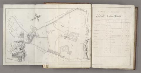
Probert, John, active 1764, cartographer, surveyor. A survey and valuation of estates the property of Nicholas Smyth Esqr. and his Lady :
Probert, John, active 1764
A survey and valuation of estates the property of Nicholas Smyth Esqr. and his Lady
1767
Rocque, John, -1762. A survey of the man[o]r of Graney :
Rocque, John, -1762
A survey of the man[o]r of Graney
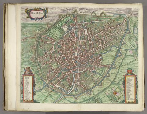
Blaeu, Joan, 1596-1673. Novum ac magnum theatrum urbium Belgicae Regiae /
Blaeu, Joan, 1596–1673
Novum ac magnum theatrum urbium Belgicae Regiae
[1649]
Mercator, Gerhard, 1512-1594. Atlas or A geographicke description of the regions, countries, and kingdomes of the world :
Mercator, Gerhard, 1512–1594
Atlas or A geographicke description of the regions, countries, and kingdomes of the world
1633 [i.e. 1636]-1638
Mercator, Gerhard, 1512-1594, cartographer. Gerardi Mercatoris Atlas, sive, Cosmographicae meditationes de fabrica mundi et fabricati figura /
Mercator, Gerhard, 1512–1594
Gerardi Mercatoris Atlas, sive, Cosmographicae meditationes de fabrica mundi et fabricati figura
anno 1632
Boazio, Baptista, cartographer. The true description or draffte of that famous Ile of Wighte :
Boazio, Baptista
The true description or draffte of that famous Ile of Wighte
1591
Jarrold and Sons. Norfolk :
Jarrold and Sons
Norfolk
[18--]
 A plan of the harbour and town of Toulon, and places adjacent :
A plan of the harbour and town of Toulon, and places adjacent
1756
Gall & Inglis. Gall & Inglis' pocket map of the suburbs of London
Gall & Inglis
Gall & Inglis' pocket map of the suburbs of London
[ca. 1897?]
Geographers' A-Z Map Company.  Centre section of the 9 sheet master plan of London.
Geographers' A-Z Map Company
Centre section of the 9 sheet master plan of London
[1995]
Adam and Charles Black (Firm) Black's travelling map of Ireland.
Adam and Charles Black (Firm)
Black's travelling map of Ireland
[184-?]
Ortelius, Abraham, 1527-1598, publisher. Theatrum orbis terrarum.
Ortelius, Abraham, 1527–1598
Theatrum orbis terrarum
XX Maij MDLXX [1570]
Blaeu, Joan, 1596-1673. Novum ac magnum theatrum urbium Belgicae Regiae /
Blaeu, Joan, 1596–1673
Novum ac magnum theatrum urbium Belgicae Regiae
[1649]
 A map of the theatre of war in Poland.
A map of the theatre of war in Poland
1863,
Mogg, Edward, author. Map of the London & Birmingham Railway with the country in its vicinity /
Mogg, Edward
Map of the London & Birmingham Railway with the country in its vicinity
Sepr. 17th. 1838
Jansson, Jan, 1588-1664. Illustriorum regni Galliae civitatum tabulae, ut & Helvetiae confoederatae civitates celebriores.
Jansson, Jan, 1588–1664
Illustriorum regni Galliae civitatum tabulae, ut & Helvetiae confoederatae civitates celebriores
[1657]
John Bartholomew & Co. Northumberland and Durham.
John Bartholomew & Co
Northumberland and Durham
[between 1888 and 1898]
 The English pilot :
The English pilot
MDCCXLI [1741]
Wren, Christopher, Sir, 1632-1723. Ichnographia urbis Londinii :
Wren, Christopher, Sir, 1632–1723
Ichnographia urbis Londinii
1724
 Ribbon map of the Father of Waters.
Ribbon map of the Father of Waters
1866
Ogilby, John, 1600-1676. The road from Cambridge to Coventry
Ogilby, John, 1600–1676
The road from Cambridge to Coventry
[1720]
 The English pilot :
The English pilot
MDCCLIII [1753]
Robert Laurie and James Whittle. The London directory, or, A new and improved plan of London, Westminster & Southwark :
Robert Laurie and James Whittle
The London directory, or, A new and improved plan of London, Westminster & Southwark
1794
Brown, Cecil, 1903-1983, cartographer. A prospect of the city of London from the south east in the year 1945 :
Brown, Cecil, 1903–1983
A prospect of the city of London from the south east in the year 1945
1949
Arrowsmith, Aaron, 1750-1823. Map of Upper Egypt /
Arrowsmith, Aaron, 1750–1823
Map of Upper Egypt
1807
Dury, Andrew. Environs of London :
Dury, Andrew
Environs of London
1769]
 Bacon's large scale plan of Walthamstow :
Bacon's large scale plan of Walthamstow
[1913]
Valck, G. (Gerard), 1651-1726, cartographer. Les isles Britanniques, qui contiennent les Royaumes d'Angleterre, Escosse, et Irlande :
Valck, G. (Gerard), 1651–1726
Les isles Britanniques, qui contiennent les Royaumes d'Angleterre, Escosse, et Irlande
[approximately 1695]
Banks, John Henry, 1816-1879, engraver. A panoramic view of London / drawn & engraved by J.H. Banks ...
Banks, John Henry, 1816–1879
A panoramic view of London / drawn & engraved by J.H. Banks ..
[1845]
Lootsman, Theunis Jacobsz., active 1629-1651, cartographer. L'atlas de la mer, ou, Monde aquatique :
Lootsman, Theunis Jacobsz., active 1629–1651
L'atlas de la mer, ou, Monde aquatique
l'an 1681
J. G. (John Gibson) A new and compleat map of all America :
J. G. (John Gibson)
A new and compleat map of all America
[1763]
Knox, James. Plan of Edinburgh and its environs /
Knox, James
Plan of Edinburgh and its environs
1822
Peacock, W. (William), -1910, publisher. Scotland.
Peacock, W. (William), -1910
Scotland
[between 1901 and 1909?]
Rocque, John, -1762. A plan of the cities of London and Westminster, the borough of Southwark, and the contiguous buildings :
Rocque, John, -1762
A plan of the cities of London and Westminster, the borough of Southwark, and the contiguous buildings
1755
Grierson, George, -1753. A mapp of the kingdom of Ireland :
Grierson, George, -1753
A mapp of the kingdom of Ireland
1740]
Cary, John, approximately 1754-1835, cartographer, engraver, publisher  Cary's new universal atlas :
Cary, John, approximately 1754–1835
Cary's new universal atlas
1808
Speed, John, 1552?-1629, cartographer. The theatre of the empire of Great-Britain :
Speed, John, 1552?-1629
The theatre of the empire of Great-Britain
MDCLXXVI [1676]
Froggett, John, active 1808-1821. Froggett's Survey of the country thirty miles round London.
Froggett, John, active 1808–1821
Froggett's Survey of the country thirty miles round London
1839
Rocque, John, -1762. To His Royal Highness George, Prince of Wales :
Rocque, John, -1762
To His Royal Highness George, Prince of Wales
1752
Evans, Lewis, 1700?-1756. A general map of the middle British colonies in America :
Evans, Lewis, 1700?-1756
A general map of the middle British colonies in America
1771
Faden, William, 1749-1836. The roads of Great Britain /
Faden, William, 1749–1836
The roads of Great Britain
1800
Wyld, James, 1812-1887. Wyld's Map of the Baltic or East Sea :
Wyld, James, 1812–1887
Wyld's Map of the Baltic or East Sea
1854
Visscher, Claes Jansz., 1586 or 1587-1652. Nova totius terrarum orbis geographica ac hydrographica tabula
Visscher, Claes Jansz., 1586 or 1587–1652
Nova totius terrarum orbis geographica ac hydrographica tabula
1652
Hermelin, Samuel Gustaf Benzelstierna, friherre, 1744-1820. Geographiske chartor öfver Swerige :
Hermelin, Samuel Gustaf Benzelstierna, friherre, 1744–1820
Geographiske chartor öfver Swerige
1797-1807
Valck, G. (Gerard), 1651-1726, cartographer. Magna Britannia, aut Anglia, Scotia et Hibernia, quarum prior divisa in septem Regna, sive Provincias, dictas Northumbriam, Merciam, Angliam Orient. Essexiam, Cantium, Sussexiam, Westsexiam, et Princi. Walliae. posterior in Septent. et Austr. Scotiam. postrema in quatuor Provincias Ultoniam, Lageniam, Momoniam, et Conagtiam /
Valck, G. (Gerard), 1651–1726
Magna Britannia, aut Anglia, Scotia et Hibernia, quarum prior divisa in septem Regna, sive Provincias, dictas Northumbriam, Merciam, Angliam Orient. Essexiam, Cantium, Sussexiam, Westsexiam, et Princi. Walliae. posterior in Septent. et Austr. Scotiam. postrema in quatuor Provincias Ultoniam, Lageniam, Momoniam, et Conagtiam
[approximately 1705]
Morden, Robert, approximately 1650-1703. [The 52 countries [sic] of England and Wales
Morden, Robert, approximately 1650–1703
[The 52 countries [sic] of England and Wales
Blaeu, Joan, 1596-1673. Le grand atlas, ou, Cosmographie Blauiane :
Blaeu, Joan, 1596–1673
Le grand atlas, ou, Cosmographie Blauiane
MDCLXVII [1667]
Waghenaer, Lucas Janszoon, 1534 or 1535-1606, cartographer. Speculum nauticum super nauigatione maris occidentalis confectum :
Waghenaer, Lucas Janszoon, 1534 or 1535–1606
Speculum nauticum super nauigatione maris occidentalis confectum
MDXCI [1591]
Hoffman, G. Spencer. Cambridge :
Hoffman, G. Spencer
Cambridge
[1930?]
Fer, Nicolas de, 1646-1720, cartographer.  Introduction a la fortification :
Fer, Nicolas de, 1646–1720
Introduction a la fortification
[1690]
Ogilby, John, 1600-1676, cartographer. Britannia depicta, or, Ogilby improv'd :
Ogilby, John, 1600–1676
Britannia depicta, or, Ogilby improv'd
1749
Great Britain. Ordnance Survey. Part the first of the general survey of England and Wales containing the whole of Essex
Great Britain. Ordnance Survey
Part the first of the general survey of England and Wales containing the whole of Essex
1805]
Ptolemy, active 2nd century. Tercia Europe tabula.
Ptolemy, active 2nd century
Tercia Europe tabula
[1486]
Kitchin, Thomas, 1719-1784, cartographer. Cambridgeshire
Kitchin, Thomas, 1719–1784
Cambridgeshire
1747
Rocque, John, -1762. A plan of the gardens & view of ye buildings of ye Rt. Honble. Henry Pelham, esq., at Echa in ye county of Surry /
Rocque, John, -1762
A plan of the gardens & view of ye buildings of ye Rt. Honble. Henry Pelham, esq., at Echa in ye county of Surry
1737
Ptolemy, active 2nd century. In hoc opere haec continentur Geographiae Cl. Ptolemaei a plurimis uiris utriusq[ue] linguae doctiss. eme[n]data, & cu[m] archetypo Graeco ab ipsis collata /
Ptolemy, active 2nd century
In hoc opere haec continentur Geographiae Cl. Ptolemaei a plurimis uiris utriusq[ue] linguae doctiss. eme[n]data, & cu[m] archetypo Graeco ab ipsis collata
anno Virginei partus 1508
Faden, William, 1749-1836. The United States of North America, with the British territories and those of Spain, according to the treaty of 1784
Faden, William, 1749–1836
The United States of North America, with the British territories and those of Spain, according to the treaty of 1784
1793
Jansson, Jan, 1588-1664. Illustriorum principumque urbium septentrionalium Europae tabulae.
Jansson, Jan, 1588–1664
Illustriorum principumque urbium septentrionalium Europae tabulae
[1657]
Mercator, Gerhard, 1512-1594, cartographer. Atlas, or, A geographicke description of the regions, countries and kingdomes of the world, through Europe, Asia, Africa, & America, represented by new and exact maps /
Mercator, Gerhard, 1512–1594
Atlas, or, A geographicke description of the regions, countries and kingdomes of the world, through Europe, Asia, Africa, & America, represented by new and exact maps
anno 1636[-1638]
 The Danubian principalities :
The Danubian principalities
[1854]
Lily, George, active 1528-1559. Britania insula quae duo regna continet Angliam et Scotiam cum Hibernia adiacente /
Lily, George, active 1528–1559
Britania insula quae duo regna continet Angliam et Scotiam cum Hibernia adiacente
anno MDLXII [1562]
Ogilby, John, 1600-1676. Britannia, volume the first, or, An illustration of the kingdom of England and dominion of Wales :
Ogilby, John, 1600–1676
Britannia, volume the first, or, An illustration of the kingdom of England and dominion of Wales
MDCLXXV [1675]
 Karta öfver segelleden från Stockholm kanalvägen till Götheborg.
Karta öfver segelleden från Stockholm kanalvägen till Götheborg
[1860?]
Laurie, Richard Holmes. Survey of the country around London :
Laurie, Richard Holmes
Survey of the country around London
1852
Faden, William, 1749-1836. A new pocket plan of the cities of London and Westminster :
Faden, William, 1749–1836
A new pocket plan of the cities of London and Westminster
1812
Rocque, John, -1762. The Seraglio & gardens of the Grand Seignior = Serrail & jardins du Grand Seigneur.
Rocque, John, -1762
The Seraglio & gardens of the Grand Seignior = Serrail & jardins du Grand Seigneur
1752
 Cambridge.
Cambridge
[1899?]
Edward Stanford Ltd. Stanford's half-inch map of the battle front between the Somme and Soissons.
Edward Stanford Ltd
Stanford's half-inch map of the battle front between the Somme and Soissons
1917
Jefferys, Thomas, -1771. The American atlas, or, A geographical description of the whole continent of America :
Jefferys, Thomas, -1771
The American atlas, or, A geographical description of the whole continent of America
MDCCLXXVI [1776]
Moll, Herman, -1732, cartographer. A set of thirty six new and correct maps of Scotland divided into its shires, &c. :
Moll, Herman, -1732
A set of thirty six new and correct maps of Scotland divided into its shires, &c.
[1725]
Speed, John, 1552?-1629. [The theatre of the empire of Great Britaine]
Speed, John, 1552?-1629
[The theatre of the empire of Great Britaine]
[1646?]
Rocque, John, -1762. To the most high puissant & noble prince, Charles, Duke of Marlborough :
Rocque, John, -1762
To the most high puissant & noble prince, Charles, Duke of Marlborough
1738
Ptolemy, active 2nd century, author, cartographer. Geographia Cl. Ptolemaei Alexandrini :
Ptolemy, active 2nd century
Geographia Cl. Ptolemaei Alexandrini
MDLXII [1562]
Arrowsmith, Aaron, 1750-1823. Ireland /
Arrowsmith, Aaron, 1750–1823
Ireland
1811
C. & J. Greenwood. Map of the county palatine of Durham,
C. & J. Greenwood
Map of the county palatine of Durham,
Jan. 26, 1831
 The English pilot :
The English pilot
MDCCXLIII [1743]
John Bartholomew and Son, creator, publisher. Children's map of London /
John Bartholomew and Son
Children's map of London
[approximately 1939]
Rocque, John, -1762. England and Wales :
Rocque, John, -1762
England and Wales
[circa 1768]
 Crumpled city London /
Crumpled city London
2011
Concanen, Alfred, cartographer. Stannard & Son's perspective view of Ashantee & the whole of the Gold Coast :
Concanen, Alfred
Stannard & Son's perspective view of Ashantee & the whole of the Gold Coast
1873
Ptolemy, active 2nd century. [World map]
Ptolemy, active 2nd century
[World map]
[1482]
Doornick, Marcus Williamsz. Platte grondt der Vebrande Stadt London /
Doornick, Marcus Williamsz
Platte grondt der Vebrande Stadt London
1666
Great Britain. Ordnance Survey. [Old series Ordnance Survey maps of England and Wales]
Great Britain. Ordnance Survey
[Old series Ordnance Survey maps of England and Wales]
[1839-1874?]
Delkeskamp, Friedrich Wilhelm, 1794-1872. Neues Panorama des Rheins und seiner nächsten Umgebungen von Mainz bis Coeln :
Delkeskamp, Friedrich Wilhelm, 1794–1872
Neues Panorama des Rheins und seiner nächsten Umgebungen von Mainz bis Coeln
1855
Saxton, Christopher, 1542?- cartographer. Southamtoniae comitatus (preter insulas Vectis, Jersey et Garnsey quae sunt partes eius dem comitatus) cum suis undiq[ue] confinibus, oppidis, pagis, villis, et fluminibus vera descriptio /
Saxton, Christopher, 1542?-
Southamtoniae comitatus (preter insulas Vectis, Jersey et Garnsey quae sunt partes eius dem comitatus) cum suis undiq[ue] confinibus, oppidis, pagis, villis, et fluminibus vera descriptio
[1575]
C. & H. Greenwood. Map of the county of Monmouth :
C. & H. Greenwood
Map of the county of Monmouth
1831
Gardner, W. R., cartographer, engraver. New and Improved map of England and Wales, including the principal part of Scotland :
Gardner, W. R.
New and Improved map of England and Wales, including the principal part of Scotland
16th. April 1823
Jansson, Jan, 1588-1664. Comitatis Cantabrigiensis :
Jansson, Jan, 1588–1664
Comitatis Cantabrigiensis
[not before 1647]
Rocque, John, -1762. A survey of the city and suburbs of Dublin :
Rocque, John, -1762
A survey of the city and suburbs of Dublin
1757
Hodskinson, Joseph, cartographer. The county of Suffolk
Hodskinson, Joseph
The county of Suffolk
1783
Seller, John, active 1658-1698, compiler, publisher. Atlas Anglicanus et Cambria, or, A book of mapps of all the countyes in the kingdom of England and dominion of Wales /
Seller, John, active 1658–1698
Atlas Anglicanus et Cambria, or, A book of mapps of all the countyes in the kingdom of England and dominion of Wales
[1694?]
Stanford, Edward, 1827-1904, publisher. A new map of metropolitan railways, tramways & miscellaneous improvements :
Stanford, Edward, 1827–1904
A new map of metropolitan railways, tramways & miscellaneous improvements
January 1st, 1874
W.J. Adams & Sons. The "District Railway" miniature map of London
W.J. Adams & Sons
The "District Railway" miniature map of London
[ca. 1887?]
Stockwell, Susan. S. Stockwell underground map
Stockwell, Susan
S. Stockwell underground map
[2012]
Gridley, Richard, 1711-1796. A plan of the city, and fortifications of Louisburg /
Gridley, Richard, 1711–1796
A plan of the city, and fortifications of Louisburg
1757
Arrowsmith, Aaron, 1750-1823. Map exhibiting the great post roads, physical and political divisions of Europe :
Arrowsmith, Aaron, 1750–1823
Map exhibiting the great post roads, physical and political divisions of Europe
2nd Jany. 1810
Ortelius, Abraham, 1527-1598, cartographer. Maris Pacifici (quod vulg ̣Mar del Zur)
Ortelius, Abraham, 1527–1598
Maris Pacifici (quod vulg ̣Mar del Zur)
1589
Senex, John, -1740. A new map of Virginia, Mary-Land, and the improved parts of Pennsylvania & New Jersey
Senex, John, -1740
A new map of Virginia, Mary-Land, and the improved parts of Pennsylvania & New Jersey
1719
Cruchley, G. F. Cruchley's New plan of London :
Cruchley, G. F
Cruchley's New plan of London
[1834]