Search Constraints
You searched for:
Period 19th century
Remove constraint Period: 19th centuryLanguage English
Remove constraint Language: EnglishWork Type map
Remove constraint Work Type: mapSearch Results
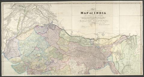
- Date:
- 1841
- Physical Description:
- 1 map : hand col., mounted on linen ; 158 x 151 cm., folded to 26 x 17 cm., in case 27 x 18 cm.
- Collection:
- Rare Books and Manuscripts
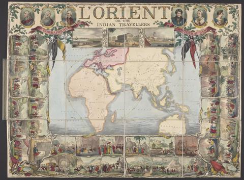
- Date:
- [1846]
- Physical Description:
- 1 sheet : hand-colored lithograph ; 56 x 75 cm
- Collection:
- Rare Books and Manuscripts
- Credit Line:
- Yale Center for British Art, Gift of Ellen and Arthur Liman, Yale JD 1957
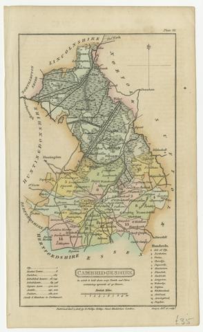
- Date:
- [1808]
- Physical Description:
- 1 map ; 18 x 11 cm, on sheet 21 x 13 cm
- Collection:
- Rare Books and Manuscripts
- Credit Line:
- Yale Center for British Art, Gift of David Alan Richards, Yale BA 1967, JD 1972
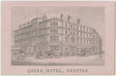
- Date:
- [188-?]
- Physical Description:
- 4 pages : illustrations ; 120 x 80 mm
- Collection:
- Rare Books and Manuscripts
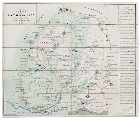
- Date:
- [circa 1840]
- Physical Description:
- 1 game : hand-colored lithograph ; 55 x 64 cm, folded to 16 x 11 cm
- Collection:
- Rare Books and Manuscripts
- Credit Line:
- Yale Center for British Art, Gift of Ellen and Arthur Liman, Yale JD 1957
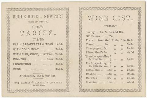
- Date:
- [late 19th century]
- Physical Description:
- 1 tariff card : map ; 76 x 114 mm
- Collection:
- Rare Books and Manuscripts
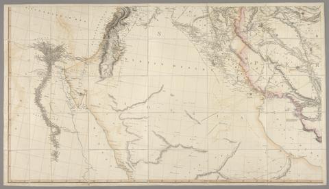
- Date:
- 1814 [i.e. 1821?]
- Physical Description:
- 1 map on 4 sheets : hand col., mounted on linen ; 162 x 283 cm., on sheets 79 x 153 cm. and 79 x 138 cm., folded to 26 x 16 cm., in case 27 x 18 cm.
- Collection:
- Rare Books and Manuscripts
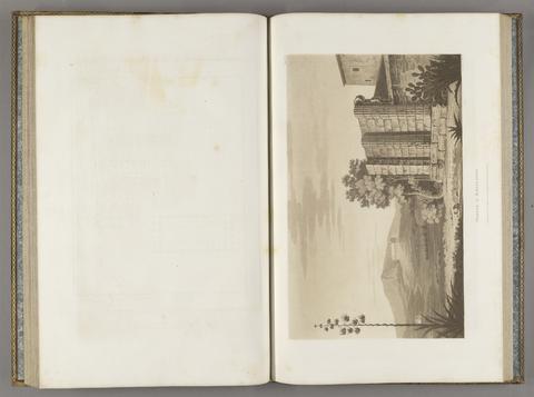
- Date:
- MDCCCVII [1807]
- Physical Description:
- [6], xxii, 74, [2] pages, [73] leaves of plates (1 folded) : illustrations, maps, plans ; 57 cm
- Collection:
- Rare Books and Manuscripts
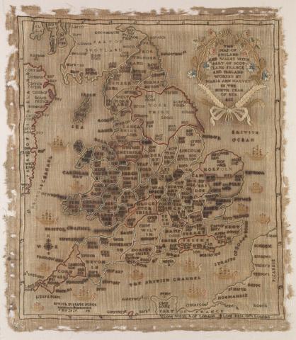
- Date:
- 1806
- Physical Description:
- 1 map : embroidery ; image 49.5 x 60 cm
- Collection:
- Rare Books and Manuscripts
- Credit Line:
- Yale Center for British Art, Gift of Mr. and Mrs. Kent Lydecker in honor of Helen B. Lydecker and Sandra Priest Rose.

- Date:
- [between 1834 and 1839]
- Physical Description:
- 3 prints on 6 sheets : engraving ; sheets end-to-end 284 x 28 cm, accordion folded to 19 x 23 cm, in covers 21 x 25 cm
- Collection:
- Rare Books and Manuscripts
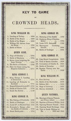
- Date:
- [ca. 1845?]
- Physical Description:
- 1 game : hand-colored lithograph ; 56 x 76 cm
- Collection:
- Rare Books and Manuscripts
- Credit Line:
- Yale Center for British Art, Gift of Ellen and Arthur Liman, Yale JD 1957
![Wallis's new dissected map of America : engraved from the latest authorities, for the use of young students in geography [cartographic material].](https://media.collections.yale.edu/thumbnail/ycba/97fc221b-81f2-421b-a9c7-67d384896a11)
- Date:
- [between 1812 and 1818]
- Physical Description:
- 1 jigsaw puzzle (39 pieces) : paper on wood, hand colored ; 26 x 21 cm, on sheet 28 x 23 cm, in wooden box 16 x 13 x 4 cm
- Collection:
- Rare Books and Manuscripts
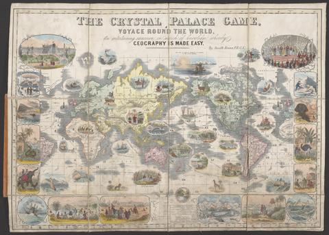
- Date:
- [1854?]
- Physical Description:
- 1 game : color, mounted on linen ; 45.5 x 65 cm, folded to 20.3 x 18 cm
- Collection:
- Rare Books and Manuscripts
- Credit Line:
- Yale Center for British Art, Gift of Ellen and Arthur Liman, Yale JD 1957

- Date:
- MDCCCXLVI [1846]
- Physical Description:
- xii, 144 pages, [1], 30 leaves of plates : illustrations, map ; 39 cm
- Collection:
- Rare Books and Manuscripts
- Credit Line:
- Yale Center for British Art, Gift of Michael D. Coe, Yale MAH 1968

- Date:
- [1851]
- Physical Description:
- 2 maps on 1 sheet : color ; maps 14.8 x 21.6 and 13.6 x 22 cm, on sheet 37 x 26 cm
- Collection:
- Rare Books and Manuscripts
- Credit Line:
- Yale Center for British Art, Gift of David Alan Richards, Yale BA 1967, JD 1972

- Date:
- January 2nd 1809
- Physical Description:
- 1 game (1 board) : paper mounted on linen, color ; 53 x 65 cm, folded to 18 x 12 cm
- Collection:
- Rare Books and Manuscripts

- Date:
- 1831
- Physical Description:
- 1 map : hand col. ; 55 x 67 cm.
- Collection:
- Rare Books and Manuscripts

- Date:
- [between 1888 and 1898]
- Physical Description:
- 1 map : color ; 23 x 17 cm, on sheet 33 x 24 cm, folded in cover to 9 x 6 cm
- Collection:
- Rare Books and Manuscripts
- Credit Line:
- Yale Center for British Art, Gift of Michael Morris

- Date:
- 16th. April 1823
- Physical Description:
- 1 map : color ; 74 x 61 cm
- Collection:
- Rare Books and Manuscripts

- Date:
- [1839-1874?]
- Physical Description:
- 110 sheets : mounted on linen ; sheets 69 x 98 cm, or smaller + index.
- Collection:
- Rare Books and Manuscripts

- Date:
- [1836]
- Physical Description:
- 1 map on 4 sheets : hand col., mounted on linen ; 113 x 137 cm, sheets 56 x 68 cm
- Collection:
- Rare Books and Manuscripts

- Date:
- 1852
- Physical Description:
- 1 map : hand col., mounted on linen ; 61 x 80 cm., folded to 22 x 13 cm., in case 23 x 14 cm.
- Collection:
- Rare Books and Manuscripts

- Date:
- MDCCCXXV [1825]
- Physical Description:
- xvi, 198, [2] pages, [7] leaves of plates : illustrations, maps ; 21 cm
- Collection:
- Rare Books and Manuscripts

- Date:
- 1854
- Physical Description:
- [2], iii, [2], 6-414 pages, 16, [1] leaves of plates (1 folded) : illustrations, color map ; 23 cm
- Collection:
- Rare Books and Manuscripts

- Date:
- [between 1875 and 1909]
- Physical Description:
- 1 jigsaw puzzle (85 pieces) : paper on wood, hand colored ; puzzle 36 x 48 cm, in box 5 x 20 x 23 cm
- Collection:
- Rare Books and Manuscripts
- Credit Line:
- Yale Center for British Art, Gift of Ellen and Arthur Liman, Yale JD 1957

- Date:
- [approximately 1890]
- Physical Description:
- 1 card ; 8 x 13 cm
- Collection:
- Rare Books and Manuscripts

- Date:
- MDCCCXXXI [1831]
- Physical Description:
- 2 volumes : illustrations ; 29 cm
- Collection:
- Rare Books and Manuscripts

- Date:
- MDCCCLXIV [1864]
- Physical Description:
- [4], viii, 332 pages : illustrations, maps (some color) ; 30 cm
- Collection:
- Rare Books and Manuscripts
- Credit Line:
- Yale Center for British Art, Gift of Paul F. Walter.

- Date:
- [1859?]
- Physical Description:
- 1 map : color ; 52 x 82 cm
- Collection:
- Rare Books and Manuscripts

- Date:
- [ca. 1897?]
- Physical Description:
- 1 map ; 51.3 x 63.3 cm, folded in covers 15 x 9 cm.
- Collection:
- Rare Books and Manuscripts

- Date:
- 15th March, 1852
- Physical Description:
- [4], 31, [1], 32-40, [1], 41-53, [1], 54-57 pages : illustrations, map ; 47 cm
- Collection:
- Rare Books and Manuscripts

- Date:
- July 4th, 1829
- Physical Description:
- 1 map ; 58 x 70 cm.
- Collection:
- Rare Books and Manuscripts

- Date:
- [not before 1862]
- Physical Description:
- 1 map ; 59 x 90 cm, on sheet 67 x 98 cm, folded to 17 x 12 cm
- Collection:
- Rare Books and Manuscripts
34. [Cambridge]

- Date:
- 1st June 1836
- Physical Description:
- 1 map ; 59 x 91 cm, on sheet 67 x 98 cm, folded to 17 x 12 cm
- Collection:
- Rare Books and Manuscripts

- Date:
- 1866
- Physical Description:
- 1 map ; 336 x 7 cm, rolled on spool in wooden case 10 x 5 cm in diameter
- Collection:
- Rare Books and Manuscripts

- Date:
- 1807
- Physical Description:
- 1 map : hand col. ; 97 x 67 cm.
- Collection:
- Rare Books and Manuscripts

- Date:
- 1829-1844
- Physical Description:
- 1 volume : maps ; 40 cm
- Collection:
- Rare Books and Manuscripts

- Date:
- [184-?]
- Physical Description:
- 1 map ; 15 x 19 in.
- Collection:
- Rare Books and Manuscripts

- Date:
- Sepr. 17th. 1838
- Physical Description:
- 1 map : mounted on cloth ; 26 x 18 cm.
- Collection:
- Rare Books and Manuscripts

- Date:
- [1817?]
- Physical Description:
- 5 sheets : maps ; each sheet 50 x 62 cm
- Collection:
- Rare Books and Manuscripts

- Date:
- 1807
- Physical Description:
- 1 map on 2 sheets : hand col. ; 120 x 157 cm., sheets 65 x 164 cm. and 66 x 164 cm.
- Collection:
- Rare Books and Manuscripts

- Date:
- [ca. 1887?]
- Physical Description:
- 1 map : col. ; 17.7 x 25.3 cm., folded in cover 14.1 x 9.2 cm.
- Collection:
- Rare Books and Manuscripts
- Credit Line:
- Yale Center for British Art, Gift of Elisabeth Fairman

- Date:
- MDCCCXCIV [1894]
- Physical Description:
- xix, [1], 411, [1] p., [13] leaves of plates : ill., map (folded) ; 32 cm.
- Collection:
- Rare Books and Manuscripts

- Date:
- 1811
- Physical Description:
- 1 map on 4 sheets : col. ; 195 x 158 cm., on sheets 91 x 79 cm.
- Collection:
- Rare Books and Manuscripts

- Date:
- [1850]
- Physical Description:
- [4], 106 pages, [5] folded leaves of plates : illustrations, map ; 16 cm
- Collection:
- Rare Books and Manuscripts

- Date:
- MDCCCI [1801]
- Physical Description:
- [4], viii, [2], cxxxii, 412, [2] pages, [4] leaves of plates ([3] folded) : portrait, maps ; 28 cm
- Collection:
- Rare Books and Manuscripts

- Date:
- [between 1884 and 1887?]
- Physical Description:
- 1 map ; 78 x 103 cm, folded to 20 x 14 cm
- Collection:
- Rare Books and Manuscripts

- Date:
- MDCCCXXI [1821]
- Physical Description:
- [8], xxix, [3], 310, [2], clxxix, [3] pages, [20] leaves of plates : illustrations, maps ; 28 cm
- Collection:
- Rare Books and Manuscripts

- Date:
- [1863?]
- Physical Description:
- 1 map : col. ; 43 x 57 cm.
- Collection:
- Rare Books and Manuscripts

- Date:
- 1828
- Physical Description:
- 7, [1] pages, LX leaves of plates (some folded) : illustrations (some color), maps (some color), plans ; 45 cm
- Collection:
- Rare Books and Manuscripts

- Date:
- ca. 1750-ca.1850
- Physical Description:
- approximately 1,500 items
- Collection:
- Rare Books and Manuscripts
- Credit Line:
- Yale Center for British Art, Paul Mellon Collection

- Date:
- [1827?]
- Physical Description:
- 1 sheet : illustrations ; 32 x 28 cm
- Collection:
- Rare Books and Manuscripts

- Date:
- 1862
- Physical Description:
- 1 map on 24 sheets : hand col. ; 185 x 154 cm, sheets 31 x 39 cm.
- Collection:
- Rare Books and Manuscripts

- Date:
- 1851
- Physical Description:
- 2 volumes : illustrations, maps ; 23 cm
- Collection:
- Rare Books and Manuscripts

- Date:
- March 13th, 1811
- Physical Description:
- 1 game : coloured, mounted on linen ; 46 x 50 cm, folded to 17 x 13 cm
- Collection:
- Rare Books and Manuscripts
56. [Downham] / engraved at the Ordnance Map Office in the Tower under the direction of Major Colby ...

- Date:
- 1st March 1824
- Physical Description:
- 1 map ; 59 x 91 cm, on sheet 67 x 98 cm, folded to 17 x 12 cm
- Collection:
- Rare Books and Manuscripts

- Date:
- ca. 1869]
- Physical Description:
- 1 map ; 416 x 532 mm, folded in cover 67 x 54 mm.
- Collection:
- Rare Books and Manuscripts
58. Cambridge.

- Date:
- [1899?]
- Physical Description:
- 1 map ; 30.4 x 21 cm
- Collection:
- Rare Books and Manuscripts
- Credit Line:
- Yale Center for British Art, Gift of David Alan Richards, Yale BA 1967, JD 1972

- Date:
- [ca. 1896]
- Physical Description:
- 1 map : color ; 90 x 71 cm, folded in cover to 20 x 13 cm
- Collection:
- Rare Books and Manuscripts

- Date:
- 1805]
- Physical Description:
- map 123 x 183 cm. on 4 sheets 63 x 93 cm.
- Collection:
- Rare Books and Manuscripts

- Date:
- 1807
- Physical Description:
- xiii, [2], 16-22, 499, [7] pages : illustrations, maps ; 28 cm
- Collection:
- Rare Books and Manuscripts

- Date:
- [1845]
- Physical Description:
- 1 map ; image 39 x 101 cm, on sheet 45 x 105 cm
- Collection:
- Rare Books and Manuscripts

- Date:
- 1878
- Physical Description:
- x, 366 p., [5] leaves of plates ([4] folded) : ill., maps ; 17 cm.+ [1] folded map (73 x 94 cm, folded to 15 x 10 cm.)
- Collection:
- Rare Books and Manuscripts
- Credit Line:
- Yale Center for British Art, Gift of Elisabeth Fairman

- Date:
- 1842
- Physical Description:
- iv, 124 pages, ([3] leaves of plates, [1] folded) : illustrations, portraits, maps ; 17 cm
- Collection:
- Rare Books and Manuscripts

- Date:
- 1834
- Physical Description:
- 3 volumes : illustrations, maps ; 33 cm
- Collection:
- Rare Books and Manuscripts
- Credit Line:
- Yale Center for British Art, Paul Mellon Collection

- Date:
- [1851?]
- Physical Description:
- 1 map ; 31 x 23 cm
- Collection:
- Rare Books and Manuscripts
- Credit Line:
- Yale Center for British Art, Gift of David Alan Richards, Yale BA 1967, JD 1972

- Date:
- Jan. 26, 1831
- Physical Description:
- 1 map ; 58 x 68 cm.
- Collection:
- Rare Books and Manuscripts

- Date:
- 1st Novr. 1838
- Physical Description:
- 1 map ; 59 x 91 cm, on sheet 67 x 98 cm, folded to 17 x 12 cm
- Collection:
- Rare Books and Manuscripts

- Date:
- 1828
- Physical Description:
- viii, 69, [1] pages, [5] leaves of plates ([4] folded) : illustrations, maps ; 23 cm
- Collection:
- Rare Books and Manuscripts

- Date:
- April 25th, 1817
- Physical Description:
- 1 map ; 40 x 53 cm
- Collection:
- Rare Books and Manuscripts

- Date:
- January 1st, 1874
- Physical Description:
- 1 map : color ; 66 x 84 cm, on sheet 73 x 87 cm, folded in cover 19 x 13 cm
- Collection:
- Rare Books and Manuscripts

- Date:
- 1835
- Physical Description:
- 3 volumes (544 pages) ; 26 cm
- Collection:
- Rare Books and Manuscripts

- Date:
- 1805
- Physical Description:
- 1 map on 4 sheets : hand col. ; 123 x 142 cm. on sheets 61 x 71 cm.
- Collection:
- Rare Books and Manuscripts
74. Cambridgeshire.

- Date:
- [1832]
- Physical Description:
- pages 67-105, [1] leaf of plates : map ; 17 cm
- Collection:
- Rare Books and Manuscripts
- Credit Line:
- Yale Center for British Art, Gift of David Alan Richards, Yale BA 1967, JD 1972

- Date:
- 1855
- Physical Description:
- 1 map : col. ; 74.3 x 64.5 cm.
- Collection:
- Rare Books and Manuscripts

- Date:
- [between 1840 and 1862]
- Physical Description:
- 1 map : on cloth ; 55 x 56 cm
- Collection:
- Rare Books and Manuscripts

- Date:
- 1851
- Physical Description:
- 1 map ; 41 x 65 cm, folded in cover 16 x 11 cm
- Collection:
- Rare Books and Manuscripts

- Date:
- 1824
- Physical Description:
- xiii, [1] 468 pages, [7] leaves of plates : illustrations, folded map ; 23 cm
- Collection:
- Rare Books and Manuscripts

- Date:
- January 1st 1838
- Physical Description:
- 1 map ; 59 x 91 cm, on sheet 67 x 98 cm, folded to 17 x 12 cm
- Collection:
- Rare Books and Manuscripts
80. Cambridgeshire.

- Date:
- [1837]
- Physical Description:
- 1 map ; 27 x 22 cm
- Collection:
- Rare Books and Manuscripts
- Credit Line:
- Yale Center for British Art, Gift of David Alan Richards, Yale BA 1967, JD 1972

- Date:
- 1804
- Physical Description:
- 1 map on 4 sheets ; sheets 63 x 80 cm.
- Collection:
- Rare Books and Manuscripts

- Date:
- 1809
- Physical Description:
- 1 map
- Collection:
- Rare Books and Manuscripts

- Date:
- Sepr. 28,1801
- Physical Description:
- 1 map : engraving ; 51 x 46 cm, on sheet 65 x 55 cm
- Collection:
- Rare Books and Manuscripts

- Date:
- [1810]
- Physical Description:
- 1 map on 4 sheets : outline colored ; 130 x 146 cm
- Collection:
- Rare Books and Manuscripts

- Date:
- [between 1855 and 1875?]
- Physical Description:
- 1 map : col. ; 46.0 x 52.7 cm, folded to 25.5 x 20.0 cm.
- Collection:
- Rare Books and Manuscripts

- Date:
- 1834
- Physical Description:
- 2 volumes : illustrations, maps ; 20 cm
- Collection:
- Rare Books and Manuscripts
87. Cambridgeshire.

- Date:
- [1824?]
- Physical Description:
- 1 map ; 12.3 x 9 cm
- Collection:
- Rare Books and Manuscripts
- Credit Line:
- Yale Center for British Art, Gift of David Alan Richards, Yale BA 1967, JD 1972

- Date:
- 1802
- Physical Description:
- 185, [3] pages, [6] leaves of plates : illustrations, maps, plans ; 15 cm
- Collection:
- Rare Books and Manuscripts

- Date:
- MDCCCXX [1820]
- Physical Description:
- xiv, [2], 178 pages, [25] leaves of plates (1 folded) : color illustrations, map ; 43 cm
- Collection:
- Rare Books and Manuscripts

- Date:
- [1843]
- Physical Description:
- 1 map : color ; 67 x 69 cm
- Collection:
- Rare Books and Manuscripts

- Date:
- [1807]
- Physical Description:
- xii, 602 pages, [28] leaves of plates : illustrations, map ; 28 cm
- Collection:
- Rare Books and Manuscripts

- Date:
- 1807
- Physical Description:
- 1 map : hand col. ; 129 x 160 cm., folded to 40 x 29 cm.
- Collection:
- Rare Books and Manuscripts

- Date:
- [1835?]
- Physical Description:
- 1 map ; 17.4 x 23 cm
- Collection:
- Rare Books and Manuscripts
- Credit Line:
- Yale Center for British Art, Gift of David Alan Richards, Yale BA 1967, JD 1972

- Date:
- 1806
- Physical Description:
- 4 volumes : illustrations, maps, plans, portrait, genealogical table ; 45 cm
- Collection:
- Rare Books and Manuscripts

- Date:
- 1874
- Physical Description:
- 1 map ; 62 x 84 cm, folded in covers 18 x 11 cm.
- Collection:
- Rare Books and Manuscripts
96. Cambridge.

- Date:
- [approximately 1880?]
- Physical Description:
- 1 map ; 21.9 x 31 cm
- Collection:
- Rare Books and Manuscripts
- Credit Line:
- Yale Center for British Art, Gift of David Alan Richards, Yale BA 1967, JD 1972

- Date:
- MDCCCXXIX [1829]
- Physical Description:
- 4 volumes : illustrations, maps, portraits ; 15 cm
- Collection:
- Rare Books and Manuscripts

- Date:
- [not before 1862]
- Physical Description:
- 1 map ; 59 x 90 cm, on sheet 67 x 98 cm, folded to 17 x 12 cm
- Collection:
- Rare Books and Manuscripts

- Date:
- November 1st, 1819 [that is, 1820]
- Physical Description:
- 1 map on 4 sheets : hand-colored, mounted on linen ; 192 x 162 cm, sheets 96 x 81 cm, folded to 32 x 27 cm, in portfolio 36 x 28 cm + 1 book ([2], 17, [1] pages ; 33 cm)
- Collection:
- Rare Books and Manuscripts

- Date:
- 1839
- Physical Description:
- xvi, 352 pages, [11] leaves of plates (1 folded) : illustrations, maps ; 22 cm
- Collection:
- Rare Books and Manuscripts