Search Constraints
You searched for:
On-site Access Accessible by appointment in the Study Room
Remove constraint On-site Access: Accessible by appointment in the Study RoomAssociated Places Wales
Remove constraint Associated Places: WalesWidth [cm] Unknown
Remove constraint Width [cm]: UnknownSearch Results
1
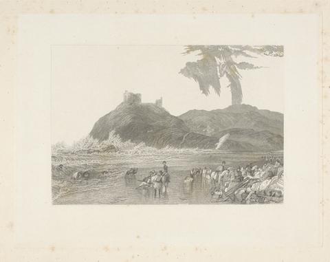
- Crickieth Castle, North Wales
- 1837
2
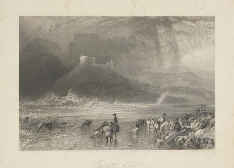
- Crickieth Castle, North Wales
- 1837
3
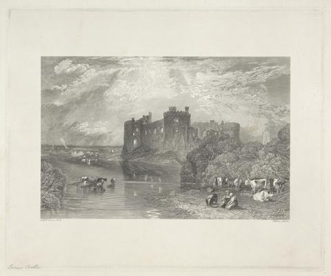
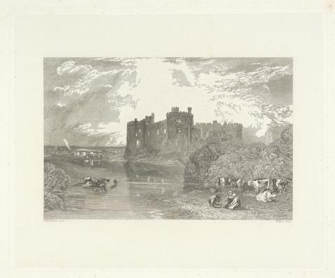
- Carew Castle, Pembroke
- 1834
4
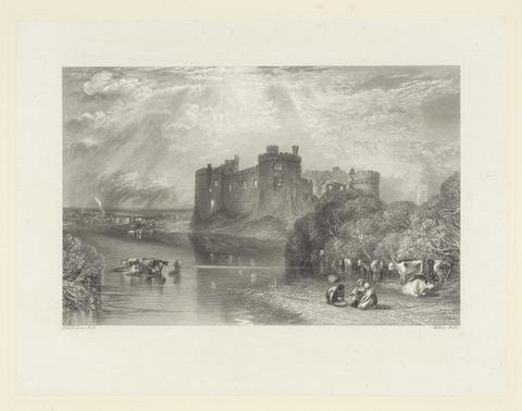
- Carew Castle, Pembroke
- 1834
5
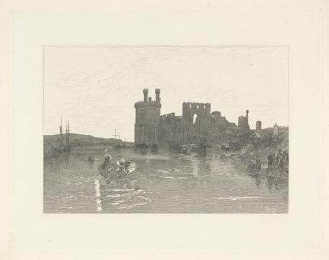
- Caernarvon Castle, Wales
- 1835
6
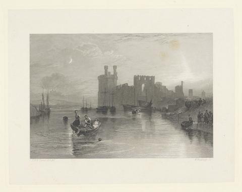
- Caernarvon Castle, Wales
- 1835
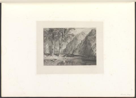
7
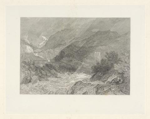
- Llanthony, Monmouthshire
- 1836
8
- Carew Castle, Pembroke
- 1834
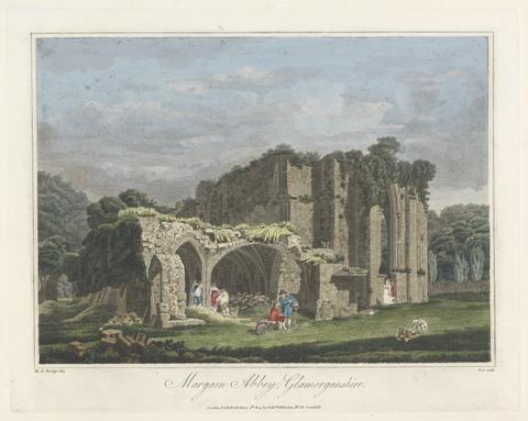
9
- Margain Abbey, Glamorganshire
- 1805
10
- Picturesque views in England and Wales
- MDCCCXXXVIII [1838]
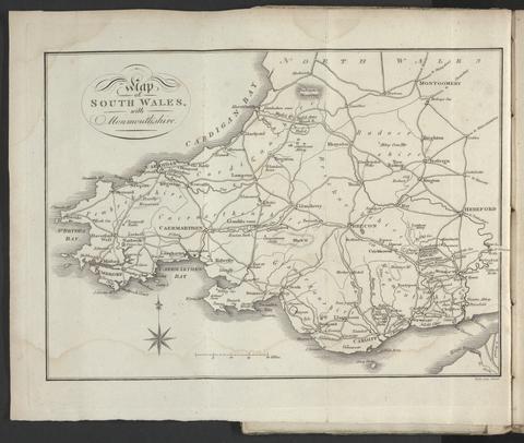
11
- A tour throughout South Wales and Monmouthshire
- 1803
![Saxton, Christopher, 1542?- [Atlas of the counties of England and Wales].](https://media.collections.yale.edu/thumbnail/ycba/4ac23653-8668-40b0-b3f1-7228f7c1d7e3)
12
- [Atlas of the counties of England and Wales]
- [1590?]
13
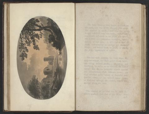
- Observations on the River Wye and several parts of South Wales, &c.
- MDCCLXXXIX [1789]
14
- A tour in North Wales
- 1817
15
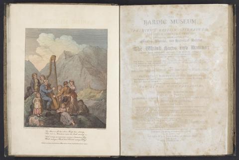
- The bardic museum
- 1802
16
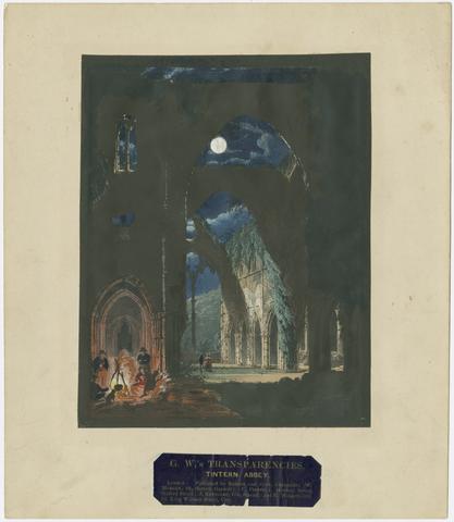
- G. W.'s transparencies
- [approximately 1840?]

17
- Sarah Annette Jones photograph album
- 1853-1855

18
- [The travellers guide
- [1686?]
19
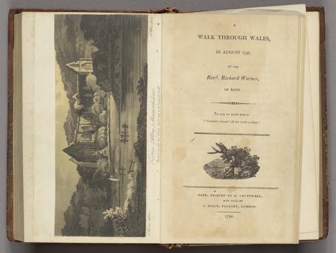
- A walk through Wales, in August 1797
- 1798
20
- [A tour in Wales MDCCLXX
- 1778-1781]
21
- Historical descriptions of new and elegant picturesque views of the antiquities of England and Wales
- [1786]
![Great Britain. Ordnance Survey, cartographer, publisher. [Old series Ordnance Survey maps of England and Wales]](https://media.collections.yale.edu/thumbnail/ycba/00e4c053-1da0-4b6a-9606-069ea90649fa)
22
- [Old series Ordnance Survey maps of England and Wales]
- 1805-1834 [i.e. 1834-1835?]

23
- The beauties of England and Wales, or, Delineations, topographical, historical, and descriptive, of each county
- 1801-1815
24
- XII views in aquatinta from drawings taken on the spot in South-Wales
- MDCCLXXV [1775-1776]
25
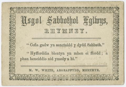
- Ysgol Sabbothol Eglwys
- [1890?]

26
- Picturesque views in England and Wales
- MDCCCXXXVIII [1838]
27
- Red cross, or, Young America in England and Wales
- 1868
28
- British Isles
- [1895-1913]
29
- Photograph album of scenes in the Lake District, Cheshire, Scotland, and Wales
- 1860s
30
- Wales illustrated
- 1830-1831
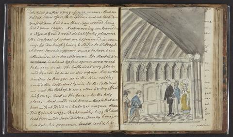
31
- Out for a holiday
- 1880, August 10-1881, August 15
32
- New and Improved map of England and Wales, including the principal part of Scotland
- 16th. April 1823
33
- [Old series Ordnance Survey maps of England and Wales]
- [1839-1874?]
34
- Curiosities of Great Britain. England & Wales delineated
- [185-?]
35
- A collection of views of gentlemen's seats, castles, and romantick places, in North Wales
- 1792
36
- A collection of Welsh tours, or, A display of the beauties of Wales selected principally from celebrated histories and popular tours
- 1798
37
- Britannia, volume the first, or, An illustration of the kingdom of England and dominion of Wales
- MDCLXXV [1675]
38
- Picturesque scenery in North Wales
- 1842
39
- A second walk through Wales
- 1799
40
- A topographical dictionary of Wales
- 1840
41
- Welsh scenery
- 1823
42
- Observations on the river Wye, and several parts of South Wales, relative chiefly to picturesque beauty, made in the summer of the year 1770
- 1782
43
- A tour through parts of Wales
- 1794
44
- An historical account of the ancient and modern state of the principality of Wales, dutchy of Cornwall, and earldom of Chester
- 1714
45
- Curiosities of Great Britain. England & Wales delineated
- 185-?]
46
- The banks of Wye
- 1811
47
- The Welsh interpreter
- 1831
48
- Peacock's Superior dissected maps
- [between 1875 and 1909]
49
- Walker's tour through England and Wales
- January 2nd 1809
50
- A collection of views in Wales
- 1806
51
- Welsh scenery
- 1825
52
- [The 52 countries [sic] of England and Wales
53
- A picturesque guide through Wales and the Marches
- 1794-1795
54
- England and Wales
- [circa 1768]
55
- The progress of architecture,
- 1830
56
- University of Cambridge photograph album
- ca. 1878-1879
57
- England and Wales
- [1851?]
58
- Atlas Anglicanus et Cambria, or, A book of mapps of all the countyes in the kingdom of England and dominion of Wales
- [1694?]
59
- Dragon trictrac =
- 1983
60
- Harriet Francis Townshend sketchbook,
- 1820-1825
61
- Introduction to the Original delineations, topographical, historical, and descriptive, intituled The beauties of England and Wales
- 1818
62
- Pigot and Co.'s national commercial directory
- 1830
63
- The Cambrian traveller's guide, in every direction
- 1813
64
- A new and accurate description of all the direct and principal cross roads in England and Wales ..
- 1789
65
- Atlas of the counties of England
- April 1st, 1834
66
- A general map of England & Wales, divided into its counties
- circa [1800?]
67
- England
- [1695?]
68
- An atlas, comprising maps of the several counties, divided into unions, and of the islands of Guernsey, Jersey, and Man
- 1842
69
- The Golden Cockerel Mabinogion
- 1948
70
- Snowdonis
- [186-?]
71
- A supplement to the tour through Great-Britain
- 1787
72
- Pigot and Co.'s national commercial directory for 1828-29
- [1828]
73
- A map of England & Wales
- 1839
74
- Plans of the cities and boroughs of England and Wales
- 1832
75
- A Picturesque description of North Wales
- 1823
76
- Observations on the river Wye,
- 1792
77
- [Old series Ordnance Survey maps of England and Wales]
- Novr. 9th, 1843 [i.e. ca. 1853-1874?]
78
- The Cambrian Mountains, or, A tour through Wales
- 1851
79
- Letters on the scenery of Wales
- 1821
80
- [Elm the elm] =
- 1996
81
- Selections from a sketch book
- 1847
82
- [Plans of borough towns included in List no. VIII on Parliamentary representation, 1832]
- [1832]
83
- Map of England and Wales
- circa [1800?]
84
- Eight select views in the County of Caernarvon, drawn from nature, and on stone
- [1827]
85
- Recollections of Bala and neighbourhood
- [184-?]
86
- Ordnance Survey of Ireland
- [1858-1862]
87
- Spooner's pictorial map of England & Wales
- Novr. 5th, 1844
88
- Leigh's new pocket road-book of England and Wales
- 1835
89
- The ruined castles of North Wales
- 1864
90
- Wallis's new railway game, or, Tour through England and Wales
- [approximately 1844]
91
- The printed maps in the atlases of Great Britain and Ireland;
- [1927]
92
- Index villaris, or, An exact register, alphabetically digested, of all the cities, market-towns, parishes, villages, ... the bishopricks, deanries [sic], churches, chapels, hospitals
- 1700
93
- Sketches in North Wales
- 1810
94
- England & Wales, founded upon the grand trigonometrical survey
- 1848
95
- Picturesque scenery in Wales
- [1860]
96
- [Atlas of the counties of England and Wales]
- [1579]
97
- Mogg's New map of England and Wales, with part of Scotland
- [183-?]
98
- Diary of John Wilson during a tour of Wales
- 1825 July 13-August 13
99
- A tour in Wales, and through several counties of England, including both the universities, performed in the summer of 1805
- 1806
100
- The Cambrian popular antiquities, or, An account of some traditions, customs, and superstitions, of Wales
- 1815