Search Constraints
Search Results

- Date:
- .15. Calen[das] Augusti anno salutis nostr[ae] 1482 [18 July 1482]
- Physical Description:
- [96] pages : map ; 22 cm
- Collection:
- Rare Books and Manuscripts

- Date:
- duodecima mensis Iulij anno salutis n[ost]r[a]e. 1493
- Physical Description:
- [20], CCXCIX, [9] leaves : 1809 illustrations, 2 maps (woodcuts) ; 50 cm (folio)
- Collection:
- Rare Books and Manuscripts

- Date:
- Anno Domini. M.D.XI. die. xx. mensis Martii. [March 22, 1511]
- Physical Description:
- 1 atlas ([62] leaves, [28] double leaves of plates) : ill., maps ; 43 cm (fol.)
- Collection:
- Rare Books and Manuscripts

- Date:
- [1574]
- Physical Description:
- 1 map ; 32 x 48 cm
- Collection:
- Rare Books and Manuscripts
- Credit Line:
- Yale Center for British Art, Gift of David Alan Richards, Yale BA 1967, JD 1972

- Date:
- [1575]
- Physical Description:
- 1 map : engraving ; 38 x 42 cm
- Collection:
- Rare Books and Manuscripts

- Date:
- MDLXXVIII [1578]
- Physical Description:
- 1 map : engraving ; 40.5 x 53.5 cm, on sheet, 41.5 x 54.5 cm
- Collection:
- Rare Books and Manuscripts
![The famouse West Indian voyadge made by the Englishe fleete of 23 shippes and barkes [cartographic material] : wherin weare gotten the townes of St . Iago, Sto. Domingo, Cartagena and St. Augustines : the same beinge begon from Plimmouth in the moneth of September 1585 and ended at Portesmouth in Iulie 1586 : the whole course of the saide viadge beinge plainlie described by the pricked line / newlie come forth by Baptista B.](https://media.collections.yale.edu/thumbnail/ycba/b67e0d67-e748-494a-ba84-e1105f721bb5)
- Date:
- [1589?]
- Physical Description:
- [5] sheets : maps (engravings)
- Collection:
- Rare Books and Manuscripts

- Date:
- 1589
- Physical Description:
- 1 map : engraving ; 33 x 49 cm
- Collection:
- Rare Books and Manuscripts

- Date:
- [ca. 1590]
- Physical Description:
- 1 map ; 42 cm in diameter, on sheet 42 x 55 cm
- Collection:
- Rare Books and Manuscripts

- Date:
- between 1613 and 1630]
- Physical Description:
- 1 map : hand col. ; 33.8 in diam.
- Collection:
- Rare Books and Manuscripts
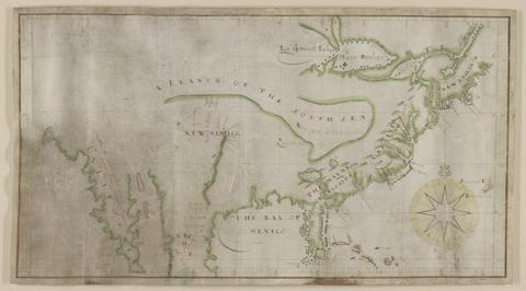
- Date:
- not before 1634
- Physical Description:
- 1 map : pen and ink and watercolor, on parchment ; 21.9 x 42.8 cm, on sheet 23.5 x 45.8 cm
- Collection:
- Rare Books and Manuscripts
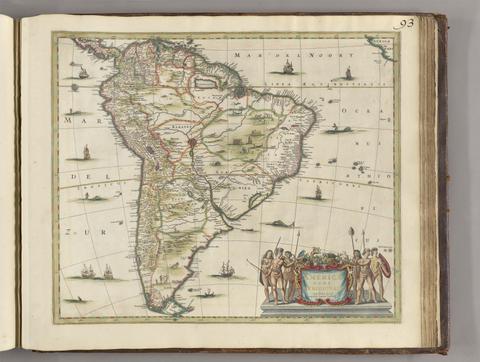
- Date:
- [between 1641 and 1680]
- Physical Description:
- 1 map ; 45 x 52 cm
- Collection:
- Rare Books and Manuscripts

- Date:
- MDCXXXXI-MDCXXXXIIII [1641]-[1644]
- Physical Description:
- 2 volumes : illustrations, maps, plans, portraits ; 52 cm (folio)
- Collection:
- Rare Books and Manuscripts

- Date:
- MDCXLIV [1644]
- Physical Description:
- 138, [8] p., [59] plates (some folded) : ill., maps, plans ; 34 cm. (fol.)
- Collection:
- Rare Books and Manuscripts
- Date:
- [1970]
- Physical Description:
- 16 p., 230 plates : 2 col. illus., coats of arms, maps. ; 54 cm
- Collection:
- Reference Library

- Date:
- 1645
- Physical Description:
- 106, 33, [11] pages, [101] leaves of plates : ill. (engravings), maps, plans ; 39 cm (fol.)
- Collection:
- Rare Books and Manuscripts

- Date:
- 1646
- Physical Description:
- 54, [6] p., 43, [34] leaves of plates (some folded) : ill. (engravings), maps, plans ; fol.
- Collection:
- Rare Books and Manuscripts

- Date:
- [1647]
- Physical Description:
- 94, [6] p., [51] leaves of plates (some folded) : ill. (engravings), maps, plans ; 32 cm. (fol.)
- Collection:
- Rare Books and Manuscripts

- Date:
- [1648?]
- Physical Description:
- [6], 3-118, [10] p., 43 leaves of plates (some folded) : ill., maps, plans ; 39 cm
- Collection:
- Rare Books and Manuscripts
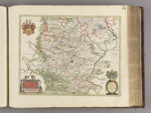
- Date:
- [1650?]
- Physical Description:
- 1 map; 40 x 51 cm
- Collection:
- Rare Books and Manuscripts

- Date:
- 1650
- Physical Description:
- 192, [16] p., [37] folded leaves of plates : ill., maps, plans ; 32 cm (fol. in 4s)
- Collection:
- Rare Books and Manuscripts

- Date:
- MDCL [1650]
- Physical Description:
- [4], 210, [14] p., [62] leaves of plates (some folded) : ill. (engravings), maps, plans ; 39 cm (fol.)
- Collection:
- Rare Books and Manuscripts

- Date:
- 1651 [1676 printing]
- Physical Description:
- 1 map : hand col. ; 2 hemipsheres each 25 cm. in diam., on sheet 45 x 57 cm.
- Collection:
- Rare Books and Manuscripts

- Date:
- [approximately 1660]
- Physical Description:
- 1 map : hand colored, vellum ; 77 x 96 cm
- Collection:
- Rare Books and Manuscripts

- Date:
- [ca. 1660]
- Physical Description:
- 1 map ; 36 x 48 cm
- Collection:
- Rare Books and Manuscripts

- Date:
- [1662?]
- Physical Description:
- 1 map ; 36 x 44 cm.
- Collection:
- Rare Books and Manuscripts

- Date:
- [1663]
- Physical Description:
- 166 pages in various pagings, [4] leaves of plates : illustrations, maps, plans ; 56 cm
- Collection:
- Rare Books and Manuscripts

- Date:
- MDCLXIII [1663]
- Physical Description:
- 2 volumes : illustrations (engravings), maps, plans ; 58 cm (folio)
- Collection:
- Rare Books and Manuscripts

- Date:
- 1666
- Physical Description:
- 1 map ; 30 x 54 cm., on sheet 50 x 58 cm.
- Collection:
- Rare Books and Manuscripts
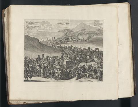
- Date:
- MDC LXX [1670]
- Physical Description:
- [18], 38, [2], 39-146, [2], 147-281, [3], 283-304, [2], 305-314, [2], 315-488, [2], 489-632, [2], 633-658, [2], 659-767, [1] pages, [98] leaves of plates : illustrations, maps, plans ; 41 cm (folio)
- Collection:
- Rare Books and Manuscripts

- Date:
- MDCLXXI [1671]
- Physical Description:
- [8], 674, [2] pages, [107] leaves of plates (some folded) : ill., ports., maps ; 43 cm (folio)
- Collection:
- Rare Books and Manuscripts

- Date:
- [1676]
- Physical Description:
- 1 map ; 38 x 50 cm., on sheet 44 x 56 cm.
- Collection:
- Rare Books and Manuscripts

- Date:
- [1678]
- Physical Description:
- 1 map : engraving ; 50 x 57 cm, on sheet 54 x 63 cm
- Collection:
- Rare Books and Manuscripts
![America [cartographic material].](https://media.collections.yale.edu/thumbnail/ycba/6f6a5b25-3bf2-4151-a3f1-3e9133dae84b)
- Date:
- [ca. 1686]
- Physical Description:
- 1 map : hand colored ; 56.5 x 95 cm, on sheet 63.5 x 102 cm
- Collection:
- Rare Books and Manuscripts
![Africa [cartographic material].](https://media.collections.yale.edu/thumbnail/ycba/f326eddf-1bc5-4bb4-83a0-d7ac0f9b6f40)
- Date:
- [ca. 1686?]
- Physical Description:
- 1 map : hand colored ; 57 x 94 cm, on sheet 62 x 102 cm
- Collection:
- Rare Books and Manuscripts
36. Europa.

- Date:
- [ca. 1686?]
- Physical Description:
- 1 map : hand colored ; 56.5 x 94 cm, on sheet 62 x 98 cm
- Collection:
- Rare Books and Manuscripts
37. Asia.

- Date:
- [ca. 1686?]
- Physical Description:
- 1 map : hand colored ; 56.5 x 94 cm, on sheet 61.5 x 102 cm
- Collection:
- Rare Books and Manuscripts
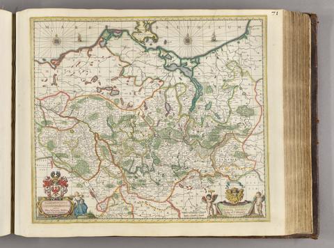
- Date:
- [ca. 1681]
- Physical Description:
- 1 map ; 46 x 52 cm
- Collection:
- Rare Books and Manuscripts
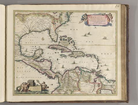
- Date:
- ca. 1682]
- Physical Description:
- 1 map : hand col. ; 44.8 x 55.1 cm.
- Collection:
- Rare Books and Manuscripts

- Date:
- [approximately 1682?]
- Physical Description:
- 1 map : hand colored ; 48 x 48 cm
- Collection:
- Rare Books and Manuscripts
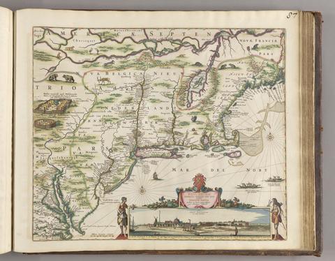
- Date:
- [ca. 1684]
- Physical Description:
- 1 map ; 46.1 x 55.9 cm, on sheet 52.4 x 62.9 cm
- Collection:
- Rare Books and Manuscripts

- Date:
- 1684-1685
- Physical Description:
- 2 volumes : illlustrations, portraits, maps ; 23 cm (4to)
- Collection:
- Rare Books and Manuscripts

- Date:
- [1685?]
- Physical Description:
- 1 map : engraving, hand-colored ; 48 x 55 cm, on sheet 53 x 65 cm
- Collection:
- Rare Books and Manuscripts
![[The travellers guide : being the best mapp of the kingdom of England and principalaty [sic] of Wales. Wherein are delineated 3000 towns and villages more than in any mapp yet extent besides ye notations of bridges & rivers &c. To which is added ye direct and cross roads according to Mr. Ogilby's late survey. / Described by C: Saxton and now carefully corrected with new additions by Phillip Lea].](https://media.collections.yale.edu/thumbnail/ycba/906da49f-9f3d-41c8-9cb7-2f67ee863785)
- Date:
- [1686?]
- Physical Description:
- 1 atlas ([10] sheets) : hand colored maps ; sheets 28 x 69 cm, and smaller
- Collection:
- Rare Books and Manuscripts

- Date:
- [1686?]
- Physical Description:
- 1 map : engraving ; 83 x 106 cm, on sheet 87 x 111 cm
- Collection:
- Rare Books and Manuscripts
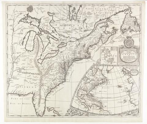
- Date:
- [ca. 1695]
- Physical Description:
- 1 map : engraving ; 51 x 60 cm
- Collection:
- Rare Books and Manuscripts

- Date:
- [1695?]
- Physical Description:
- 1 map ; 41 x 37 cm
- Collection:
- Rare Books and Manuscripts
- Credit Line:
- Yale Center for British Art, Gift of David Alan Richards, Yale BA 1967, JD 1972

- Date:
- [approximately 1695]
- Physical Description:
- 1 map : engraving, hand colored ; 46 x 56 cm, on sheet 51 x 61 cm
- Collection:
- Rare Books and Manuscripts

- Date:
- [1695?]
- Physical Description:
- 1 map ; 36 x 41 cm
- Collection:
- Rare Books and Manuscripts
- Credit Line:
- Yale Center for British Art, Gift of William H. Mandel, Yale BFA 1953, and Robert L. Russell, Yale MA 1954

- Date:
- [1695]
- Physical Description:
- 1 map : engraving ; 34 x 41 cm, on sheet 40 x 47 cm
- Collection:
- Rare Books and Manuscripts

- Date:
- 1704
- Physical Description:
- 3 volumes in 1 : illustrations, portraits, maps ; 20 cm
- Collection:
- Rare Books and Manuscripts

- Date:
- [approximately 1705]
- Physical Description:
- 1 map : engraving, hand-colored ; 46 x 58 cm, on sheet 54 x 65 cm
- Collection:
- Rare Books and Manuscripts
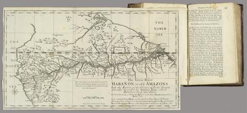
- Date:
- MDCCXII [1712]
- Physical Description:
- 2 volumes : illustrations, maps ; 20 cm
- Collection:
- Rare Books and Manuscripts

- Date:
- [approximately 1715?]
- Physical Description:
- 1 map : engraving, hand-colored ; 32 x 46 cm, on sheet 46 x 58 cm
- Collection:
- Rare Books and Manuscripts

- Date:
- [approximately 1715?]
- Physical Description:
- 1 map : engraving, hand-colored ; 41 x 33 cm, on sheet 47 x 53 cm
- Collection:
- Rare Books and Manuscripts

- Date:
- [1717?]
- Physical Description:
- 1 map on 4 sheets ; sheets 47 x 146 cm or smaller, folded in cover 48 x 31 cm
- Collection:
- Rare Books and Manuscripts

- Date:
- 1719
- Physical Description:
- 1 map ; 48 x 54 cm, on sheet 53 x 59 cm
- Collection:
- Rare Books and Manuscripts

- Date:
- 1719
- Physical Description:
- 1 map : engraving, hand colored ; 49 x 58 cm, on sheet 55 x 63 cm
- Collection:
- Rare Books and Manuscripts

- Date:
- [1720?]
- Physical Description:
- 1 map ; 11 x 11 cm, on sheet 19 x 15 cm
- Collection:
- Rare Books and Manuscripts
- Credit Line:
- Yale Center for British Art, Gift of David Alan Richards, Yale BA 1967, JD 1972
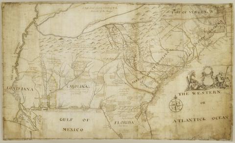
- Date:
- 1721
- Physical Description:
- 1 map : pen and black and brown ink, with red, yellow, and blue-gray wash ; 78 x 132 cm.
- Collection:
- Rare Books and Manuscripts
- Credit Line:
- Yale Center for British Art, Gift of the Acorn Foundation, Inc., Alexander O. Vietor, Yale BA 1936, President, in honor of Paul Mellon

- Date:
- [1723]
- Physical Description:
- 1 map on 2 sheets ; 106 x 125 cm, sheets 55 x 72 cm
- Collection:
- Rare Books and Manuscripts

- Date:
- 1724
- Physical Description:
- 1 atlas ([58] leaves) : maps ; 17 x 20 cm
- Collection:
- Rare Books and Manuscripts
63. America.

- Date:
- [after 1727]
- Physical Description:
- 1 map : outline color ; 56.7 x 97.3 cm
- Collection:
- Rare Books and Manuscripts

- Date:
- MDCCXXIX [1729]
- Physical Description:
- 4 volumes : illustrations, maps, tables ; 21 cm (8vo)
- Collection:
- Rare Books and Manuscripts

- Date:
- [1730]
- Physical Description:
- 1 map : engraving, hand-colored ; 48 x 56 cm., on sheet 52 x 60 cm
- Collection:
- Rare Books and Manuscripts

- Date:
- MDCCXXXVIII [1738]
- Physical Description:
- [8], 187, [1] pages, ([2] folded leaves of plates) : maps ; 25 cm
- Collection:
- Rare Books and Manuscripts

- Physical Description:
- 23, [5] pages, [1] folded leaf of plates : maps ; 23 cm
- Collection:
- Rare Books and Manuscripts

- Date:
- [1739]
- Physical Description:
- 1 map on 20 sheets ; sheets 53 x 72 cm or smaller, bound 53 x 41 cm. + 1 key map (48 x 47 cm.)
- Collection:
- Rare Books and Manuscripts

- Date:
- 1744-1760
- Physical Description:
- 1 map in 182 sheets : engraved, part. col. some sheets ; 58.5 x 90 cm. each ; 4 index sheets.
- Collection:
- Rare Books and Manuscripts

- Date:
- MDCCXLVII [1748]
- Physical Description:
- xxviii, 336 [i.e. 344] pages, [9] leaves of plates, (4 folded) : illustrations, maps ; 22 cm (8vo)
- Collection:
- Rare Books and Manuscripts

- Date:
- 1749
- Physical Description:
- 1 map ; 63 x 47 cm, on sheet 66 x 50 cm
- Collection:
- Rare Books and Manuscripts

- Date:
- [1749 October 3]
- Physical Description:
- 1 map ; 16 x 4 cm, on sheet 30 x 42 cm
- Collection:
- Rare Books and Manuscripts

- Date:
- ca. 1750-ca.1850
- Physical Description:
- approximately 1,500 items
- Collection:
- Rare Books and Manuscripts
- Credit Line:
- Yale Center for British Art, Paul Mellon Collection

- Date:
- [1750]
- Physical Description:
- 1 map : engraving ; 69 x 51 cm, on sheet 73 x 56 cm
- Collection:
- Rare Books and Manuscripts

- Date:
- MDCCLII [1752]
- Physical Description:
- [4], vi, 84, 95, [1] pages, [3] folded leaves of plates : illustrations, maps ; 22 cm
- Collection:
- Rare Books and Manuscripts

- Date:
- Febry 13th, 1755
- Physical Description:
- 1 map : engraving ; 136 x 195 cm, on sheets 77 x 57 cm
- Collection:
- Rare Books and Manuscripts

- Date:
- 1757
- Physical Description:
- 1 map ; 50 x 68 cm., on sheet 55 x 72 cm.
- Collection:
- Rare Books and Manuscripts

- Date:
- [that is, 1757]
- Physical Description:
- 1 map in 4 sheets : hand colored ; 136 x 192 cm, sheets 71 x 99 cm and 71 x 100 cm
- Collection:
- Rare Books and Manuscripts

- Date:
- 1759
- Physical Description:
- 510 pages : illustrations, diagrams, maps ; 30 cm
- Collection:
- Rare Books and Manuscripts

- Date:
- 1759
- Physical Description:
- 1 map ; 17.8 x 16 cm
- Collection:
- Rare Books and Manuscripts
- Credit Line:
- Yale Center for British Art, Gift of David Alan Richards, Yale BA 1967, JD 1972

- Date:
- [between 1762 and 1773]
- Physical Description:
- 1 map on 2 sheets ; 120 x 188 cm., sheets 67 x 108 cm.
- Collection:
- Rare Books and Manuscripts

- Date:
- [1762?]
- Physical Description:
- 1 map on 4 sheets : hand colored ; 87 x 89 cm
- Collection:
- Rare Books and Manuscripts
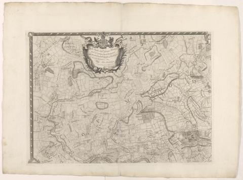
- Date:
- [1763]
- Physical Description:
- 1 map on 4 sheets ; 86 x 125 cm., sheets 58 x 79 cm.
- Collection:
- Rare Books and Manuscripts

- Physical Description:
- 13 volumes : illustrations, maps ; 54 cm
- Collection:
- Rare Books and Manuscripts
- Credit Line:
- Yale Center for British Art, Paul Mellon Collection
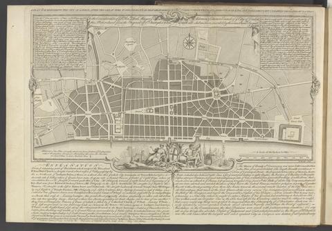
- Date:
- MDCCLXVU [1766]
- Physical Description:
- xv, [1], 132 pages, IIII folded leaves of plates : plans ; 27 cm
- Collection:
- Rare Books and Manuscripts

- Date:
- MDCCLXVI [1766]
- Physical Description:
- 2 volumes : illustrations, maps ; 20 cm
- Collection:
- Rare Books and Manuscripts

- Date:
- 1768
- Physical Description:
- 2 v. : ill. (some folded), 9 maps, plan ; 48 x 25 cm
- Collection:
- Rare Books and Manuscripts

- Date:
- MDCCLXIX [1769]
- Physical Description:
- [8], 122 pages, [2] leaves of plates, (1 folded) : illustrations, maps ; 28 cm (4to)
- Collection:
- Rare Books and Manuscripts

- Date:
- MDCCLXX [1770]
- Physical Description:
- viii, 99, [1] pages, [8] leaves of plates (7 folded) : maps, plans ; 28 cm (4to)
- Collection:
- Rare Books and Manuscripts

- Date:
- 1771
- Physical Description:
- 1 map : engraving, hand colored ; 48 x 63 cm, on sheet 53 x 71 cm
- Collection:
- Rare Books and Manuscripts

- Date:
- [1773]
- Physical Description:
- 1 map on 18 sheets ; 273 x 189 cm, sheets 54 x 72 cm
- Collection:
- Rare Books and Manuscripts

- Date:
- [1775?]
- Physical Description:
- 1 map on 8 sheets : hand col., mounted on linen ; 135 x 192 cm., sheets 70 x 51 or smaller.
- Collection:
- Rare Books and Manuscripts

- Date:
- MDCCLXXV [1775]
- Physical Description:
- [12], 464 pages, ([1] folded leaf of plates) : map ; 28 cm (4to)
- Collection:
- Rare Books and Manuscripts

- Date:
- circa [1800?]
- Physical Description:
- 1 map : silk embroidery on linen ; 49 x 46 cm
- Collection:
- Rare Books and Manuscripts

- Physical Description:
- v. ; 18 cm
- Collection:
- Rare Books and Manuscripts

- Date:
- MDCCLXXVI. [1776]
- Physical Description:
- vi, 46, 16 p., [1] folded leaf of plates : map ; 44 cm (fol.)
- Collection:
- Rare Books and Manuscripts

- Date:
- l'an VI de la République, 1798
- Physical Description:
- 4 volumes : illustrations ; 21 cm
- Collection:
- Rare Books and Manuscripts

- Date:
- [1782]
- Physical Description:
- 1 map on 9 sheets ; sheets 54 x 71 cm + 1 index map (52 x 71 cm)
- Collection:
- Rare Books and Manuscripts

- Date:
- 1783
- Physical Description:
- 1 map on 6 sheets : hand col. ; 120 x 162 cm on sheets 64 x 56 cm
- Collection:
- Rare Books and Manuscripts
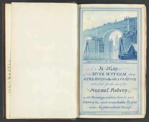
- Date:
- 1784-1800
- Physical Description:
- 2 v. ; ill. ; 22 cm.
- Collection:
- Rare Books and Manuscripts