<< YCBA Home Yale Center for British Art Yale Center for British Art << YCBA Home

YCBA Collections Search

Search Constraints

You searched for:

Work Type map

Remove constraint Work Type: map

Image Use Under Certain Circumstances

Remove constraint Image Use: Under Certain Circumstances

Classification Maps & Atlas (printed)

Remove constraint Classification: Maps & Atlas (printed)

Search Results

Saxton, Christopher, 1542?- cartographer. [The travellers guide :
Saxton, Christopher, 1542?-
[The travellers guide
[1686?]
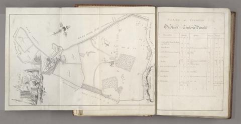
Probert, John, active 1764, cartographer, surveyor. A survey and valuation of estates the property of Nicholas Smyth Esqr. and his Lady :
Probert, John, active 1764
A survey and valuation of estates the property of Nicholas Smyth Esqr. and his Lady
1767
Froggett, John, active 1808-1821, cartographer.  Froggett's survey of the country thirty miles round London, 1836
Froggett, John, active 1808–1821
Froggett's survey of the country thirty miles round London, 1836
[1836]
Rocque, John, -1762. A map of the county of Middlesex :
Rocque, John, -1762
A map of the county of Middlesex
1757
Gall & Inglis. Gall & Inglis' pocket map of the suburbs of London
Gall & Inglis
Gall & Inglis' pocket map of the suburbs of London
[ca. 1897?]
Valck, G. (Gerard), 1651-1726, cartographer. Magna Britannia, aut Anglia, Scotia et Hibernia, quarum prior divisa in septem Regna, sive Provincias, dictas Northumbriam, Merciam, Angliam Orient. Essexiam, Cantium, Sussexiam, Westsexiam, et Princi. Walliae. posterior in Septent. et Austr. Scotiam. postrema in quatuor Provincias Ultoniam, Lageniam, Momoniam, et Conagtiam /
Valck, G. (Gerard), 1651–1726
Magna Britannia, aut Anglia, Scotia et Hibernia, quarum prior divisa in septem Regna, sive Provincias, dictas Northumbriam, Merciam, Angliam Orient. Essexiam, Cantium, Sussexiam, Westsexiam, et Princi. Walliae. posterior in Septent. et Austr. Scotiam. postrema in quatuor Provincias Ultoniam, Lageniam, Momoniam, et Conagtiam
[approximately 1705]
Adam and Charles Black (Firm) Black's travelling map of Ireland.
Adam and Charles Black (Firm)
Black's travelling map of Ireland
[184-?]
Boazio, Baptista, cartographer. The true description or draffte of that famous Ile of Wighte :
Boazio, Baptista
The true description or draffte of that famous Ile of Wighte
1591
Rapkin, J., engraver. Overland route to India
Rapkin, J.
Overland route to India
[1851]
Speed, John, 1552?-1629. America with those known parts in that unknowne worlde both people and manner of buildings /
Speed, John, 1552?-1629
America with those known parts in that unknowne worlde both people and manner of buildings
[1662?]
Wren, Christopher, Sir, 1632-1723. Ichnographia urbis Londinii :
Wren, Christopher, Sir, 1632–1723
Ichnographia urbis Londinii
1724
Ortelius, Abraham, 1527-1598, cartographer. Maris Pacifici (quod vulg ̣Mar del Zur)
Ortelius, Abraham, 1527–1598
Maris Pacifici (quod vulg ̣Mar del Zur)
1589
Senex, John, -1740. A new map of Virginia, Mary-Land, and the improved parts of Pennsylvania & New Jersey
Senex, John, -1740
A new map of Virginia, Mary-Land, and the improved parts of Pennsylvania & New Jersey
1719
 Cambridge Shire /
Cambridge Shire
[1695?]
Goos, Pieter, approximately 1616-1675. West-Indische paskaert :
Goos, Pieter, approximately 1616–1675
West-Indische paskaert
[approximately 1660]
Wyld, James, 1812-1887. Wyld's military map of the theatre of war.
Wyld, James, 1812–1887
Wyld's military map of the theatre of war
[1859?]
John Bartholomew and Son, creator, publisher. Children's map of London /
John Bartholomew and Son
Children's map of London
[approximately 1939]
Rocque, John, -1762. England and Wales :
Rocque, John, -1762
England and Wales
[circa 1768]
 Crumpled city London /
Crumpled city London
2011
Robert Laurie and James Whittle. The London directory, or, A new and improved plan of London, Westminster & Southwark :
Robert Laurie and James Whittle
The London directory, or, A new and improved plan of London, Westminster & Southwark
1794
Arrowsmith, Aaron, 1750-1823. Map of Upper Egypt /
Arrowsmith, Aaron, 1750–1823
Map of Upper Egypt
1807
Overton, Henry, 1675 or 1676-1751. America.
Overton, Henry, 1675 or 1676–1751
America
[after 1727]
Doornick, Marcus Williamsz. Platte grondt der Vebrande Stadt London /
Doornick, Marcus Williamsz
Platte grondt der Vebrande Stadt London
1666
John Bartholomew & Co. Northumberland and Durham.
John Bartholomew & Co
Northumberland and Durham
[between 1888 and 1898]
Rocque, John, -1762. The Seraglio & gardens of the Grand Seignior = Serrail & jardins du Grand Seigneur.
Rocque, John, -1762
The Seraglio & gardens of the Grand Seignior = Serrail & jardins du Grand Seigneur
1752
Gardner, W. R., cartographer, engraver. New and Improved map of England and Wales, including the principal part of Scotland :
Gardner, W. R.
New and Improved map of England and Wales, including the principal part of Scotland
16th. April 1823
Great Britain. Ordnance Survey. [Old series Ordnance Survey maps of England and Wales]
Great Britain. Ordnance Survey
[Old series Ordnance Survey maps of England and Wales]
[1839-1874?]
Hogenberg, Frans, approximately 1539-1590, engraver. Londinum feracissimi Angliae Regni metropolis.
Hogenberg, Frans, approximately 1539–1590
Londinum feracissimi Angliae Regni metropolis
[1574]
 Ribbon map of the Father of Waters.
Ribbon map of the Father of Waters
1866
Stockwell, Susan. S. Stockwell underground map
Stockwell, Susan
S. Stockwell underground map
[2012]
Kip, William, engraver. Galliae descriptio
Kip, William
Galliae descriptio
[ca. 1602]
Morden, Robert, approximately 1650-1703. A new mapp of England Scotland and Ireland
Morden, Robert, approximately 1650–1703
A new mapp of England Scotland and Ireland
[1678]
C. & J. Greenwood. Map of the county of Kent,
C. & J. Greenwood
Map of the county of Kent,
July 4th, 1829
Great Britain. Ordnance Survey.  [Dunmow] /
Great Britain. Ordnance Survey
[Dunmow]
[not before 1862]
Great Britain. Ordnance Survey. [Cambridge]
Great Britain. Ordnance Survey
[Cambridge]
1st June 1836
Rocque, John, -1762. A plan of Paris and the adjacent country :
Rocque, John, -1762
A plan of Paris and the adjacent country
1748
Peacock, W. (William), -1910, publisher. Peacock's Superior dissected maps :
Peacock, W. (William), -1910
Peacock's Superior dissected maps
[between 1875 and 1909]
Geographers' A-Z Map Company.  Centre section of the 9 sheet master plan of London.
Geographers' A-Z Map Company
Centre section of the 9 sheet master plan of London
[1995]
Morden, Robert, approximately 1650-1703, cartographer. A new map of the English plantations in America
Morden, Robert, approximately 1650–1703
A new map of the English plantations in America
[ca. 1677]
Saxton, Christopher, 1542?- cartographer. Southamtoniae comitatus (preter insulas Vectis, Jersey et Garnsey quae sunt partes eius dem comitatus) cum suis undiq[ue] confinibus, oppidis, pagis, villis, et fluminibus vera descriptio /
Saxton, Christopher, 1542?-
Southamtoniae comitatus (preter insulas Vectis, Jersey et Garnsey quae sunt partes eius dem comitatus) cum suis undiq[ue] confinibus, oppidis, pagis, villis, et fluminibus vera descriptio
[1575]
C. & H. Greenwood. Map of the county of Monmouth :
C. & H. Greenwood
Map of the county of Monmouth
1831
Laurie, Richard Holmes. Survey of the country around London :
Laurie, Richard Holmes
Survey of the country around London
1852
Edward Stanford Ltd. Stanford's map of central London.
Edward Stanford Ltd
Stanford's map of central London
1927
Evans, Lewis, 1700?-1756. A general map of the middle British colonies in America :
Evans, Lewis, 1700?-1756
A general map of the middle British colonies in America
1771
Ogilby, John, 1600-1676. The road from Cambridge to Coventry
Ogilby, John, 1600–1676
The road from Cambridge to Coventry
[1720]
Mogg, Edward, author. Map of the London & Birmingham Railway with the country in its vicinity /
Mogg, Edward
Map of the London & Birmingham Railway with the country in its vicinity
Sepr. 17th. 1838
W.J. Adams & Sons. The "District Railway" miniature map of London
W.J. Adams & Sons
The "District Railway" miniature map of London
[ca. 1887?]
Edward Stanford Ltd. Stanford's half-inch map of the battle front between the Somme and Soissons.
Edward Stanford Ltd
Stanford's half-inch map of the battle front between the Somme and Soissons
1917
Stanford, Edward, 1827-1904, publisher. A new map of metropolitan railways, tramways & miscellaneous improvements :
Stanford, Edward, 1827–1904
A new map of metropolitan railways, tramways & miscellaneous improvements
January 1st, 1874
 Cambridge.
Cambridge
[1899?]
Saxton, Christopher, 1542?- cartographer. Wiltshire, wth. Salisbury citty & Stone heng described ano. 1689
Saxton, Christopher, 1542?-
Wiltshire, wth. Salisbury citty & Stone heng described ano. 1689
[approximately 1715?]
Moll, Herman, -1732. A new map containing the towns, gentlemens houses, villages, and other remarks round London :
Moll, Herman, -1732
A new map containing the towns, gentlemens houses, villages, and other remarks round London
[ca. 1700]
Dury, Andrew, cartographer.  A topographical map of Hartford-shire, from an actual survey :
Dury, Andrew
A topographical map of Hartford-shire, from an actual survey
[1782]
Greenough, George Bellas, 1778-1855, cartographer. A geological map of England & Wales /
Greenough, George Bellas, 1778–1855
A geological map of England & Wales
November 1st, 1819 [that is, 1820]
Blome, Richard, 1635-1705, cartographer, publisher. A mapp of Cambridgshire
Blome, Richard, 1635–1705
A mapp of Cambridgshire
[1673]
Greenough, George Bellas, 1778-1855, cartographer. A geological map of England & Wales /
Greenough, George Bellas, 1778–1855
A geological map of England & Wales
November 1st, 1819 [that is, 1820]
Carrington, F. A. (Frederick Augustus), 1801-1860. A map of Scotland :
Carrington, F. A. (Frederick Augustus), 1801–1860
A map of Scotland
1856
Cassini, César-François, 1714-1784, cartographer. A map of the kingdom of France :
Cassini, César-François, 1714–1784
A map of the kingdom of France
Augt. 2nd. 1838
Rocque, John, -1762. A plan of London on the same scale as that of Paris :
Rocque, John, -1762
A plan of London on the same scale as that of Paris
1754
Gwynn, John, 1713-1786, cartographer.  A plan for rebuilding the city of London, after the great fire in 1666 :
Gwynn, John, 1713–1786
A plan for rebuilding the city of London, after the great fire in 1666
[1749 October 3]
Cassini, César-François, 1714-1784. Carte de France /
Cassini, César-François, 1714–1784
Carte de France
1744-1760
 Cambridgeshire
Cambridgeshire
[1843?]
Valck, G. (Gerard), 1651-1726, cartographer. Les isles Britanniques, qui contiennent les Royaumes d'Angleterre, Escosse, et Irlande :
Valck, G. (Gerard), 1651–1726
Les isles Britanniques, qui contiennent les Royaumes d'Angleterre, Escosse, et Irlande
[approximately 1695]
 Karta öfver segelleden från Stockholm kanalvägen till Götheborg.
Karta öfver segelleden från Stockholm kanalvägen till Götheborg
[1860?]
Hodskinson, Joseph, cartographer. The county of Suffolk
Hodskinson, Joseph
The county of Suffolk
1783
Boazio, Baptista. S. Augustini pars est terrae Florida
Boazio, Baptista
S. Augustini pars est terrae Florida
[1588?]
Great Britain. MI9. France (north west), Belgium (west and central), Holland (part of) ; France (south west), Spain (north).
Great Britain. MI9
France (north west), Belgium (west and central), Holland (part of) ; France (south west), Spain (north)
[1943?]
Snell, Robert, fl. 1756-1785. To the nobility, gentry, clergy and others, this map of the county of Monmouth, is most humbly inscribed /
Snell, Robert, fl. 1756–1785
To the nobility, gentry, clergy and others, this map of the county of Monmouth, is most humbly inscribed
1785
Arrowsmith, Aaron, 1750-1823, cartographer.  A new map of Mexico and adjacent provinces
Arrowsmith, Aaron, 1750–1823
A new map of Mexico and adjacent provinces
1810
Bacon, G. W. (George Washington), 1830-1921, cartographer. Cambridge.
Bacon, G. W. (George Washington), 1830–1921
Cambridge
[approximately 1880?]
Faden, William, 1749-1836. A new pocket plan of the cities of London & Westminster :
Faden, William, 1749–1836
A new pocket plan of the cities of London & Westminster
[1790]
Evans, Lewis, 1700?-1756, cartographer. A map of Pensilvania, New-Jersey, New-York, and the three Delaware counties
Evans, Lewis, 1700?-1756
A map of Pensilvania, New-Jersey, New-York, and the three Delaware counties
1749
 Cruchley's railway & telegraphic map of Somerset
Cruchley's railway & telegraphic map of Somerset
[between 1855 and 1875?]
Jansson, Jan, 1588-1664. Comitatis Cantabrigiensis :
Jansson, Jan, 1588–1664
Comitatis Cantabrigiensis
[not before 1647]
Arrowsmith, Aaron, 1750-1823. To Captain Carmichael Smyth of the Corps of Royal Engineers who obligingly furnished many of the materials this chart of the Cape of Good Hope is inscribed /
Arrowsmith, Aaron, 1750–1823
To Captain Carmichael Smyth of the Corps of Royal Engineers who obligingly furnished many of the materials this chart of the Cape of Good Hope is inscribed
1805
Lily, George, active 1528-1559. Britania insula quae duo regna continet Angliam et Scotiam cum Hibernia adiacente /
Lily, George, active 1528–1559
Britania insula quae duo regna continet Angliam et Scotiam cum Hibernia adiacente
anno MDLXII [1562]
Rapkin, J. England and Wales /
Rapkin, J
England and Wales
[1851?]
 Karta öfver segelleden från Stockholm kanalvägen till Götheborg :
Karta öfver segelleden från Stockholm kanalvägen till Götheborg
[1851?]
Great Britain. Ordnance Survey.  [Dunwich] /
Great Britain. Ordnance Survey
[Dunwich]
August 7th, 1837
Arrowsmith, Aaron, 1750-1823. Map of the Province of Malabar by A. Arrowsmith.
Arrowsmith, Aaron, 1750–1823
Map of the Province of Malabar by A. Arrowsmith
1809
Cary, John, approximately 1754-1835, engraver, publisher. A new map of Leicestershire
Cary, John, approximately 1754–1835
A new map of Leicestershire
Sepr. 28,1801
Carolus Flandro, Joris, 1601-1625. Tabula Islandiae
Carolus Flandro, Joris, 1601–1625
Tabula Islandiae
[ca. 1660]
Ptolemy, active 2nd century. Prima Europa tabula.
Ptolemy, active 2nd century
Prima Europa tabula
[1486]
 The city of London, in the time of the Saxons (about the year 1000)
The city of London, in the time of the Saxons (about the year 1000)
April 25th, 1817
 Karta öfver segelleden från Stockholm kanalvägen till Götheborg
Karta öfver segelleden från Stockholm kanalvägen till Götheborg
[1856]
Great Britain. Ordnance Survey. Part the first of the general survey of England and Wales containing the whole of Essex
Great Britain. Ordnance Survey
Part the first of the general survey of England and Wales containing the whole of Essex
1805]
Ptolemy, active 2nd century. Tercia Europe tabula.
Ptolemy, active 2nd century
Tercia Europe tabula
[1486]
Kitchin, Thomas, 1719-1784, cartographer. Cambridgeshire
Kitchin, Thomas, 1719–1784
Cambridgeshire
1747
Richard Jackson (Firm), cartographer, publisher. Jackson's map of the Bedale Hunt.
Richard Jackson (Firm)
Jackson's map of the Bedale Hunt
[ca. 1896]
Rocque, John, -1762. A map of the kingdom of Ireland :
Rocque, John, -1762
A map of the kingdom of Ireland
[between 1762 and 1773]
Perrot, A. M. (Aristide Michel), 1793-1879, cartographer. Carte pittoresque et maritime de la France
Perrot, A. M. (Aristide Michel), 1793–1879
Carte pittoresque et maritime de la France
1841
Great Britain. Ordnance Survey.  [Downham] /
Great Britain. Ordnance Survey
[Downham]
1st March 1824
Johnston, Keith, 1844-1879. North & central Italy and the island of Corsica /
Johnston, Keith, 1844–1879
North & central Italy and the island of Corsica
[1863?]
Bowen, Thomas, -1790, engraver. The roads from London to Norwich, Cambridge, Ely & Kings Lynn
Bowen, Thomas, -1790
The roads from London to Norwich, Cambridge, Ely & Kings Lynn
[1775?]
Stanford, Edward, 1827-1904, cartographer. Stanford's library map of London and its suburbs
Stanford, Edward, 1827–1904
Stanford's library map of London and its suburbs
1862
Popple, Henry, -1743, cartographer. A map of the British Empire in America :
Popple, Henry, -1743
A map of the British Empire in America
[ca. 1737]
 Survey of London made in the year 1745.
Survey of London made in the year 1745
[between 1884 and 1887?]
Banks, John Henry, 1816-1879, engraver. A panoramic view of London / drawn & engraved by J.H. Banks ...
Banks, John Henry, 1816–1879
A panoramic view of London / drawn & engraved by J.H. Banks ..
[1845]
Arrowsmith, Aaron, 1750-1823. Ireland /
Arrowsmith, Aaron, 1750–1823
Ireland
1811
C. & J. Greenwood. Map of the county palatine of Durham,
C. & J. Greenwood
Map of the county palatine of Durham,
Jan. 26, 1831