Search Constraints
You searched for:
On-site Access Accessible by appointment in the Study Room
Remove constraint On-site Access: Accessible by appointment in the Study RoomPeriod 18th century
Remove constraint Period: 18th centuryLanguage English
Remove constraint Language: EnglishWork Type map
Remove constraint Work Type: mapSearch Results

1
- A plan of mathematical learning taught in the Royal Academy, Portsmouth
- approximately 1798-1799

2
- The route of the mail & post coaches, George Boulton & Co. proprietors
- [between 1796 and 1809]

3
- The environs of London
- [1763]

4
- A map of London and the adjacent country 10 miles round
- 1748

5
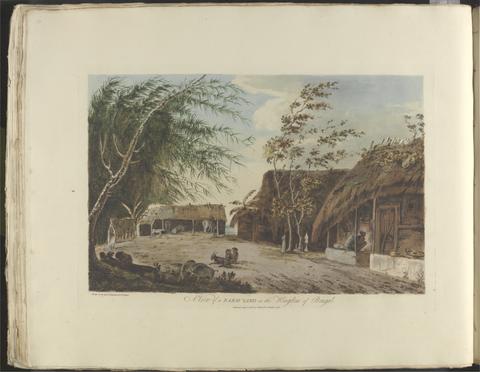
- London and Westminster improved
- MDCCLXVU [1766]

6
- A plan of Rome
- 1750

7
- London and Westminster in the reign of Queen Elizabeth anno dom. 1563
- October 30th, 1789

8
- North America, and the West Indies
- [1764?]

9
- A survey and valuation of estates the property of Nicholas Smyth Esqr. and his Lady
- 1767

10
- Wallis's tour of Europe
- Nov. 24th, 1794

11
- A survey of the estate of John Plampin Esquire, taken in 1774,
- 1774

12
- A survey of the estate of Richard Moore, Esq., Kentwell Hall, Suffolk
- 1777

13
- A voyage to the South Sea, and round the world, perform'd in the years 1708, 1709, 1710, and 1711, by the ships Duke and Dutchess of Bristol
- MDCCXII [1712]

14
- To Martin Folkes, esq., president of the Royal Society
- 1749

15
- Sir Joseph Banks's fishery book of the River Witham in Lincolnshire
- 1784-1800

16
- The county of Dorset
- June 1st, 1795

17
- A map of Hindoostan or the Mogul Empire
- 1788

18
- Survey and valuation of the several estates belonging to John Kinchant Esqr. and Emma his wife
- 1765

19
- Map of the southeastern part of North America
- 1721
20
- Choix de vues de l'Inde
- [1788]

21
- A voyage to North-America: undertaken by command of the present King of France
- MDCCLXVI [1766]
22
- A map of the county of Middlesex
- 1757
23
- The elements of navigation
- 1759
24
- Travels through the middle settlements in North America, in the years 1759 and 1760
- 1798
25
- A description of the Spanish islands and settlements on the coast of the West Indies
- 1762
26
- The Seraglio & gardens of the Grand Seignior = Serrail & jardins du Grand Seigneur
- 1752
27
- An exact survey of the cities of London and Westminster, the borough of Southwark, with the country near ten miles round
- [1747]
28
- An exact survey of the city and suburbs of Dublin
- 1756
29
- A map of the kingdom of Ireland
- [between 1762 and 1773]
30
- A new and accurate survey of the cities of London and Westminster, the borough of Southwark
- 1751
31
- A plan of the city of Dublin and the environs
- 1760]
32
- The roads from London to Norwich, Cambridge, Ely & Kings Lynn
- [1775?]
33
- The American gazetteer
- 1762
34
- The road from Cambridge to Coventry
- [1720]
35
- The London directory, or, A new and improved plan of London, Westminster & Southwark
- 1794
36
- Cambridgeshire
- 1747
37
- The county of Suffolk
- 1783
38
- A description of the windward passage, and Gulf of Florida, with the course of the British trading-ships to, and from the island of Jamaica
39
- A new and compleat map of all America
- [1763]
40
- The natural history of Cambridgeshire
- [1763]
41
- The road from London to Cambridge, Ely & Kings Lynn
- [1769]
42
- A survey of the city and suburbs of Dublin
- 1757
43
- Twenty-one plans, with explanations of different actions in the West Indies, during the late war
- MDCCLXXXIV [1784]
44
- A map of the British and French dominions in North America
- [that is, 1757]
45
- Ichnographia urbis Londinii
- 1724
46
- A new map of Virginia, Mary-Land, and the improved parts of Pennsylvania & New Jersey
- 1719
47
- The history of the British plantations in America
- MDCCXXXVIII [1738]
48
- A plan of Paris and the adjacent country
- 1748
49
- The present state of the European settlements on the Missisippi
- MDCCLXX [1770]
50
- England and Wales
- [circa 1768]
51
- Travels through the United States of North America
- 1799
52
- The history of the American Indians
- MDCCLXXV [1775]
53
- The history of the bucaniers of America
- 1704
54
- The United States of North America, with the British territories and those of Spain, according to the treaty of 1784
- 1793
55
- A general map of the middle British colonies in America
- 1771
56
- America
- [after 1727]
57
- Travels through the interior parts of America
- MDCCLXXXIX [1789]
58
- A map of the British colonies in North America
- [1775?]
59
- A new map of the English empire in America
- 1719
60
- Cambridgeshire
- [1784]
61
- A general map of England & Wales, divided into its counties
- circa [1800?]
62
- A new pocket plan of the cities of London & Westminster
- [1790]
63
- Map of England and Wales
- circa [1800?]
64
- A plan of Paris &c.
- 1754,
65
- A topographical map of the county of Norfolk
- 1797
66
- The sea of Marmara or Propontis
- Jany. 11th, 1786
67
- A voyage round the world
- 1789
68
- A voyage round the world
- MDCCLXXIX [1789]
69
- A map of the British Empire in America
- [ca. 1737]
70
- James Bruce archive,
- ca. 1750-ca.1850
71
- The history and antiquities of the county of Essex
- 1768
72
- A map of Pensilvania, New-Jersey, New-York, and the three Delaware counties
- 1749
73
- A plan for rebuilding the city of London, after the great fire in 1666
- [1749 October 3]
74
- A plan of London on the same scale as that of Paris
- 1754
75
- To the nobility, gentry, clergy and others, this map of the county of Monmouth, is most humbly inscribed
- 1785
76
- A plan of Paris &c.
- 1754
77
- Travels through the Maritime Alps, from Italy to Lyons, across the Col de Tende, by the way of Nice, Provence, Languedoc, &c.
- 1795
78
- A new and exact map of America laid down from the latest observations and discoveries
- [approximately 1740?]
79
- To the Right Honourable William Baron of Hedon, Viscount Pulteney of Wrington and Earl of Bath
- 1746
80
- Bowles's New pocket plan of the cities of London & Westminster
- [1790]
81
- The history of the origin, progress, and termination of the American war
- 1794
82
- A topographical map of Wiltshire
- [1773]
83
- The American traveller, or, Observations on the present state, culture and commerce of the British colonies in America, and the further improvements of which they are capable
- MDCCLXIX [1769]
84
- A new map containing the towns, gentlemens houses, villages, and other remarks round London
- [ca. 1700]
85
- A topographical map of Hartford-shire, from an actual survey
- [1782]
86
- Wiltshire, wth. Salisbury citty & Stone heng described ano. 1689
- [approximately 1715?]
87
- Proposals
- 1745]
88
- A collection of voyages
- MDCCXXIX [1729]
89
- A survey of the city, harbour, bay and environs of Dublin
- 1757
90
- A map of the British Empire in America
- [ca. 1737]
91
- The County of Cambridge
- 1759
92
- Manuscript copy of Richard Turner's A view of the earth : a short system of modern geography
- 1798
93
- A topographical description of such parts of North America as are contained in the (annexed) map of the middle British colonies & in North America.
- MDCCLXXVI. [1776]
94
- A New Geographical Game exhibiting a complete Tour through Scotland and the Western Isles. Neele Sc
- 1792
95
- A map of Cambridgeshire
- [1720?]
96
- A map of the British Empire in America, with the French and Spanish settlements adjacent thereto
- [1739]
97
- Glamorga[n]shire
- [approximately 1715?]
98
- A history of the campaigns of 1780 and 1781 in the southern provinces of North America
- MDCCLXXXVII [1787]
99
- The first map of Australia
- [1856]
100
- A plan of the cities of London and Westminster, and borough of Southwark, with the contiguous buildings
- 1746