<< YCBA Home Yale Center for British Art Yale Center for British Art << YCBA Home

YCBA Collections Search

Search Constraints

You searched for:

On-site Access Accessible by appointment in the Study Room

Remove constraint On-site Access: Accessible by appointment in the Study Room

Period 18th century

Remove constraint Period: 18th century

Classification Maps & Atlas (printed)

Remove constraint Classification: Maps & Atlas (printed)

Search Results

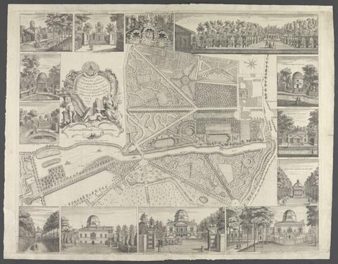
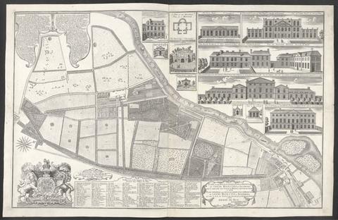
Rocque, John, -1762. A plan of the house & gardens of His Grace the Duke of Devonshire at Chiswick :
Rocque, John, -1762
A plan of the house & gardens of His Grace the Duke of Devonshire at Chiswick
[17--]
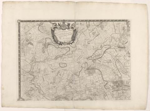
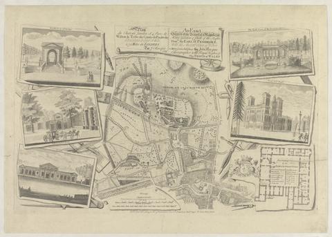
Rocque, John, -1762. The environs of London :
Rocque, John, -1762
The environs of London
[1763]
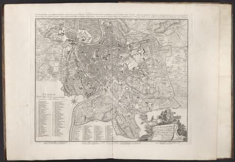
Rocque, John, -1762. A plan of Rome /
Rocque, John, -1762
A plan of Rome
1750
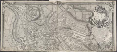
Rocque, John, -1762. A plan of the city of Bristol /
Rocque, John, -1762
A plan of the city of Bristol
1743
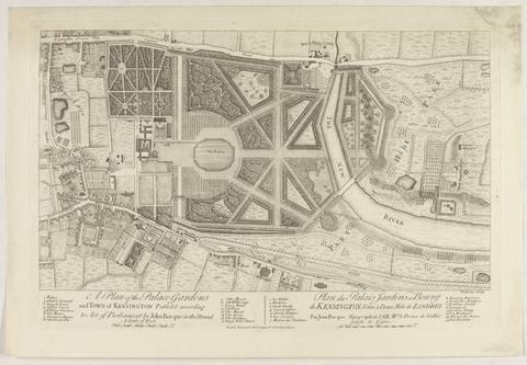
Rocque, John, -1762. A plan of the palace gardens and town of Kensington ... = Plan du palais jardins et bourg de Kensington :
Rocque, John, -1762
A plan of the palace gardens and town of Kensington ... = Plan du palais jardins et bourg de Kensington
[1736?]
 The English pilot :
The English pilot
MDCCIII [1703]
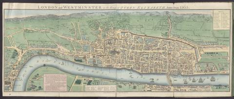
Agas, Ralph, 1545-1621, cartographer. London and Westminster in the reign of Queen Elizabeth anno dom. 1563
Agas, Ralph, 1545–1621
London and Westminster in the reign of Queen Elizabeth anno dom. 1563
October 30th, 1789
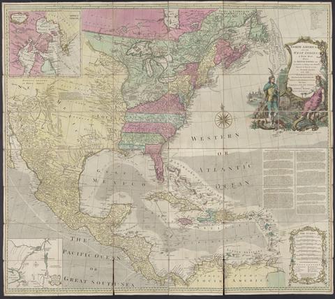
 North America, and the West Indies :
North America, and the West Indies
[1764?]
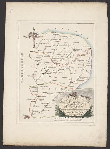
Boulton, George. The route of the mail & post coaches, George Boulton & Co. proprietors :
Boulton, George
The route of the mail & post coaches, George Boulton & Co. proprietors
[between 1796 and 1809]
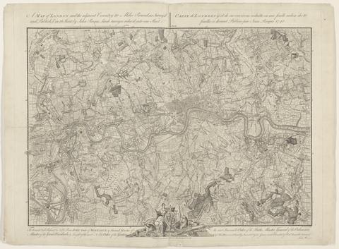
Rocque, John, -1762 A map of London and the adjacent country 10 miles round :
Rocque, John, -1762
A map of London and the adjacent country 10 miles round
1748
Rocque, John, -1762. Plan of the house, gardens, park & hermitage of Their Majesties at Richmond :
Rocque, John, -1762
Plan of the house, gardens, park & hermitage of Their Majesties at Richmond
1734
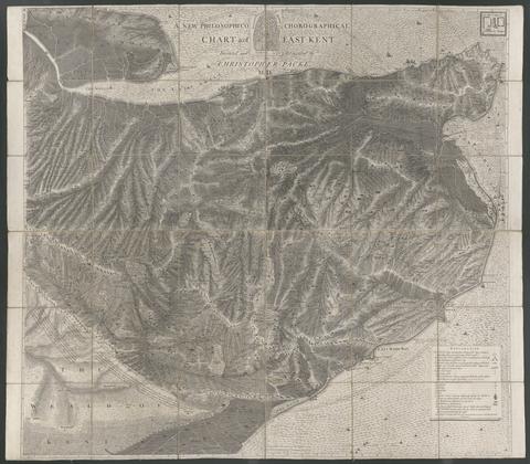
Packe, Christopher, 1686-1749. A new philosophico chorographical chart of East-Kent /
Packe, Christopher, 1686–1749
A new philosophico chorographical chart of East-Kent
1743
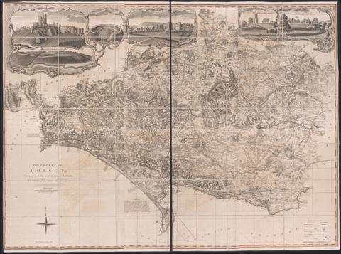
Taylor, Isaac, 1730-1807, cartographer.  The county of Dorset /
Taylor, Isaac, 1730–1807
The county of Dorset
June 1st, 1795
Probert, John, active 1764, cartographer, surveyor. A survey and valuation of estates the property of Nicholas Smyth Esqr. and his Lady :
Probert, John, active 1764
A survey and valuation of estates the property of Nicholas Smyth Esqr. and his Lady
1767
Rocque, John, -1762. Plan du chateau, jardin et parc de Wilton :
Rocque, John, -1762
Plan du chateau, jardin et parc de Wilton
1754
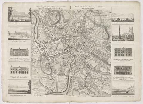
Rocque, John, -1762. A survey of the city and suburbs of Bristol /
Rocque, John, -1762
A survey of the city and suburbs of Bristol
1750
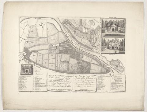
Rocque, John, -1762. An exact plan of the royal palace gardens and park at Richmond :
Rocque, John, -1762
An exact plan of the royal palace gardens and park at Richmond
1754
 To Martin Folkes, esq., president of the Royal Society :
To Martin Folkes, esq., president of the Royal Society
1749
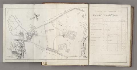
Rocque, John, -1762. A survey of the man[o]r of Graney :
Rocque, John, -1762
A survey of the man[o]r of Graney
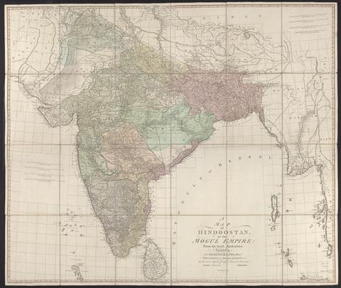
Rennell, James, 1742-1830. A map of Hindoostan or the Mogul Empire :
Rennell, James, 1742–1830
A map of Hindoostan or the Mogul Empire
1788
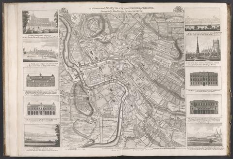
Rocque, John, -1762. A geometrical plan of the city and suburbs of Bristol /
Rocque, John, -1762
A geometrical plan of the city and suburbs of Bristol
[175-?]
 The English pilot :
The English pilot
MDCCXLI [1741]
 The English pilot :
The English pilot
MDCCLIII [1753]
 The English pilot :
The English pilot
MDCCXLIII [1743]
Des Barres, Joseph F. W. (Joseph Frederick Wallet), 1729-1824.  The Atlantic Neptune
Des Barres, Joseph F. W. (Joseph Frederick Wallet), 1729–1824
The Atlantic Neptune
[1774-1800?]
Ogilby, John, 1600-1676, cartographer. Britannia depicta, or, Ogilby improv'd :
Ogilby, John, 1600–1676
Britannia depicta, or, Ogilby improv'd
1749
Rocque, John, -1762. A plan of the cities of London and Westminster, the borough of Southwark, and the contiguous buildings :
Rocque, John, -1762
A plan of the cities of London and Westminster, the borough of Southwark, and the contiguous buildings
1755
Gibson, J. (John), active 1750-1792, engraver. The road from London to Cambridge, Ely & Kings Lynn :
Gibson, J. (John), active 1750–1792
The road from London to Cambridge, Ely & Kings Lynn
[1769]
Arrowsmith, Aaron, 1750-1823. A map of the United States of North America :
Arrowsmith, Aaron, 1750–1823
A map of the United States of North America
Jany. 1st 1796
Hermelin, Samuel Gustaf Benzelstierna, friherre, 1744-1820. Geographiske chartor öfver Swerige :
Hermelin, Samuel Gustaf Benzelstierna, friherre, 1744–1820
Geographiske chartor öfver Swerige
1797-1807
Rocque, John, -1762. A survey of the city and suburbs of Dublin :
Rocque, John, -1762
A survey of the city and suburbs of Dublin
1757
Jefferys, Thomas, -1771, cartographer.  The American atlas, or, A geographical description of the whole continent of America :
Jefferys, Thomas, -1771
The American atlas, or, A geographical description of the whole continent of America
MDCCLXXVI [1776]
 The American military pocket atlas :
The American military pocket atlas
[1776]
Rocque, John, -1762. To the most high puissant & noble prince, Charles, Duke of Marlborough :
Rocque, John, -1762
To the most high puissant & noble prince, Charles, Duke of Marlborough
1738
Moll, Herman, -1732, cartographer. A set of thirty six new and correct maps of Scotland divided into its shires, &c. :
Moll, Herman, -1732
A set of thirty six new and correct maps of Scotland divided into its shires, &c.
[1725]
Rocque, John, -1762. A survey of the house, gardens & park of Claremount :
Rocque, John, -1762
A survey of the house, gardens & park of Claremount
1750
 A Topographical Map of the Isle of Wight ... on a scale of 2 inches to a mile ... By J. Andrews ... Second edition. (A Plan of the Town of Newport).
A Topographical Map of the Isle of Wight ... on a scale of 2 inches to a mile ... By J. Andrews ... Second edition. (A Plan of the Town of Newport)
1775
Rocque, John, -1762. A plan of the gardens & view of ye buildings of ye Rt. Honble. Henry Pelham, esq., at Echa in ye county of Surry /
Rocque, John, -1762
A plan of the gardens & view of ye buildings of ye Rt. Honble. Henry Pelham, esq., at Echa in ye county of Surry
1737
Rocque, John, -1762. A map of the county of Middlesex :
Rocque, John, -1762
A map of the county of Middlesex
1757
 A plan of the harbour and town of Toulon, and places adjacent :
A plan of the harbour and town of Toulon, and places adjacent
1756
Hodskinson, Joseph, cartographer. The county of Suffolk
Hodskinson, Joseph
The county of Suffolk
1783
Overton, Henry, 1675 or 1676-1751. America.
Overton, Henry, 1675 or 1676–1751
America
[after 1727]
Oakley, Edward, active 18th century. Plan tres exact de Metz :
Oakley, Edward, active 18th century
Plan tres exact de Metz
1754
Dury, Andrew. Environs of London :
Dury, Andrew
Environs of London
1769]
Rocque, John, -1762. England and Wales :
Rocque, John, -1762
England and Wales
[circa 1768]
Valck, G. (Gerard), 1651-1726, cartographer. Magna Britannia, aut Anglia, Scotia et Hibernia, quarum prior divisa in septem Regna, sive Provincias, dictas Northumbriam, Merciam, Angliam Orient. Essexiam, Cantium, Sussexiam, Westsexiam, et Princi. Walliae. posterior in Septent. et Austr. Scotiam. postrema in quatuor Provincias Ultoniam, Lageniam, Momoniam, et Conagtiam /
Valck, G. (Gerard), 1651–1726
Magna Britannia, aut Anglia, Scotia et Hibernia, quarum prior divisa in septem Regna, sive Provincias, dictas Northumbriam, Merciam, Angliam Orient. Essexiam, Cantium, Sussexiam, Westsexiam, et Princi. Walliae. posterior in Septent. et Austr. Scotiam. postrema in quatuor Provincias Ultoniam, Lageniam, Momoniam, et Conagtiam
[approximately 1705]
Robert Laurie and James Whittle. The London directory, or, A new and improved plan of London, Westminster & Southwark :
Robert Laurie and James Whittle
The London directory, or, A new and improved plan of London, Westminster & Southwark
1794
Kitchin, Thomas, 1719-1784, cartographer. Cambridgeshire
Kitchin, Thomas, 1719–1784
Cambridgeshire
1747
J. G. (John Gibson) A new and compleat map of all America :
J. G. (John Gibson)
A new and compleat map of all America
[1763]
Grierson, George, -1753. A mapp of the kingdom of Ireland :
Grierson, George, -1753
A mapp of the kingdom of Ireland
1740]
Faden, William, 1749-1836. The United States of North America, with the British territories and those of Spain, according to the treaty of 1784
Faden, William, 1749–1836
The United States of North America, with the British territories and those of Spain, according to the treaty of 1784
1793
Lobeck, Tobias, engraver, artist, publisher. Atlas geographicus portatilis, XXIX mappis orbis habitabilis regna exhibens /
Lobeck, Tobias
Atlas geographicus portatilis, XXIX mappis orbis habitabilis regna exhibens
[1762?]
 The English pilot :
The English pilot
MDCCXXXIX [1739]
Visscher, Nicolaes, 1649-1702. Atlas minor, sive, Geographia compendiosa, qua orbis terrarum, per paucas attamen novissimas tabulas ostenditur.
Visscher, Nicolaes, 1649–1702
Atlas minor, sive, Geographia compendiosa, qua orbis terrarum, per paucas attamen novissimas tabulas ostenditur
[approximately 1716?]
Ablancourt, sieur d', 1621-1696. Suite du Neptune françois, ou, Atlas nouveau des cartes marines :
Ablancourt, sieur d', 1621–1696
Suite du Neptune françois, ou, Atlas nouveau des cartes marines
MDCC [1700]
Ogilby, John, 1600-1676. The road from Cambridge to Coventry
Ogilby, John, 1600–1676
The road from Cambridge to Coventry
[1720]
Evans, Lewis, 1700?-1756. A general map of the middle British colonies in America :
Evans, Lewis, 1700?-1756
A general map of the middle British colonies in America
1771
Gridley, Richard, 1711-1796. A plan of the city, and fortifications of Louisburg /
Gridley, Richard, 1711–1796
A plan of the city, and fortifications of Louisburg
1757
Wren, Christopher, Sir, 1632-1723. Ichnographia urbis Londinii :
Wren, Christopher, Sir, 1632–1723
Ichnographia urbis Londinii
1724
Senex, John, -1740. A new map of Virginia, Mary-Land, and the improved parts of Pennsylvania & New Jersey
Senex, John, -1740
A new map of Virginia, Mary-Land, and the improved parts of Pennsylvania & New Jersey
1719
Rocque, John, -1762. To His Royal Highness George, Prince of Wales :
Rocque, John, -1762
To His Royal Highness George, Prince of Wales
1752
 Le Neptune françois, ou, Atlas nouveau des cartes marines :
Le Neptune françois, ou, Atlas nouveau des cartes marines
1703
Rocque, John, -1762. The Seraglio & gardens of the Grand Seignior = Serrail & jardins du Grand Seigneur.
Rocque, John, -1762
The Seraglio & gardens of the Grand Seignior = Serrail & jardins du Grand Seigneur
1752
Rocque, John, -1762. An exact copy of a map of the city and harbour of Dublin /
Rocque, John, -1762
An exact copy of a map of the city and harbour of Dublin
1780]
Rocque, John, -1762. A plan of Paris and the adjacent country :
Rocque, John, -1762
A plan of Paris and the adjacent country
1748
Jefferys, Thomas, -1771, cartographer, engraver.  The American atlas, or, A geographical description of the whole continent of America :
Jefferys, Thomas, -1771
The American atlas, or, A geographical description of the whole continent of America
MDCCLXXV [1775]
Oakley, Edward, active 18th century. A plan of the city and the harbour of Rochefort :
Oakley, Edward, active 18th century
A plan of the city and the harbour of Rochefort
1757
Rocque, John, -1762. A new and accurate survey of the cities of London and Westminster, the borough of Southwark :
Rocque, John, -1762
A new and accurate survey of the cities of London and Westminster, the borough of Southwark
1751
Rocque, John, -1762. A plan of the city of Dublin and the environs :
Rocque, John, -1762
A plan of the city of Dublin and the environs
1760]
Bowen, Thomas, -1790, engraver. The roads from London to Norwich, Cambridge, Ely & Kings Lynn
Bowen, Thomas, -1790
The roads from London to Norwich, Cambridge, Ely & Kings Lynn
[1775?]
Faden, William, 1749-1836. The sea of Marmara or Propontis :
Faden, William, 1749–1836
The sea of Marmara or Propontis
Jany. 11th, 1786
Coronelli, Vincenzo, 1650-1718. Isole Britanniche.
Coronelli, Vincenzo, 1650–1718
Isole Britanniche
[1706]
Rocque, John, -1762. A plan of Paris &c. :
Rocque, John, -1762
A plan of Paris &c.
1754,
Rocque, John, -1762. A plan of Madras and Fort St. George :
Rocque, John, -1762
A plan of Madras and Fort St. George
1751
Seutter, Matthaeus, 1678-1756, engraver, publisher. Atlas geographicus, oder, Accurate Vorstellung der ganzen Welt in den nothwendigsten und von dem hochberühmten hamburgischen Rectore :
Seutter, Matthaeus, 1678–1756
Atlas geographicus, oder, Accurate Vorstellung der ganzen Welt in den nothwendigsten und von dem hochberühmten hamburgischen Rectore
MDCCXX [1720]
Faden, William, 1749-1836.  A topographical map of the county of Norfolk
Faden, William, 1749–1836
A topographical map of the county of Norfolk
1797
Faden, William, 1749-1836. A new pocket plan of the cities of London & Westminster :
Faden, William, 1749–1836
A new pocket plan of the cities of London & Westminster
[1790]
Wyngaerde, Anton van den, d. 1571. Van den Wyngaerde's View of London (circa 1550)
Wyngaerde, Anton van den, d. 1571
Van den Wyngaerde's View of London (circa 1550)
1881-1882
Andrews, John, 1736-1809, cartographer. A topographical map of Wiltshire :
Andrews, John, 1736–1809
A topographical map of Wiltshire
[1773]
Moll, Herman, -1732. A new map containing the towns, gentlemens houses, villages, and other remarks round London :
Moll, Herman, -1732
A new map containing the towns, gentlemens houses, villages, and other remarks round London
[ca. 1700]
Dury, Andrew, cartographer.  A topographical map of Hartford-shire, from an actual survey :
Dury, Andrew
A topographical map of Hartford-shire, from an actual survey
[1782]
Seutter, Matthaeus, 1678-1756. Recens edita totius Novi Belgii, in America Septentrionali siti /
Seutter, Matthaeus, 1678–1756
Recens edita totius Novi Belgii, in America Septentrionali siti
[1730]
Fer, Nicolas de, 1646-1720, cartographer. Les forces de l'Europe, Asie, Afrique et Amerique, ou, Description des principales villes, avec leurs fortifications :
Fer, Nicolas de, 1646–1720
Les forces de l'Europe, Asie, Afrique et Amerique, ou, Description des principales villes, avec leurs fortifications
[1707]
 A map of Cambridgeshire.
A map of Cambridgeshire
[1720?]
Popple, Henry, -1743, cartographer. A map of the British Empire in America :
Popple, Henry, -1743
A map of the British Empire in America
[ca. 1737]
Mitchell, John, 1711-1768, cartographer. A map of the British colonies in North America :
Mitchell, John, 1711–1768
A map of the British colonies in North America
[1775?]
Senex, John, -1740. A new map of the English empire in America
Senex, John, -1740
A new map of the English empire in America
1719
 Cambridgeshire.
Cambridgeshire
[1784]
Vooght, Claes Janszoon, -1696, cartographer, author. Le nouveau & grand illuminant flambeau de la mer, de tout le monde :
Vooght, Claes Janszoon, -1696
Le nouveau & grand illuminant flambeau de la mer, de tout le monde
1736
Bowles, Carington, 1724-1793. Bowles's New pocket plan of the cities of London & Westminster :
Bowles, Carington, 1724–1793
Bowles's New pocket plan of the cities of London & Westminster
[1790]
Rocque, John, -1762. To the Right Honourable William Baron of Hedon, Viscount Pulteney of Wrington and Earl of Bath :
Rocque, John, -1762
To the Right Honourable William Baron of Hedon, Viscount Pulteney of Wrington and Earl of Bath
1746
Visscher, Nicolaes, 1649-1702, cartographer, publisher. Atlas minor, sive, Geographia compendiosa, qua orbis terrarum per paucas attamen novissimas tabulas ostenditur.
Visscher, Nicolaes, 1649–1702
Atlas minor, sive, Geographia compendiosa, qua orbis terrarum per paucas attamen novissimas tabulas ostenditur
[circa 1703?]
Rocque, John, -1762. A scenographic plan of the city of the kings :
Rocque, John, -1762
A scenographic plan of the city of the kings
1755
Evans, Lewis, 1700?-1756, cartographer. A map of Pensilvania, New-Jersey, New-York, and the three Delaware counties
Evans, Lewis, 1700?-1756
A map of Pensilvania, New-Jersey, New-York, and the three Delaware counties
1749
Oakley, Edward, active 18th century. A plan of the city, port, & fortifications of Brest and Recouvrance, with their environs /
Oakley, Edward, active 18th century
A plan of the city, port, & fortifications of Brest and Recouvrance, with their environs
1757
Rocque, John, -1762. A map of the kingdom of Ireland :
Rocque, John, -1762
A map of the kingdom of Ireland
[between 1762 and 1773]
Oakley, Edward, active 18th century. Plan tres exact de Thionville :
Oakley, Edward, active 18th century
Plan tres exact de Thionville
1753
 An actual Topographical Survey of the County of Sussex; by T. Yeakell & W. Gardner, Surveyors. Engrav'd by Thos. Yeakell. Scale of three ... miles[ = 150 mm].
An actual Topographical Survey of the County of Sussex; by T. Yeakell & W. Gardner, Surveyors. Engrav'd by Thos. Yeakell. Scale of three ... miles[ = 150 mm]
1778-1783
 [Composite world atlas].
[Composite world atlas]
[1799?]
Rocque, John, -1762. Plan general du palais & jardins de Kensington :
Rocque, John, -1762
Plan general du palais & jardins de Kensington
1736