Search Constraints
You searched for:
Collection Rare Books and Manuscripts
Remove constraint Collection: Rare Books and ManuscriptsWork Type engraving
Remove constraint Work Type: engravingClassification Maps & Atlas (printed)
Remove constraint Classification: Maps & Atlas (printed)Search Results
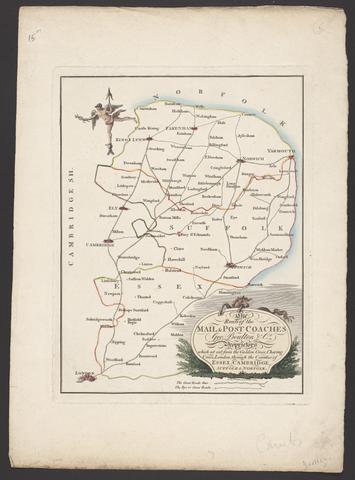
- Date:
- [between 1796 and 1809]
- Physical Description:
- 1 map : engraving ; 26 x 20 cm, on sheet 38 x 28 cm
- Collection:
- Rare Books and Manuscripts
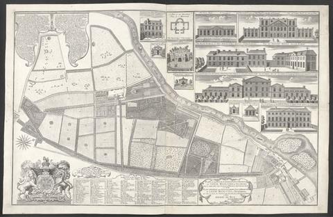
- Date:
- 1734
- Physical Description:
- 1 map : ill. ; 57 x 90 cm., on sheet 62 x 96 cm.
- Collection:
- Rare Books and Manuscripts
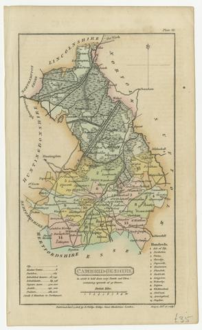
- Date:
- [1808]
- Physical Description:
- 1 map ; 18 x 11 cm, on sheet 21 x 13 cm
- Collection:
- Rare Books and Manuscripts
- Credit Line:
- Yale Center for British Art, Gift of David Alan Richards, Yale BA 1967, JD 1972
![[Atlas of the counties of England and Wales].](https://media.collections.yale.edu/thumbnail/ycba/4ac23653-8668-40b0-b3f1-7228f7c1d7e3)
- Date:
- [1590?]
- Physical Description:
- 1 atlas ([74] leaves) : 34 maps (some folded) ; 44 cm
- Collection:
- Rare Books and Manuscripts
![Academiarum totius Europae seu orbis Christiani iuxta suas provincias nova tabula ad usum studiosorum emendate accomodate [cartographic material] / W. Kip sculp.](https://media.collections.yale.edu/thumbnail/ycba/73140180-2c50-4f87-81ba-d3ce924ad548)
- Date:
- An 1602
- Physical Description:
- 1 map ; 80 mm in diameter, on sheet 13 x 18 cm.
- Collection:
- Rare Books and Manuscripts
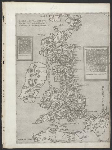
- Date:
- MDLVI [1556]
- Physical Description:
- 1 map ; 47.9 x 34.5 cm, on sheet 53.3 x 40.0 cm.
- Collection:
- Rare Books and Manuscripts
- Date:
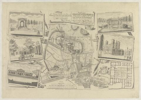
- 1754
- Physical Description:
- 1 map : ill. ; 29 x 30 cm., on sheet 47 x 61 cm.
- Collection:
- Rare Books and Manuscripts
- Date:
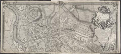
- 1743
- Physical Description:
- 1 map on 2 sheets ; 100 x 228 cm., sheets 110 x 122 cm.
- Collection:
- Rare Books and Manuscripts

- Date:
- MDLXXVIII [1578]
- Physical Description:
- 1 map : engraving ; 40.5 x 53.5 cm, on sheet, 41.5 x 54.5 cm
- Collection:
- Rare Books and Manuscripts
![[The travellers guide : being the best mapp of the kingdom of England and principalaty [sic] of Wales. Wherein are delineated 3000 towns and villages more than in any mapp yet extent besides ye notations of bridges & rivers &c. To which is added ye direct and cross roads according to Mr. Ogilby's late survey. / Described by C: Saxton and now carefully corrected with new additions by Phillip Lea].](https://media.collections.yale.edu/thumbnail/ycba/906da49f-9f3d-41c8-9cb7-2f67ee863785)
- Date:
- [1686?]
- Physical Description:
- 1 atlas ([10] sheets) : hand colored maps ; sheets 28 x 69 cm, and smaller
- Collection:
- Rare Books and Manuscripts

- Date:
- 1749
- Physical Description:
- 1 map ; 46 x 91 cm., on sheet 55 x 96 cm.
- Collection:
- Rare Books and Manuscripts
- Date:
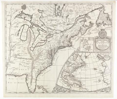
- [ca. 1695]
- Physical Description:
- 1 map : engraving ; 51 x 60 cm
- Collection:
- Rare Books and Manuscripts
![[Old series Ordnance Survey maps of England and Wales]](https://media.collections.yale.edu/thumbnail/ycba/00e4c053-1da0-4b6a-9606-069ea90649fa)
- Date:
- 1805-1834 [i.e. 1834-1835?]
- Physical Description:
- 65 maps on 66 sheets : mounted on linen ; sheets 69 x 98 cm, or smaller + index.
- Collection:
- Rare Books and Manuscripts
- Date:
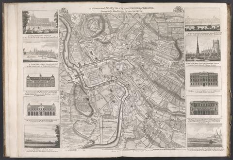
- [175-?]
- Physical Description:
- 1 map : ill. ; 48 x 45 cm., on sheet 55 x 75 cm.
- Collection:
- Rare Books and Manuscripts
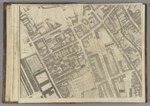
- Date:
- 1677]
- Physical Description:
- 1 map : 160 x 255 cm. on 20 sheets 40 x 51 cm.
- Collection:
- Rare Books and Manuscripts
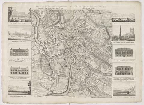
- Date:
- 1750
- Physical Description:
- 1 map ; 48 x 45 cm., on sheet 57 x 78 cm.
- Collection:
- Rare Books and Manuscripts
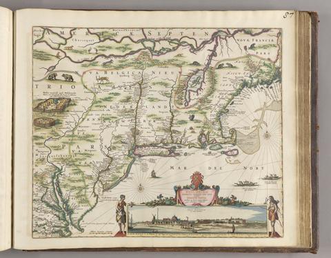
- Date:
- [ca. 1684]
- Physical Description:
- 1 map ; 46.1 x 55.9 cm, on sheet 52.4 x 62.9 cm
- Collection:
- Rare Books and Manuscripts
![[Chart of the Thames estuary with a view of the English fleet burning in the Medway] [cartographic material].](https://media.collections.yale.edu/thumbnail/ycba/02ae63ff-cd23-4365-8ae6-55a7533753c2)
- Date:
- 1667
- Physical Description:
- 1 map ; 34 x 45 cm, on sheet 45 x 49 cm
- Collection:
- Rare Books and Manuscripts

- Date:
- anno 1632
- Physical Description:
- 1 atlas ([6], 749 [i.e. 743], [1] pages, [1] leaf of plates) : 179 maps ; 22 x 29 cm (4to)
- Collection:
- Rare Books and Manuscripts

- Date:
- 1591
- Physical Description:
- 1 map : engraving ; 24 x 33 cm, on sheet 29 x 43 cm
- Collection:
- Rare Books and Manuscripts

- Date:
- [1575]
- Physical Description:
- 1 map : engraving ; 38 x 42 cm
- Collection:
- Rare Books and Manuscripts

- Date:
- 1831
- Physical Description:
- 1 map : hand col. ; 55 x 67 cm.
- Collection:
- Rare Books and Manuscripts

- Date:
- [ca. 1677]
- Physical Description:
- 1 map : engraving ; 42 x 52 cm
- Collection:
- Rare Books and Manuscripts

- Date:
- 1589
- Physical Description:
- 1 map : engraving ; 33 x 49 cm
- Collection:
- Rare Books and Manuscripts

- Date:
- 1852
- Physical Description:
- 1 map : hand col., mounted on linen ; 61 x 80 cm., folded to 22 x 13 cm., in case 23 x 14 cm.
- Collection:
- Rare Books and Manuscripts

- Date:
- 1666
- Physical Description:
- 1 map ; 30 x 54 cm., on sheet 50 x 58 cm.
- Collection:
- Rare Books and Manuscripts

- Date:
- [1662?]
- Physical Description:
- 1 map ; 36 x 44 cm.
- Collection:
- Rare Books and Manuscripts

- Date:
- July 4th, 1829
- Physical Description:
- 1 map ; 58 x 70 cm.
- Collection:
- Rare Books and Manuscripts

- Date:
- [1678]
- Physical Description:
- 1 map : engraving ; 50 x 57 cm, on sheet 54 x 63 cm
- Collection:
- Rare Books and Manuscripts

- Date:
- [1695?]
- Physical Description:
- 1 map ; 41 x 37 cm
- Collection:
- Rare Books and Manuscripts
- Credit Line:
- Yale Center for British Art, Gift of David Alan Richards, Yale BA 1967, JD 1972

- Date:
- anno domini MDC [1600]
- Physical Description:
- 1 atlas : maps ; 30 cm (fol.)
- Collection:
- Rare Books and Manuscripts

- Date:
- [approximately 1660]
- Physical Description:
- 1 map : hand colored, vellum ; 77 x 96 cm
- Collection:
- Rare Books and Manuscripts

- Date:
- [ca. 1602]
- Physical Description:
- 1 map ; 80 mm in diameter, on sheet 13 x 18 cm.
- Collection:
- Rare Books and Manuscripts

- Date:
- [1836]
- Physical Description:
- 1 map on 4 sheets : hand col., mounted on linen ; 113 x 137 cm, sheets 56 x 68 cm
- Collection:
- Rare Books and Manuscripts

- Date:
- [approximately 1705]
- Physical Description:
- 1 map : engraving, hand-colored ; 46 x 58 cm, on sheet 54 x 65 cm
- Collection:
- Rare Books and Manuscripts

- Physical Description:
- 52 maps : ill. ; on playing cards 9.5 x 5.5 cm.
- Collection:
- Rare Books and Manuscripts

- Date:
- [1720]
- Physical Description:
- 1 map ; sheet 21 x 15 cm
- Collection:
- Rare Books and Manuscripts
- Credit Line:
- Yale Center for British Art, Gift of David Alan Richards, Yale BA 1967, JD 1972

- Date:
- [between 1762 and 1773]
- Physical Description:
- 1 map on 2 sheets ; 120 x 188 cm., sheets 67 x 108 cm.
- Collection:
- Rare Books and Manuscripts

- Date:
- 1841
- Physical Description:
- 1 map : engraving ; 79 x 92, on sheet 82 x 108, folded to 22 x 13 cm
- Collection:
- Rare Books and Manuscripts

- Date:
- 1693
- Physical Description:
- 2 volumes : maps, illustrations ; 55 cm (fol.)
- Collection:
- Rare Books and Manuscripts

- Date:
- 1808
- Physical Description:
- 1 atlas ([4] pages, [114] leaves of plates) : 56 maps ; 56 cm (fol.)
- Collection:
- Rare Books and Manuscripts
42. Scotland.

- Date:
- [between 1901 and 1909?]
- Physical Description:
- 1 jigsaw puzzle (63 pieces) : paper on wood, hand colored ; map 37 x 30 cm, puzzle 43 x 35 cm, in box 26 x 21 x 5 cm
- Collection:
- Rare Books and Manuscripts
- Credit Line:
- Yale Center for British Art, Gift of Ellen and Arthur Liman, Yale JD 1957

- Date:
- 1666
- Physical Description:
- 1 atlas ([20] pages, [82] leaves of plates (2 folded)) : 41 maps ; 59 cm (folio)
- Collection:
- Rare Books and Manuscripts

- Date:
- 1627
- Physical Description:
- 1 atlas ([2], 44, 5-8 pages) : illustrations, 22 maps ; 43 cm
- Collection:
- Rare Books and Manuscripts

- Date:
- 1862
- Physical Description:
- 1 map on 24 sheets : hand col. ; 185 x 154 cm, sheets 31 x 39 cm.
- Collection:
- Rare Books and Manuscripts

- Date:
- MDCLXVII [1667]
- Physical Description:
- 12 volumes : color illustrations, color maps ; 57 cm
- Collection:
- Rare Books and Manuscripts

- Date:
- 1724
- Physical Description:
- 1 map ; 35 x 70 cm., on sheet 49 x 72 cm.
- Collection:
- Rare Books and Manuscripts

- Date:
- [1839-1874?]
- Physical Description:
- 110 sheets : mounted on linen ; sheets 69 x 98 cm, or smaller + index.
- Collection:
- Rare Books and Manuscripts

- Date:
- [1769]
- Physical Description:
- 1 map ; 16.7 x 29.0 cm
- Collection:
- Rare Books and Manuscripts
- Credit Line:
- Yale Center for British Art, Gift of David Alan Richards, Yale BA 1967, JD 1972

- Date:
- 1751
- Physical Description:
- 1 atlas ([2], [32] leaves) : maps ; 55 cm.
- Collection:
- Rare Books and Manuscripts

- Date:
- 1771
- Physical Description:
- 1 map : engraving, hand colored ; 48 x 63 cm, on sheet 53 x 71 cm
- Collection:
- Rare Books and Manuscripts

- Date:
- [1694?]
- Physical Description:
- 1 atlas ([115] leaves) : 57 hand-colored maps ; 53 cm
- Collection:
- Rare Books and Manuscripts

- Date:
- 1652
- Physical Description:
- 1 map ; 29 x 43 cm, on sheet 45 x 55 cm
- Collection:
- Rare Books and Manuscripts

- Date:
- [1851?]
- Physical Description:
- 1 map ; 31 x 23 cm
- Collection:
- Rare Books and Manuscripts
- Credit Line:
- Yale Center for British Art, Gift of David Alan Richards, Yale BA 1967, JD 1972

- Date:
- anno MDLXII [1562]
- Physical Description:
- 1 map ; 47.0 x 34.2 cm, on sheet 53.2 x 40.0 cm.
- Collection:
- Rare Books and Manuscripts

- Date:
- 1842
- Physical Description:
- 1 atlas (57 maps) ; 34 cm.
- Collection:
- Rare Books and Manuscripts

- Date:
- 1757
- Physical Description:
- 1 map : 48 x 70 cm., on sheet 55 x 75 cm.
- Collection:
- Rare Books and Manuscripts

- Date:
- MDLXII [1562]
- Physical Description:
- 1 atlas ([8], 112, 286, [66] pages, 64 double leaves of plates) : illustrations, maps ; 24 cm (4to)
- Collection:
- Rare Books and Manuscripts

- Date:
- [1776]
- Physical Description:
- 1 atlas ([3], vi-viii, [2] pages, [6] folded leaves of plates) : maps ; 23 cm
- Collection:
- Rare Books and Manuscripts

- Date:
- [approximately 1695]
- Physical Description:
- 1 map : engraving, hand colored ; 46 x 56 cm, on sheet 51 x 61 cm
- Collection:
- Rare Books and Manuscripts

- Date:
- [1588?]
- Physical Description:
- 1 map ; 40.1 x 54.2 cm., on sheet 41.8 x 56.1cm.
- Collection:
- Rare Books and Manuscripts

- Date:
- anno Virginei partus 1508
- Physical Description:
- 1 atlas ([284] pages, [68] leaves of plates) : illustrations, 34 maps ; 43 cm (folio)
- Collection:
- Rare Books and Manuscripts

- Date:
- 1749
- Physical Description:
- 1 atlas (5, [3] pages, [2], 273, [1] pages of plates) : illustrations, maps, coats of arms ; 21 cm
- Collection:
- Rare Books and Manuscripts

- Date:
- 1747
- Physical Description:
- 1 map ; 17.3 x 15 cm
- Collection:
- Rare Books and Manuscripts
- Credit Line:
- Yale Center for British Art, Gift of David Alan Richards, Yale BA 1967, JD 1972

- Date:
- 1637
- Physical Description:
- 1 atlas ([22], 56, 55-56, [2], 401, [1], 409-599, 520-566, 649-930, [32] pages, 5 leaves of plates) : illustrations, maps ; 30 cm
- Collection:
- Rare Books and Manuscripts

- Date:
- April 1st, 1834
- Physical Description:
- [47] leaves : 47 maps ; 66 x 84 cm
- Collection:
- Rare Books and Manuscripts

- Date:
- [1775?]
- Physical Description:
- 1 map ; 15.8 x 28 cm
- Collection:
- Rare Books and Manuscripts
- Credit Line:
- Yale Center for British Art, Gift of David Alan Richards, Yale BA 1967, JD 1972
68. Cambridgeshire.

- Date:
- [1824?]
- Physical Description:
- 1 map ; 12.3 x 9 cm
- Collection:
- Rare Books and Manuscripts
- Credit Line:
- Yale Center for British Art, Gift of David Alan Richards, Yale BA 1967, JD 1972

- Date:
- Jan. 26, 1831
- Physical Description:
- 1 map ; 58 x 68 cm.
- Collection:
- Rare Books and Manuscripts

- Date:
- 1719
- Physical Description:
- 1 map : engraving, hand colored ; 49 x 58 cm, on sheet 55 x 63 cm
- Collection:
- Rare Books and Manuscripts
71. Cambridgeshire.

- Date:
- [1784]
- Physical Description:
- 1 sheet ([2] pages) ; 32 x 23 cm
- Collection:
- Rare Books and Manuscripts
- Credit Line:
- Yale Center for British Art, Gift of David Alan Richards, Yale BA 1967, JD 1972

- Date:
- anno MDC [1600]
- Physical Description:
- 1 atlas ([36] pages) : illustrations, maps ; 30 cm (fol.)
- Collection:
- Rare Books and Manuscripts

- Date:
- [Amsterdam?] :
- Physical Description:
- 1 atlas ([44] leaves of plates) ; 44 maps ; 13 x 18 cm.
- Collection:
- Rare Books and Manuscripts

- Date:
- [1858-1862]
- Physical Description:
- 205 maps ; each 31 x 45 cm.
- Collection:
- Rare Books and Manuscripts

- Date:
- 1856-1882
- Physical Description:
- 131 maps ; each 46 x 61 cm.
- Collection:
- Rare Books and Manuscripts

- Date:
- anno cum privilegio 1616
- Physical Description:
- 1 atlas ([8], 94, [2], 99-126, [2], 131-132, [2], 137-146, [6] leaves) : maps ; 44 cm (folio)
- Collection:
- Rare Books and Manuscripts

- Date:
- Novr. 9th, 1843 [i.e. ca. 1853-1874?]
- Physical Description:
- 110 sheets : mounted on linen ; sheets 69 x 98 cm, or smaller + index.
- Collection:
- Rare Books and Manuscripts

- Date:
- Sepr. 28,1801
- Physical Description:
- 1 map : engraving ; 51 x 46 cm, on sheet 65 x 55 cm
- Collection:
- Rare Books and Manuscripts

- Date:
- [1774-1800?]
- Physical Description:
- 1 atlas (8 volumes) : illustrations (some hand-colored), maps (some hand-colored) ; 83 x 65 cm
- Collection:
- Rare Books and Manuscripts

- Date:
- [ca. 1737]
- Physical Description:
- 1 map ; 48 x 47 cm, on sheet 54 x 64 cm
- Collection:
- Rare Books and Manuscripts

- Date:
- 1749
- Physical Description:
- 1 map ; 63 x 47 cm, on sheet 66 x 50 cm
- Collection:
- Rare Books and Manuscripts
82. Cambridgeshire.

- Date:
- [1837]
- Physical Description:
- 1 map ; 27 x 22 cm
- Collection:
- Rare Books and Manuscripts
- Credit Line:
- Yale Center for British Art, Gift of David Alan Richards, Yale BA 1967, JD 1972
83. Atlas.

- Date:
- [not before 1688]
- Physical Description:
- 1 atlas ([1] leaf, [117] leaves of plates) : 58 maps ; 54 cm
- Collection:
- Rare Books and Manuscripts

- Date:
- [1851?]
- Physical Description:
- 1 map ; 244 x 25 cm, folded in cover 11 x 26 cm
- Collection:
- Rare Books and Manuscripts

- Date:
- [1645]
- Physical Description:
- 1 map : engraving ; 40 x 30 cm, on sheet 50 x 60 cm
- Collection:
- Rare Books and Manuscripts

- Date:
- MDCCXX [1720]
- Physical Description:
- 1 atlas ([4] pages, [40] leaves of plates) : 19 maps ; 54 cm
- Collection:
- Rare Books and Manuscripts

- Date:
- [1695?]
- Physical Description:
- 1 map ; 36 x 41 cm
- Collection:
- Rare Books and Manuscripts
- Credit Line:
- Yale Center for British Art, Gift of William H. Mandel, Yale BFA 1953, and Robert L. Russell, Yale MA 1954

- Date:
- [1589?]
- Physical Description:
- 1 map ; 40.5 x 52.5 cm., on sheet 41.8 x 55.6 cm.
- Collection:
- Rare Books and Manuscripts

- Date:
- MDLVIII [1558]
- Physical Description:
- 1 map ; 38.2 x 52.3 cm, on sheet 42.8 x 55.6 cm.
- Collection:
- Rare Books and Manuscripts

- Date:
- 1748
- Physical Description:
- 1 map : ill. ; 57 x 90 cm., on sheet 62 x 93 cm.
- Collection:
- Rare Books and Manuscripts

- Date:
- [1773]
- Physical Description:
- 1 map on 18 sheets ; 273 x 189 cm, sheets 54 x 72 cm
- Collection:
- Rare Books and Manuscripts

- Date:
- [ca. 1700]
- Physical Description:
- 1 map ; 26 x 28 cm., on sheet 30 x 32 cm.
- Collection:
- Rare Books and Manuscripts

- Date:
- [1782]
- Physical Description:
- 1 map on 9 sheets ; sheets 54 x 71 cm + 1 index map (52 x 71 cm)
- Collection:
- Rare Books and Manuscripts

- Date:
- [1853]
- Physical Description:
- 1 view ; 179 x 27 cm, folded in cover 30 cm
- Collection:
- Rare Books and Manuscripts

- Date:
- [1695]
- Physical Description:
- 1 map : engraving ; 34 x 41 cm, on sheet 40 x 47 cm
- Collection:
- Rare Books and Manuscripts

- Date:
- [1686?]
- Physical Description:
- 1 map : engraving ; 83 x 106 cm, on sheet 87 x 111 cm
- Collection:
- Rare Books and Manuscripts

- Date:
- [1830?]
- Physical Description:
- 1 map ; 19 x 25 cm
- Collection:
- Rare Books and Manuscripts
- Credit Line:
- Yale Center for British Art, Gift of David Alan Richards, Yale BA 1967, JD 1972

- Date:
- 1610
- Physical Description:
- 1 map : engraving ; 37 x 42 cm
- Collection:
- Rare Books and Manuscripts
- Credit Line:
- Yale Center for British Art, Gift of David Alan Richards, Yale BA 1967, JD 1972

- Date:
- MDXLVI [1546]
- Physical Description:
- 1 map on 2 sheets ; 51.8 x 72.2 cm, on sheet 56.2 x 76.3 cm.
- Collection:
- Rare Books and Manuscripts

- Date:
- [1835?]
- Physical Description:
- 1 map ; 17.4 x 23 cm
- Collection:
- Rare Books and Manuscripts
- Credit Line:
- Yale Center for British Art, Gift of David Alan Richards, Yale BA 1967, JD 1972